
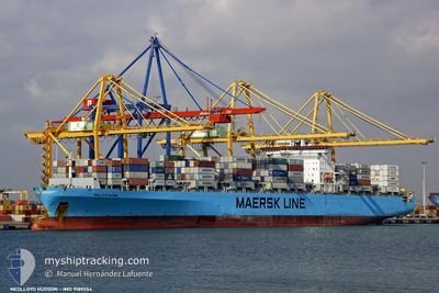
DIMITRIS Y
Container Ship
Current Trip
INPAV
| Time Travelled | 15 h, 20 mins |
|---|---|
| Remaining Time | --- |
| Distance Travelled | 67.74 nm |
| Remaining Distance | --- |
| AVG Speed | 15.1 Noeuds |
| MAX Speed | 15.6 Noeuds |
| AVG Wind | 9.9 knots |
| MAX Wind | 18 knots |
| MIN Temp | 21.2°C / 70.16°F |
| MAX Temp | 23.8°C / 74.84°F |
| Tirant d eau | 14 m |
| Position reçue | 3 d depuis |
Current Position
| Longitude | 77.12802° |
|---|---|
| Latitude | 7.70142° |
| Etat | Under way using engine |
| Vitesse | 16.1 Noeuds |
| Parcours | 302.5° |
| Zone | Laccadive Sea |
| Station | T-AIS |
| Position reçue | 3 d depuis |
Info
Information
The current position of DIMITRIS Y is in Laccadive Sea with coordinates 7.70142° / 77.12802° as reported on 2025-02-01 16:00 by AIS to our vessel tracker app. The vessel's current speed is 16.1 Noeuds
The vessel DIMITRIS Y (IMO: 9189354, MMSI: 636016979) is a Container Ship that was built in 2000 ( 25 Age ). It's sailing under the flag of [LR] Liberia.
In this page you can find informations about the vessels current position, last detected port calls, and current voyage information. If the vessels is not in coverage by AIS you will find the latest position.
The current position of DIMITRIS Y is detected by our AIS receivers and we are not responsible for the reliability of the data. The last position was recorded while the vessel was in Coverage by the Ais receivers of our vessel tracking app.
The current draught of DIMITRIS Y as reported by AIS is 14 meters
Weather
| Temperature | 21.7°C / 71.06°F |
|---|---|
| Wind Speed | 17 knots |
| Direction | 348° NNW |
| Pressure | 1014.7 hPa |
| Humidity | 57.8 % |
| Cloud Coverage | 6 % |
Featured Company
Last Port Calls
| Port | Arrival | Departure | Time In Port |
|---|---|---|---|
| 2025-02-04 03:31 | 2025-02-04 14:49 | 11 h | |
| 2025-01-27 15:33 | 2025-01-28 16:21 | 1 d | |
| 2025-01-25 07:23 | 2025-01-26 18:32 | 1 d | |
| 2025-01-21 00:29 | 2025-01-23 02:37 | 2 d | |
| 2025-01-16 23:09 | 2025-01-18 10:06 | 1 d | |
| 2025-01-14 10:33 | 2025-01-15 04:57 | 18 h | |
| 2025-01-08 14:21 | 2025-01-09 21:53 | 1 d | |
| 2025-01-03 07:33 | 2025-01-04 07:01 | 23 h | |
| 2024-12-27 20:20 | 2024-12-28 05:16 | 8 h | |
| 2024-12-17 09:13 | 2024-12-18 10:53 | 1 d |
Most Visited Ports (Last year)
| Port | Arrivals | |
|---|---|---|
| 13 | ||
| 13 | ||
| 8 | ||
| 7 | ||
| 6 | ||
| 6 |
Last Trips
| Origin | Departure | Destination | Arrival | Distance | |
|---|---|---|---|---|---|
| 2025-01-29 00:21 | 2025-02-04 09:01 | 2441.70 nm | |||
| 2025-01-27 02:32 | 2025-01-27 23:33 | 204.35 nm | |||
| 2025-01-23 09:37 | 2025-01-25 15:23 | 802.79 nm | |||
| 2025-01-18 18:06 | 2025-01-21 07:29 | 814.41 nm | |||
| 2025-01-15 12:57 | 2025-01-17 07:09 | 202.81 nm | |||
| 2025-01-10 03:23 | 2025-01-14 18:33 | 1454.33 nm | |||
| 2025-01-04 12:31 | 2025-01-08 19:51 | 931.64 nm | |||
| 2024-12-28 10:46 | 2025-01-03 13:03 | 980.86 nm | |||
| 2024-12-18 18:53 | 2024-12-28 01:50 | 2463.13 nm | |||
| 2024-12-16 12:34 | 2024-12-17 17:13 | 195.80 nm |
Events
| Heure | Evenement | Détails | Position/ Destination | Info |
|---|---|---|---|---|
| 2025-02-04 14:49 | Démarrage | 0.83 nm, South of PIPAVAV |
20.90124 / 71.50056
INPAV
|
Vitesse: 6.4 kn Parcours: 190° |
| 2025-02-04 14:49 | PORT DE DEPART |
|
20.90124 / 71.50056
INPAV
|
Vitesse: 1.4 kn Parcours: 207° |
| 2025-02-04 03:31 | Arret |
20.92018 / 71.51331
[IN] PIPAVAV
|
Vitesse: 0.3 kn Parcours: 52° |
|
| 2025-02-04 03:31 | Port d'arrivée |
|
20.92018 / 71.51331
[IN] PIPAVAV
|
Vitesse: 0.8 kn Parcours: 48° |
| 2025-02-01 16:00 | Etat Changé | Default Under way using engine |
7.70237 / 77.12649
INPAV
|
Vitesse: 16.1 kn Parcours: 302.5° |
| 2025-02-01 16:00 | Hors de la zone couverte |
7.70142 / 77.12802
Laccadive Sea
INPAV
|
Vitesse: 16.1 kn Parcours: 302.5° |
|
| 2025-02-01 15:25 | Etat Changé | Under way using engine Default |
7.61419 / 77.25995
INPAV
|
Vitesse: 16 kn Parcours: 307° |
| 2025-02-01 15:15 | Etat Changé | Default Under way using engine |
7.58795 / 77.29514
INPAV
|
Vitesse: 16.1 kn Parcours: 306.1° |
| 2025-02-01 11:35 | Changement de zone | Indian part of the Laccadive Sea Sri Lankan part of the Laccadive Sea |
7.02782 / 78.13027
Laccadive Sea
INPAV
|
Vitesse: 16 kn Parcours: 302.9° |
| 2025-02-01 11:33 | Etat Changé | Under way using engine Default |
7.02419 / 78.13588
INPAV
|
Vitesse: 16 kn Parcours: 303° |