
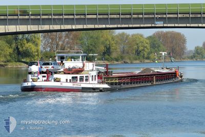
DYTHAR
Cargo
Current Trip
DYTHAR is out of coverage. Learn how you can join the community and extend the coverage to your area by clicking here!
THUIS
Unknown Port
ETA*
---
| Time Travelled | 2 days |
|---|---|
| Remaining Time | --- |
| Distance Travelled | 117.25 nm |
| Remaining Distance | --- |
| AVG Speed | 7.9 Noeuds |
| MAX Speed | 10.2 Noeuds |
| AVG Wind | 14.8 knots |
| MAX Wind | 26 knots |
| MIN Temp | -2.5°C / 27.5°F |
| MAX Temp | 0.7°C / 33.26°F |
| Tirant d eau | 0 m |
| Position reçue | 21 h, 4 m depuis |
Current Position
| Longitude | 5.68847° |
|---|---|
| Latitude | 50.79070° |
| Etat | Under way using engine |
| Vitesse | 7.8 Noeuds |
| Parcours | 175.9° |
| Zone | North Sea |
| Station | T-AIS |
| Position reçue | 21 h, 4 m depuis |
Info
info
Information
The current position of DYTHAR is in North Sea with coordinates 50.79070° / 5.68847° as reported on 2026-01-08 06:50 by AIS to our vessel tracker app. The vessel's current speed is 7.8 Noeuds
The vessel DYTHAR (MMSI: 244129846) is a Cargo It's sailing under the flag of [NL] Netherlands.
In this page you can find informations about the vessels current position, last detected port calls, and current voyage information. If the vessels is not in coverage by AIS you will find the latest position.
The current position of DYTHAR is detected by our AIS receivers and we are not responsible for the reliability of the data. The last position was recorded while the vessel was in Coverage by the Ais receivers of our vessel tracking app.
Weather
| Temperature | -1.3°C / 29.66°F |
|---|---|
| Wind Speed | 7 knots |
| Direction | 204° SSW |
| Pressure | 1007.9 hPa |
| Humidity | 93.7 % |
| Cloud Coverage | 89 % |
Featured Company
Limited time offer - Install a base station receiver to your area and list your company on MyShipTracking Free forever!
Last Port Calls
| Port | Arrival | Departure | Time In Port |
|---|---|---|---|
| 2026-01-05 23:11 | 2026-01-06 18:34 | 19 h | |
| 2026-01-05 14:10 | 2026-01-05 14:51 | 41 m | |
| 2026-01-05 07:57 | 2026-01-05 12:26 | 4 h | |
| 2026-01-03 11:20 | 2026-01-05 07:43 | 1 d | |
| 2026-01-02 16:56 | 2026-01-02 17:44 | 47 m | |
| 2026-01-01 14:14 | 2026-01-02 13:55 | 23 h | |
| 2026-01-01 13:12 | 2026-01-01 13:41 | 29 m | |
| 2025-12-31 11:21 | 2026-01-01 10:28 | 23 h | |
| 2025-12-30 19:06 | 2025-12-31 08:41 | 13 h | |
| 2025-12-30 15:13 | 2025-12-30 16:12 | 58 m |
Last Trips
| Origin | Departure | Destination | Arrival | Distance | |
|---|---|---|---|---|---|
| 2026-01-05 14:51 | 2026-01-05 23:11 | 55.52 nm | |||
| 2026-01-05 12:26 | 2026-01-05 14:10 | 13.16 nm | |||
| 2026-01-05 07:43 | 2026-01-05 07:57 | 0.17 nm | |||
| 2026-01-02 17:44 | 2026-01-03 11:20 | 79.19 nm | |||
| 2026-01-02 13:55 | 2026-01-02 16:56 | 22.48 nm | |||
| 2026-01-01 13:41 | 2026-01-01 14:14 | 4.50 nm | |||
| 2026-01-01 10:28 | 2026-01-01 13:12 | 23.65 nm | |||
| 2025-12-31 08:41 | 2025-12-31 11:21 | 23.06 nm | |||
| 2025-12-30 16:12 | 2025-12-30 19:06 | 18.84 nm | |||
| 2025-12-30 11:36 | 2025-12-30 15:13 | 25.15 nm |
Events
| Heure | Evenement | Détails | Position/ Destination | Info |
|---|---|---|---|---|
| 2026-01-08 06:50 | Hors de la zone couverte |
50.79070 / 5.68847
North Sea
|
Vitesse: 7.8 kn Parcours: 175.9° |
|
| 2026-01-08 06:48 | Dans la zone couverte |
50.79448 / 5.68726
North Sea
|
Vitesse: 7.5 kn Parcours: 163° |
|
| 2026-01-07 15:21 | Hors de la zone couverte |
51.13066 / 4.96167
North Sea
|
Vitesse: 7.1 kn Parcours: 113.2° |
|
| 2026-01-07 14:46 | Démarrage | 0.41 nm, North West of OLEN |
51.15818 / 4.86221
THUIS
|
Vitesse: 3.1 kn Parcours: 111.8° |
| 2026-01-07 14:45 | Etat Changé | Under way using engine Moored |
51.15839 / 4.86134
THUIS
|
Vitesse: Parcours: 511° |
| 2026-01-07 14:41 | Etat Changé | Moored Under way using engine |
51.15850 / 4.86090
THUIS
|
Vitesse: 0.3 kn Parcours: 511° |
| 2026-01-07 14:21 | Arret | 0.52 nm, North West of OLEN |
51.15893 / 4.85939
THUIS
|
Vitesse: 0.3 kn Parcours: 511° |
| 2026-01-07 08:24 | Démarrage | 3.43 nm, South West of BERGEN OP ZOOM |
51.44515 / 4.23166
THUIS
|
Vitesse: 5.2 kn Parcours: 176.6° |
| 2026-01-07 08:22 | Etat Changé | Under way using engine Moored |
51.44716 / 4.23125
THUIS
|
Vitesse: Parcours: 511° |
| 2026-01-07 08:08 | Etat Changé | Moored Under way using engine |
51.44743 / 4.23117
THUIS
|
Vitesse: 0.1 kn Parcours: 511° |