
EIGER
Cargo
Current Trip
| Trip Time | 9 h, 51 mins |
|---|---|
| Trip Distance | 84.76 nm |
| AVG Speed | 9.4 Noeuds |
| MAX Speed | 11.5 Noeuds |
| Tirant d eau | 2 m |
| AVG Wind | 14.5 knots |
| MAX Wind | 16 knots |
| MIN Temp | 2.5°C / 36.5°F |
| MAX Temp | 4.5°C / 40.1°F |
| Position reçue | 2 m depuis |
Current Position
| Longitude | 4.46079° |
|---|---|
| Latitude | 51.23853° |
| Etat | Moored |
| Vitesse | |
| Parcours | --- |
| Zone | North Sea |
| Station | T-AIS |
| Position reçue | 2 m depuis |
Info
Information
The current position of EIGER is in North Sea with coordinates 51.23853° / 4.46079° as reported on 2025-02-11 05:42 by AIS to our vessel tracker app. The vessel's current speed is 0 Noeuds and is currently inside the port of ANTWERP.
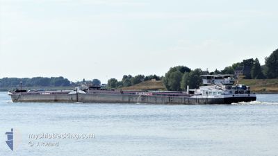
The vessel EIGER (MMSI: 244660203) is a Cargo It's sailing under the flag of [NL] Netherlands.
In this page you can find informations about the vessels current position, last detected port calls, and current voyage information. If the vessels is not in coverage by AIS you will find the latest position.
The current position of EIGER is detected by our AIS receivers and we are not responsible for the reliability of the data. The last position was recorded while the vessel was in Coverage by the Ais receivers of our vessel tracking app.
The current draught of EIGER as reported by AIS is 2 meters
Weather
| Temperature | 3.7°C / 38.66°F |
|---|---|
| Wind Speed | 8 knots |
| Direction | 206° SSW |
| Pressure | 1014.1 hPa |
| Humidity | 96.7 % |
| Cloud Coverage | 100 % |
Featured Company
Last Port Calls
| Port | Arrival | Departure | Time In Port |
|---|---|---|---|
| 2025-02-11 01:11 | |||
| 2025-02-10 15:12 | 2025-02-10 15:20 | 7 m | |
| 2025-02-10 10:57 | 2025-02-10 14:28 | 3 h | |
| 2025-02-10 01:54 | 2025-02-10 10:49 | 8 h | |
| 2025-02-09 23:50 | 2025-02-10 01:43 | 1 h | |
| 2025-02-08 19:31 | 2025-02-09 04:36 | 9 h | |
| 2025-02-05 09:41 | 2025-02-06 13:09 | 1 d | |
| 2025-02-04 07:18 | 2025-02-04 10:03 | 2 h | |
| 2025-02-02 06:43 | 2025-02-02 07:44 | 1 h | |
| 2025-02-01 21:18 | 2025-02-01 22:47 | 1 h |
Most Visited Ports (Last year)
| Port | Arrivals | |
|---|---|---|
| 59 | ||
| 38 | ||
| 34 | ||
| 26 | ||
| 20 | ||
| 16 |
Last Trips
| Origin | Departure | Destination | Arrival | Distance | |
|---|---|---|---|---|---|
| 2025-02-10 16:20 | 2025-02-11 02:11 | 84.76 nm | |||
| 2025-02-10 15:28 | 2025-02-10 16:12 | 0.69 nm | |||
| 2025-02-10 11:49 | 2025-02-10 11:57 | 0.44 nm | |||
| 2025-02-10 02:43 | 2025-02-10 02:54 | 0.41 nm | |||
| 2025-02-09 05:36 | 2025-02-10 00:50 | 100.98 nm | |||
| 2025-02-06 14:09 | 2025-02-08 20:31 | 263.52 nm | |||
| 2025-02-04 11:03 | 2025-02-05 10:41 | 60.17 nm | |||
| 2025-02-02 08:44 | 2025-02-04 08:18 | 247.20 nm | |||
| 2025-02-01 23:47 | 2025-02-02 07:43 | 43.39 nm | |||
| 2025-02-01 09:41 | 2025-02-01 22:18 | 83.88 nm |
Events
| Heure | Evenement | Détails | Position/ Destination | Info |
|---|---|---|---|---|
| 2025-02-11 03:33 | Etat Changé | Moored Under way using engine |
51.23851 / 4.46081
[BE] ANTWERP
|
Vitesse: 0.1 kn Parcours: 511° |
| 2025-02-11 03:14 | Arret |
51.23862 / 4.46073
[BE] ANTWERP
|
Vitesse: 0.3 kn Parcours: 511° |
|
| 2025-02-11 01:11 | Port d'arrivée |
|
51.38338 / 4.25012
[BE] ANTWERP
|
Vitesse: 9 kn Parcours: 149.1° |
| 2025-02-11 00:42 | Démarrage | 3.29 nm, South West of BERGEN OP ZOOM |
51.44779 / 4.23118
RHEIN
|
Vitesse: 3.2 kn Parcours: 171.6° |
| 2025-02-11 00:08 | Arret | 3.01 nm, South West of BERGEN OP ZOOM |
51.45388 / 4.22860
RHEIN
|
Vitesse: 0.3 kn Parcours: 511° |
| 2025-02-10 21:53 | Démarrage | 1.31 nm, West of WILLEMSTAD |
51.68932 / 4.40554
RHEIN
|
Vitesse: 6 kn Parcours: 230.8° |
| 2025-02-10 21:50 | Etat Changé | Under way using engine Default |
51.69105 / 4.40888
RHEIN
|
Vitesse: Parcours: -1° |
| 2025-02-10 21:49 | Etat Changé | Default Under way using engine |
51.69104 / 4.40892
RHEIN
|
Vitesse: Parcours: 511° |
| 2025-02-10 21:34 | Arret | 1.17 nm, West of WILLEMSTAD |
51.69108 / 4.40894
RHEIN
|
Vitesse: 0.1 kn Parcours: 511° |
| 2025-02-10 21:22 | Démarrage | 0.8 nm, West of WILLEMSTAD |
51.69605 / 4.41869
RHEIN
|
Vitesse: 3.1 kn Parcours: 236.9° |