
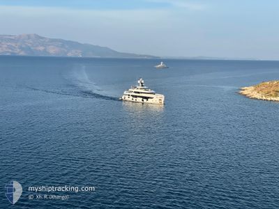
EMOCEAN
Not available
Current Trip
| Trip Time | 18 h, 27 mins |
|---|---|
| Trip Distance | 109.60 nm |
| AVG Speed | 7.5 Noeuds |
| MAX Speed | 12.7 Noeuds |
| Tirant d eau | 2.5 m |
| AVG Wind | 19 knots |
| MAX Wind | 21 knots |
| MIN Temp | 25.6°C / 78.08°F |
| MAX Temp | 26.4°C / 79.52°F |
| Position reçue | 1 m depuis |
Current Position
| Longitude | -63.08809° |
|---|---|
| Latitude | 18.03938° |
| Etat | Moored |
| Vitesse | |
| Parcours | 190° |
| Zone | Caribbean Sea |
| Station | T-AIS |
| Position reçue | 1 m depuis |
Info
Information
The current position of EMOCEAN is in Caribbean Sea with coordinates 18.03938° / -63.08809° as reported on 2025-02-09 03:31 by AIS to our vessel tracker app. The vessel's current speed is 0 Noeuds and is currently inside the port of ST MAARTEN.
The vessel EMOCEAN (IMO: 9878840, MMSI: 319218400) is a Not available It's sailing under the flag of [KY] Cayman Is.
In this page you can find informations about the vessels current position, last detected port calls, and current voyage information. If the vessels is not in coverage by AIS you will find the latest position.
The current position of EMOCEAN is detected by our AIS receivers and we are not responsible for the reliability of the data. The last position was recorded while the vessel was in Coverage by the Ais receivers of our vessel tracking app.
The current draught of EMOCEAN as reported by AIS is 2.5 meters
Weather
| Temperature | 26.3°C / 79.34°F |
|---|---|
| Wind Speed | 19 knots |
| Direction | 69° ENE |
| Pressure | 1017.1 hPa |
| Humidity | 75 % |
| Cloud Coverage | 3 % |
Featured Company
Last Port Calls
| Port | Arrival | Departure | Time In Port |
|---|---|---|---|
| 2025-02-02 13:41 | |||
| 2025-02-01 12:26 | 2025-02-01 19:14 | 6 h | |
| 2025-01-23 11:05 | 2025-01-25 18:58 | 2 d | |
| 2025-01-06 13:52 | 2025-01-22 20:06 | 16 d | |
| 2025-01-04 20:59 | 2025-01-04 23:39 | 2 h | |
| 2024-12-23 13:50 | 2024-12-30 20:07 | 7 d | |
| 2024-12-17 18:44 | 2024-12-18 16:34 | 21 h | |
| 2024-12-17 18:43 |
Most Visited Ports (Last year)
| Port | Arrivals | |
|---|---|---|
| 7 | ||
| 5 | ||
| 5 | ||
| 4 | ||
| 4 | ||
| 3 |
Last Trips
| Origin | Departure | Destination | Arrival | Distance | |
|---|---|---|---|---|---|
| 2025-02-01 15:14 | 2025-02-02 09:41 | 109.60 nm | |||
| 2025-01-25 14:58 | 2025-02-01 08:26 | 112.37 nm | |||
| 2025-01-22 16:06 | 2025-01-23 07:05 | 107.93 nm | |||
| 2025-01-04 19:39 | 2025-01-06 09:52 | 41.40 nm | |||
| 2024-12-30 16:07 | 2025-01-04 16:59 | 95.71 nm | |||
| 2024-12-18 11:34 | 2024-12-23 09:50 | 1081.15 nm | |||
| 2024-12-17 13:43 | 2024-12-17 13:44 | 0.01 nm |
Events
| Heure | Evenement | Détails | Position/ Destination | Info |
|---|---|---|---|---|
| 2025-02-07 21:37 | Etat Changé | Moored Under way using engine |
18.03937 / -63.08808
[SX] ST MAARTEN
|
Vitesse: Parcours: 102° |
| 2025-02-07 21:31 | Etat Changé | Under way using engine Moored |
18.03940 / -63.08810
[SX] ST MAARTEN
|
Vitesse: Parcours: 190° |
| 2025-02-02 14:40 | Etat Changé | Moored At anchor |
18.03936 / -63.08809
[SX] ST MAARTEN
|
Vitesse: 0.1 kn Parcours: 190° |
| 2025-02-02 13:42 | Arret |
18.03710 / -63.08877
[SX] ST MAARTEN
|
Vitesse: 0.2 kn Parcours: 199° |
|
| 2025-02-02 13:41 | Port d'arrivée |
|
18.03711 / -63.08877
[SX] ST MAARTEN
|
Vitesse: 0.6 kn Parcours: 184° |
| 2025-02-02 13:15 | Démarrage | 0.81 nm, West of ST MAARTEN |
18.03464 / -63.10609
ST.MAARTEN
|
Vitesse: 4.3 kn Parcours: 123° |
| 2025-02-02 11:02 | Etat Changé | At anchor Under way using engine |
18.03551 / -63.10815
ST.MAARTEN
|
Vitesse: 0.5 kn Parcours: 27° |
| 2025-02-02 06:45 | Arret | 0.92 nm, West of ST MAARTEN |
18.03550 / -63.10823
ST.MAARTEN
|
Vitesse: 0.2 kn Parcours: 89° |
| 2025-02-02 06:19 | Changement de zone | Sint-Maarten part of the Caribbean Sea Saint-Martin part of the Caribbean Sea |
18.02720 / -63.16414
Caribbean Sea
ST.MAARTEN
|
Vitesse: 10.1 kn Parcours: 91.2° |
| 2025-02-02 04:46 | Changement de zone | Saint-Martin part of the Caribbean Sea Anguilla part of the Caribbean Sea |
18.04287 / -63.43162
Caribbean Sea
ST.MAARTEN
|
Vitesse: 10.7 kn Parcours: 97.3° |