
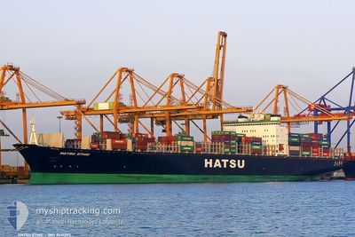
EVER ETHIC
Container Ship
Current Trip
| Time Travelled | 6 days |
|---|---|
| Remaining Time | 1 h, 54 mins |
| Distance Travelled | 2115.36 nm |
| Remaining Distance | 200.17 nm |
| AVG Speed | 13.6 Noeuds |
| MAX Speed | 19.9 Noeuds |
| AVG Wind | 9.5 knots |
| MAX Wind | 20.5 knots |
| MIN Temp | 25.8°C / 78.44°F |
| MAX Temp | 28.8°C / 83.84°F |
| Tirant d eau | 13.8 m |
| Position reçue | 2 d depuis |
Current Position
| Longitude | 76.56896° |
|---|---|
| Latitude | 8.29053° |
| Etat | Under way using engine |
| Vitesse | 13.2 Noeuds |
| Parcours | 307.2° |
| Zone | Laccadive Sea |
| Station | T-AIS |
| Position reçue | 2 d depuis |
Info
Information
The current position of EVER ETHIC is in Laccadive Sea with coordinates 8.29053° / 76.56896° as reported on 2025-02-05 11:13 by AIS to our vessel tracker app. The vessel's current speed is 13.2 Noeuds and is heading at the port of NHAVA SHEVA. The estimated time of arrival as calculated by MyShipTracking vessel tracking app is 2025-02-07 15:28 LT
The vessel EVER ETHIC (IMO: 9241293, MMSI: 235603000) is a Container Ship that was built in 2003 ( 22 Age ). It's sailing under the flag of [GB] United Kingdom.
In this page you can find informations about the vessels current position, last detected port calls, and current voyage information. If the vessels is not in coverage by AIS you will find the latest position.
The current position of EVER ETHIC is detected by our AIS receivers and we are not responsible for the reliability of the data. The last position was recorded while the vessel was in Coverage by the Ais receivers of our vessel tracking app.
The current draught of EVER ETHIC as reported by AIS is 13.8 meters
Weather
| Temperature | 27.8°C / 82.04°F |
|---|---|
| Wind Speed | 11 knots |
| Direction | 263° W |
| Pressure | 1009.4 hPa |
| Humidity | 67.2 % |
| Cloud Coverage | --- |
Featured Company
Last Port Calls
| Port | Arrival | Departure | Time In Port |
|---|---|---|---|
| 2025-01-31 05:17 | 2025-01-31 15:13 | 9 h | |
| 2025-01-29 17:50 | 2025-01-30 07:25 | 13 h | |
| 2025-01-23 18:10 | 2025-01-24 11:40 | 17 h | |
| 2025-01-20 02:45 | 2025-01-20 20:44 | 17 h | |
| 2025-01-17 22:09 | 2025-01-19 00:23 | 1 d | |
| 2025-01-06 20:08 | 2025-01-07 08:57 | 12 h | |
| 2025-01-01 04:21 | 2025-01-02 03:33 | 23 h | |
| 2024-12-26 21:21 | 2024-12-27 23:17 | 1 d | |
| 2024-12-24 01:08 | 2024-12-25 07:17 | 1 d | |
| 2024-12-17 00:22 | 2024-12-17 11:32 | 11 h |
Last Trips
| Origin | Departure | Destination | Arrival | Distance | |
|---|---|---|---|---|---|
| 2025-01-30 15:25 | 2025-01-31 13:17 | 198.38 nm | |||
| 2025-01-24 19:40 | 2025-01-30 01:50 | 1632.75 nm | |||
| 2025-01-21 04:44 | 2025-01-24 02:10 | 946.75 nm | |||
| 2025-01-19 08:23 | 2025-01-20 10:45 | 461.18 nm | |||
| 2025-01-07 16:57 | 2025-01-18 06:09 | 3102.59 nm | |||
| 2025-01-02 09:03 | 2025-01-07 04:08 | 1419.96 nm | |||
| 2024-12-28 04:47 | 2025-01-01 09:51 | 1258.82 nm | |||
| 2024-12-25 12:47 | 2024-12-27 02:51 | 423.18 nm | |||
| 2024-12-17 19:32 | 2024-12-24 06:38 | 2306.59 nm | |||
| 2024-12-16 14:07 | 2024-12-17 08:22 | 204.60 nm |
Events
| Heure | Evenement | Détails | Position/ Destination | Info |
|---|---|---|---|---|
| 2025-02-07 03:27 | Arret |
16.00182 / 72.74212
MYPKG>INNSA
|
Vitesse: 0.3 kn Parcours: 350° |
|
| 2025-02-05 11:23 | Etat Changé | Default Under way using engine |
8.31253 / 76.53987
MYPKG>INNSA
|
Vitesse: 13.2 kn Parcours: 307.2° |
| 2025-02-05 11:13 | Hors de la zone couverte |
8.29053 / 76.56896
Laccadive Sea
MYPKG>INNSA
|
Vitesse: 13.2 kn Parcours: 307.2° |
|
| 2025-02-05 10:01 | Etat Changé | Under way using engine Default |
8.14809 / 76.79076
MYPKG>INNSA
|
Vitesse: 12.9 kn Parcours: 303° |
| 2025-02-05 09:56 | Etat Changé | Default Under way using engine |
8.13851 / 76.80517
MYPKG>INNSA
|
Vitesse: 12.8 kn Parcours: 302.9° |
| 2025-02-05 05:43 | Detecté en mer | Indian part of the Laccadive Sea |
7.60018 / 77.55817
Laccadive Sea
MYPKG>INNSA
|
Vitesse: 13.6 kn Parcours: 302.4° |
| 2025-02-05 05:43 | Etat Changé | Under way using engine Default |
7.60018 / 77.55817
MYPKG>INNSA
|
Vitesse: 13.8 kn Parcours: 302° |
| 2025-02-05 05:43 | Dans la zone couverte |
7.60018 / 77.55817
Laccadive Sea
MYPKG>INNSA
|
Vitesse: 13.6 kn Parcours: 302.4° |
|
| 2025-02-04 16:55 | Etat Changé | Default Under way using engine |
5.98734 / 80.01229
MYPKG>INNSA
|
Vitesse: 14.1 kn Parcours: 296.8° |
| 2025-02-04 16:49 | Hors de la zone couverte |
5.97818 / 80.03146
Laccadive Sea
MYPKG>INNSA
|
Vitesse: 14.1 kn Parcours: 296.8° |