
FAN YA NING DE
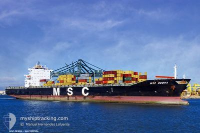
Container Ship
Current Trip
| Time Travelled | 6 h, 40 mins |
|---|---|
| Remaining Time | 1 day |
| Distance Travelled | 61.48 nm |
| Remaining Distance | 367.24 nm |
| AVG Speed | 10.7 Noeuds |
| MAX Speed | 12.6 Noeuds |
| AVG Wind | 5.9 knots |
| MAX Wind | 10 knots |
| MIN Temp | 17.7°C / 63.86°F |
| MAX Temp | 18.7°C / 65.66°F |
| Tirant d eau | 11.3 m |
| Position reçue | 4 h, 25 m depuis |
Current Position
| Longitude | 113.79698° |
|---|---|
| Latitude | 22.31797° |
| Etat | Under way using engine |
| Vitesse | 12 Noeuds |
| Parcours | 166.5° |
| Zone | South China Sea |
| Station | T-AIS |
| Position reçue | 4 h, 25 m depuis |
Info
Information
The current position of FAN YA NING DE is in South China Sea with coordinates 22.31797° / 113.79698° as reported on 2025-02-12 03:36 by AIS to our vessel tracker app. The vessel's current speed is 12 Noeuds and is heading at the port of QINZHOU. The estimated time of arrival as calculated by MyShipTracking vessel tracking app is 2025-02-13 19:08 LT
The vessel FAN YA NING DE (IMO: 9302554, MMSI: 414328000) is a Container Ship that was built in 2006 ( 19 Age ). It's sailing under the flag of [CN] China.
In this page you can find informations about the vessels current position, last detected port calls, and current voyage information. If the vessels is not in coverage by AIS you will find the latest position.
The current position of FAN YA NING DE is detected by our AIS receivers and we are not responsible for the reliability of the data. The last position was recorded while the vessel was in Coverage by the Ais receivers of our vessel tracking app.
The current draught of FAN YA NING DE as reported by AIS is 11.3 meters
Weather
| Temperature | 18.3°C / 64.94°F |
|---|---|
| Wind Speed | 10 knots |
| Direction | 49° NE |
| Pressure | 1015.4 hPa |
| Humidity | 95.1 % |
| Cloud Coverage | 100 % |
Featured Company
Last Port Calls
| Port | Arrival | Departure | Time In Port |
|---|---|---|---|
| 2025-02-11 10:01 | 2025-02-12 01:21 | 15 h | |
| 2025-02-05 14:13 | 2025-02-07 11:17 | 1 d | |
| 2025-02-02 12:13 | 2025-02-02 22:01 | 9 h | |
| 2025-01-27 18:53 | 2025-01-30 19:25 | 3 d | |
| 2025-01-25 02:17 | 2025-01-25 15:33 | 13 h | |
| 2025-01-19 07:13 | 2025-01-20 04:45 | 21 h | |
| 2025-01-15 06:46 | 2025-01-16 07:49 | 1 d | |
| 2025-01-11 00:49 | 2025-01-12 14:41 | 1 d | |
| 2025-01-07 21:32 | 2025-01-08 10:17 | 12 h | |
| 2025-01-03 21:29 | 2025-01-05 00:29 | 1 d |
Last Trips
| Origin | Departure | Destination | Arrival | Distance | |
|---|---|---|---|---|---|
| 2025-02-07 19:17 | 2025-02-11 18:01 | 1233.29 nm | |||
| 2025-02-03 06:01 | 2025-02-05 22:13 | 815.38 nm | |||
| 2025-01-31 03:25 | 2025-02-02 20:13 | 792.45 nm | |||
| 2025-01-25 23:33 | 2025-01-28 02:53 | 425.74 nm | |||
| 2025-01-20 12:45 | 2025-01-25 10:17 | 1227.17 nm | |||
| 2025-01-16 15:49 | 2025-01-19 15:13 | 883.32 nm | |||
| 2025-01-12 22:41 | 2025-01-15 14:46 | 709.62 nm | |||
| 2025-01-08 18:17 | 2025-01-11 08:49 | 696.10 nm | |||
| 2025-01-05 08:29 | 2025-01-08 05:32 | 868.64 nm | |||
| 2024-12-31 23:53 | 2025-01-04 05:29 | 875.26 nm |
Events
| Heure | Evenement | Détails | Position/ Destination | Info |
|---|---|---|---|---|
| 2025-02-12 03:39 | Etat Changé | Default Under way using engine |
22.30935 / 113.79900
CN QZH
|
Vitesse: 12 kn Parcours: 166.5° |
| 2025-02-12 03:36 | Hors de la zone couverte |
22.31797 / 113.79698
South China Sea
CN QZH
|
Vitesse: 12 kn Parcours: 166.5° |
|
| 2025-02-12 03:36 | Tirant d'eau modifié | 11.3 12.3 |
22.32012 / 113.79649
CN QZH
|
Vitesse: 11.9 kn Parcours: 168.1° |
| 2025-02-12 03:36 | Changement de destination | CN QZH CN/XCT |
22.32012 / 113.79649
CN QZH
|
Vitesse: 11.9 kn Parcours: 168.1° |
| 2025-02-12 03:36 | Changement d'ETA | 2025/02/13 22:00 2024/10/10 14:00 |
22.32012 / 113.79649
CN QZH
|
Vitesse: 11.9 kn Parcours: 168.1° |
| 2025-02-12 03:35 | Etat Changé | Under way using engine Default |
22.32012 / 113.79649
CN/XCT
|
Vitesse: 11.9 kn Parcours: 167° |
| 2025-02-12 03:33 | Etat Changé | Default Under way using engine |
22.32766 / 113.79475
CN/XCT
|
Vitesse: 11.7 kn Parcours: 169.5° |
| 2025-02-12 03:26 | Etat Changé | Under way using engine Default |
22.34957 / 113.78997
CN/XCT
|
Vitesse: 11.5 kn Parcours: 169° |
| 2025-02-12 03:26 | Dans la zone couverte |
22.34957 / 113.78997
South China Sea
|
Vitesse: 11.7 kn Parcours: 169.5° |
|
| 2025-02-12 01:33 | Démarrage | 1.17 nm, South East of NANSHA |
22.65502 / 113.68455
CN/XCT
|
Vitesse: 5.9 kn Parcours: 151° |