

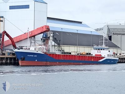
FLUVIUS AXE
General Cargo
Current Trip
| Trip Time | 7 h, 45 mins |
|---|---|
| Trip Distance | 76.97 nm |
| AVG Speed | 10.6 Noeuds |
| MAX Speed | 12.5 Noeuds |
| Tirant d eau | 3 m |
| AVG Wind | 17.5 knots |
| MAX Wind | 27.8 knots |
| MIN Temp | 6.4°C / 43.52°F |
| MAX Temp | 9.5°C / 49.1°F |
| Position reçue | 3 h, 41 m depuis |
Current Position
| Longitude | -2.42164° |
|---|---|
| Latitude | 56.49572° |
| Etat | Under way using engine |
| Vitesse | 6.3 Noeuds |
| Parcours | 9.1° |
| Zone | North Sea |
| Station | T-AIS |
| Position reçue | 3 h, 41 m depuis |
Information
The current position of FLUVIUS AXE is in North Sea with coordinates 56.49572° / -2.42164° as reported on 2025-06-04 03:04 by AIS to our vessel tracker app. The vessel's current speed is 6.3 Noeuds and is currently inside the port of MONTROSE.
The vessel FLUVIUS AXE (IMO: 9163623, MMSI: 314654000) is a General Cargo that was built in 1998 ( 27 Age ). It's sailing under the flag of [BB] Barbados.
In this page you can find informations about the vessels current position, last detected port calls, and current voyage information. If the vessels is not in coverage by AIS you will find the latest position.
The current position of FLUVIUS AXE is detected by our AIS receivers and we are not responsible for the reliability of the data. The last position was recorded while the vessel was in Coverage by the Ais receivers of our vessel tracking app.
The current draught of FLUVIUS AXE as reported by AIS is 3 meters
Weather
| Temperature | 7.9°C / 46.22°F |
|---|---|
| Wind Speed | 12 knots |
| Direction | 218° SW |
| Pressure | 994.5 hPa |
| Humidity | 71.7 % |
| Cloud Coverage | 40 % |
Featured Company
Last Port Calls
| Port | Arrival | Departure | Time In Port |
|---|---|---|---|
| 2025-06-04 06:21 | |||
| 2025-06-01 21:16 | 2025-06-03 22:36 | 2 d | |
| 2025-05-27 15:20 | 2025-05-28 03:16 | 11 h | |
| 2025-05-21 07:12 | 2025-05-21 07:16 | 3 m | |
| 2025-05-20 20:46 | 2025-05-20 23:24 | 2 h | |
| 2025-05-15 12:36 | 2025-05-16 14:59 | 1 d | |
| 2025-05-14 08:46 | |||
| 2025-05-08 12:34 | 2025-05-10 12:25 | 1 d | |
| 2025-05-05 17:32 | 2025-05-07 17:35 | 2 d | |
| 2025-05-02 16:04 | 2025-05-03 15:44 | 23 h |
Most Visited Ports (Last year)
| Port | Arrivals | |
|---|---|---|
| 6 | ||
| 6 | ||
| 4 | ||
| 3 | ||
| 3 | ||
| 3 |
Last Trips
| Origin | Departure | Destination | Arrival | Distance | |
|---|---|---|---|---|---|
| 2025-06-03 22:36 | 2025-06-04 06:21 | 76.97 nm | |||
| 2025-05-28 03:16 | 2025-06-01 21:16 | 1140.65 nm | |||
| 2025-05-21 07:16 | 2025-05-27 15:20 | 739.22 nm | |||
| 2025-05-20 23:24 | 2025-05-21 07:12 | 49.40 nm | |||
| 2025-05-16 14:59 | 2025-05-20 20:46 | 1041.21 nm | |||
| 2025-05-10 12:25 | 2025-05-15 12:36 | 845.22 nm | |||
| 2025-05-10 12:25 | 2025-05-14 08:46 | 844.05 nm | |||
| 2025-05-07 17:35 | 2025-05-08 12:34 | 186.60 nm | |||
| 2025-05-03 15:44 | 2025-05-05 17:32 | 468.57 nm | |||
| 2025-04-30 09:30 | 2025-05-02 16:04 | 249.07 nm |
Events
| Heure | Evenement | Détails | Position/ Destination | Info |
|---|---|---|---|---|
| 2025-06-04 05:30 | Arret |
56.70437 / -2.46688
[GB] MONTROSE
|
Vitesse: Parcours: 135° |
|
| 2025-06-04 05:21 | Port d'arrivée |
|
56.70406 / -2.46719
[GB] MONTROSE
|
Vitesse: 7.7 kn Parcours: 271° |
| 2025-06-04 03:14 | Etat Changé | Default Under way using engine |
56.51531 / -2.41729
MONTROSE
|
Vitesse: 6.3 kn Parcours: 9.1° |
| 2025-06-04 03:04 | Hors de la zone couverte |
56.49572 / -2.42164
North Sea
MONTROSE
|
Vitesse: 6.3 kn Parcours: 9.1° |
|
| 2025-06-04 02:01 | Etat Changé | Under way using engine Default |
56.31041 / -2.43898
MONTROSE
|
Vitesse: 11.5 kn Parcours: 10° |
| 2025-06-04 01:40 | Etat Changé | Default Under way using engine |
56.24606 / -2.45293
MONTROSE
|
Vitesse: 11.2 kn Parcours: 9.4° |
| 2025-06-03 23:31 | Tirant d'eau modifié | 3 4.8 |
56.04808 / -3.04088
MONTROSE
|
Vitesse: 11.7 kn Parcours: 74.2° |
| 2025-06-03 23:31 | Changement de destination | MONTROSE GRANGEMOUTH |
56.04808 / -3.04088
MONTROSE
|
Vitesse: 11.7 kn Parcours: 74.2° |
| 2025-06-03 23:31 | Changement d'ETA | 2025/06/04 07:00 2025/06/01 20:00 |
56.04808 / -3.04088
MONTROSE
|
Vitesse: 11.7 kn Parcours: 74.2° |
| 2025-06-03 22:54 | Etat Changé | Under way using engine Default |
56.03146 / -3.25421
GRANGEMOUTH
|
Vitesse: 11.8 kn Parcours: 74° |