

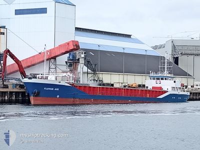
FLUVIUS AXE
General Cargo

Current Trip
| Trip Time | 4 days |
|---|---|
| Trip Distance | 1140.65 nm |
| AVG Speed | 9.9 Knots |
| MAX Speed | 13 Knots |
| Draught | 4.8 m |
| AVG Wind | 15.5 knots |
| MAX Wind | 26 knots |
| MIN Temp | 7.7°C / 45.86°F |
| MAX Temp | 14.4°C / 57.92°F |
| Position Received | 9 h, 32 m ago |
Current Position
| Longitude | -3.26296° |
|---|---|
| Latitude | 56.03110° |
| Status | Under way using engine |
| Speed | 9.8 Knots |
| Course | 255.5° |
| Area | North Sea |
| Station | T-AIS |
| Position Received | 9 h, 32 m ago |
Information
The current position of FLUVIUS AXE is in North Sea with coordinates 56.03110° / -3.26296° as reported on 2025-06-01 18:31 by AIS to our vessel tracker app. The vessel's current speed is 9.8 Knots and is currently inside the port of GRANGEMOUTH.
The vessel FLUVIUS AXE (IMO: 9163623, MMSI: 314654000) is a General Cargo that was built in 1998 ( 27 years old ). It's sailing under the flag of [BB] Barbados.
In this page you can find informations about the vessels current position, last detected port calls, and current voyage information. If the vessels is not in coverage by AIS you will find the latest position.
The current position of FLUVIUS AXE is detected by our AIS receivers and we are not responsible for the reliability of the data. The last position was recorded while the vessel was in Coverage by the Ais receivers of our vessel tracking app.
The current draught of FLUVIUS AXE as reported by AIS is 4.8 meters
Weather
| Temperature | 5.1°C / 41.18°F |
|---|---|
| Wind Speed | 6 knots |
| Direction | 244° WSW |
| Pressure | 1013.3 hPa |
| Humidity | 91.3 % |
| Cloud Coverage | 2 % |


Featured Company
Last Port Calls
| Port | Arrival | Departure | Time In Port |
|---|---|---|---|
| 2025-06-01 21:16 | |||
| 2025-05-27 15:20 | 2025-05-28 03:16 | 11 h | |
| 2025-05-21 07:12 | 2025-05-21 07:16 | 3 m | |
| 2025-05-20 20:46 | 2025-05-20 23:24 | 2 h | |
| 2025-05-15 12:36 | 2025-05-16 14:59 | 1 d | |
| 2025-05-14 08:46 | |||
| 2025-05-08 12:34 | 2025-05-10 12:25 | 1 d | |
| 2025-05-05 17:32 | 2025-05-07 17:35 | 2 d | |
| 2025-05-02 16:04 | 2025-05-03 15:44 | 23 h | |
| 2025-04-30 09:23 | 2025-04-30 09:30 | 6 m |
Most Visited Ports (Last year)
| Port | Arrivals | |
|---|---|---|
| 6 | ||
| 6 | ||
| 4 | ||
| 3 | ||
| 3 | ||
| 3 |
Last Trips
| Origin | Departure | Destination | Arrival | Distance | |
|---|---|---|---|---|---|
| 2025-05-28 03:16 | 2025-06-01 21:16 | 1140.65 nm | |||
| 2025-05-21 07:16 | 2025-05-27 15:20 | 739.22 nm | |||
| 2025-05-20 23:24 | 2025-05-21 07:12 | 49.40 nm | |||
| 2025-05-16 14:59 | 2025-05-20 20:46 | 1041.21 nm | |||
| 2025-05-10 12:25 | 2025-05-15 12:36 | 845.22 nm | |||
| 2025-05-10 12:25 | 2025-05-14 08:46 | 844.05 nm | |||
| 2025-05-07 17:35 | 2025-05-08 12:34 | 186.60 nm | |||
| 2025-05-03 15:44 | 2025-05-05 17:32 | 468.57 nm | |||
| 2025-04-30 09:30 | 2025-05-02 16:04 | 249.07 nm | |||
| 2025-04-28 19:16 | 2025-04-30 09:23 | 377.70 nm |
Events
| Time | Event | Details | Position / Dest | Info |
|---|---|---|---|---|
| 2025-06-01 21:00 | STOP Moving |
56.02647 / -3.69964
[GB] GRANGEMOUTH
|
Speed: 0.2 kn Course: 59° |
|
| 2025-06-01 20:37 | START Moving |
56.03425 / -3.68788
[GB] GRANGEMOUTH
|
Speed: 3.1 kn Course: 232° |
|
| 2025-06-01 20:20 | STOP Moving |
56.03525 / -3.68434
[GB] GRANGEMOUTH
|
Speed: Course: 242° |
|
| 2025-06-01 20:16 | PORT ARRIVAL |
|
56.03558 / -3.68348
[GB] GRANGEMOUTH
|
Speed: 2.9 kn Course: 254° |
| 2025-06-01 18:36 | Status Changed | Default Under way using engine |
56.02713 / -3.28751
GRANGEMOUTH
|
Speed: 9.8 kn Course: 255.5° |
| 2025-06-01 18:31 | OUT of Coverage |
56.03110 / -3.26296
North Sea
GRANGEMOUTH
|
Speed: 9.8 kn Course: 255.5° |
|
| 2025-06-01 18:22 | Status Changed | Under way using engine Default |
56.03804 / -3.22003
GRANGEMOUTH
|
Speed: 10.1 kn Course: 252° |
| 2025-06-01 18:19 | Status Changed | Default Under way using engine |
56.04085 / -3.20472
GRANGEMOUTH
|
Speed: 10.3 kn Course: 244.7° |
| 2025-06-01 16:10 | Status Changed | Under way using engine Default |
56.13587 / -2.65238
GRANGEMOUTH
|
Speed: 10.6 kn Course: 265° |
| 2025-06-01 15:57 | Status Changed | Default Under way using engine |
56.13834 / -2.58262
GRANGEMOUTH
|
Speed: 10.4 kn Course: 260.6° |