
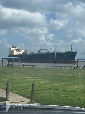
GLOBE IRIS
Tanker
Current Trip
| Time Travelled | 5 days |
|---|---|
| Remaining Time | --- |
| Distance Travelled | 1766.83 nm |
| Remaining Distance | --- |
| AVG Speed | 15 Noeuds |
| MAX Speed | 17.7 Noeuds |
| AVG Wind | 17.1 knots |
| MAX Wind | 31 knots |
| MIN Temp | 4.9°C / 40.82°F |
| MAX Temp | 22.1°C / 71.78°F |
| Tirant d eau | 8.3 m |
| Position reçue | 4 d depuis |
Current Position
| Longitude | 140.78573° |
|---|---|
| Latitude | 34.55181° |
| Etat | Under way using engine |
| Vitesse | 16.1 Noeuds |
| Parcours | 106.9° |
| Zone | North Pacific Ocean |
| Station | T-AIS |
| Position reçue | 4 d depuis |
Info
Information
The current position of GLOBE IRIS is in North Pacific Ocean with coordinates 34.55181° / 140.78573° as reported on 2025-02-02 19:02 by AIS to our vessel tracker app. The vessel's current speed is 16.1 Noeuds and is heading at the port of BALBOA. The estimated time of arrival as calculated by MyShipTracking vessel tracking app is 2025-02-24 18:01 LT
The vessel GLOBE IRIS (IMO: 9902160, MMSI: 373263000) is a Tanker It's sailing under the flag of [PA] Panama.
In this page you can find informations about the vessels current position, last detected port calls, and current voyage information. If the vessels is not in coverage by AIS you will find the latest position.
The current position of GLOBE IRIS is detected by our AIS receivers and we are not responsible for the reliability of the data. The last position was recorded while the vessel was in Coverage by the Ais receivers of our vessel tracking app.
The current draught of GLOBE IRIS as reported by AIS is 8.3 meters
Weather
| Temperature | 22.1°C / 71.78°F |
|---|---|
| Wind Speed | 14 knots |
| Direction | 287° WNW |
| Pressure | 1010.7 hPa |
| Humidity | 79.9 % |
| Cloud Coverage | 6 % |
Featured Company
Events
| Heure | Evenement | Détails | Position/ Destination | Info |
|---|---|---|---|---|
| 2025-02-02 19:22 | Etat Changé | Default Under way using engine |
34.52804 / 140.88019
PA BLB
|
Vitesse: 16.1 kn Parcours: 106.9° |
| 2025-02-02 19:02 | Hors de la zone couverte |
34.55181 / 140.78573
North Pacific Ocean
PA BLB
|
Vitesse: 16.1 kn Parcours: 106.9° |
|
| 2025-02-02 15:16 | Etat Changé | Under way using engine Default |
34.84402 / 139.67038
PA BLB
|
Vitesse: 15.6 kn Parcours: 132° |
| 2025-02-02 15:05 | Dans la zone couverte |
34.84402 / 139.67038
North Pacific Ocean
PA BLB
|
Vitesse: 15.5 kn Parcours: 113.2° |
|
| 2025-02-02 13:57 | Etat Changé | Default Under way using engine |
35.16305 / 139.75243
PA BLB
|
Vitesse: 10.8 kn Parcours: 195.5° |
| 2025-02-02 13:57 | Hors de la zone couverte |
35.16365 / 139.75264
North Pacific Ocean
PA BLB
|
Vitesse: 10.8 kn Parcours: 195.5° |
|
| 2025-02-02 13:32 | Etat Changé | Under way using engine Default |
35.22295 / 139.77202
PA BLB
|
Vitesse: 12.7 kn Parcours: 184° |
| 2025-02-02 13:21 | Etat Changé | Default Under way using engine |
35.25896 / 139.76900
PA BLB
|
Vitesse: 13.7 kn Parcours: 145.3° |
| 2025-02-02 12:15 | Démarrage | 3.03 nm, South East of KAWASAKI |
35.46402 / 139.78955
PA BLB
|
Vitesse: 3.3 kn Parcours: 229° |
| 2025-02-02 12:04 | Etat Changé | Under way using engine At anchor |
35.46215 / 139.78983
PA BLB
|
Vitesse: 0.4 kn Parcours: 353° |