
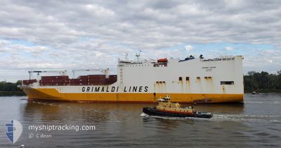
GRANDE GABON
Ro-Ro Cargo
Current Trip
| Time Travelled | 16 h, 51 mins |
|---|---|
| Remaining Time | 3 h, 54 mins |
| Distance Travelled | 260.95 nm |
| Remaining Distance | 59.33 nm |
| AVG Speed | 16.2 Noeuds |
| MAX Speed | 21.5 Noeuds |
| AVG Wind | 6.4 knots |
| MAX Wind | 10 knots |
| MIN Temp | 0.5°C / 32.9°F |
| MAX Temp | 4.1°C / 39.38°F |
| Tirant d eau | 7.4 m |
| Position reçue | 1 m depuis |
Current Position
| Longitude | 7.09989° |
|---|---|
| Latitude | 53.85540° |
| Etat | Under way using engine |
| Vitesse | 15 Noeuds |
| Parcours | 80.2° |
| Zone | North Sea |
| Station | T-AIS |
| Position reçue | 1 m depuis |
Info
Information
The current position of GRANDE GABON is in North Sea with coordinates 53.85540° / 7.09989° as reported on 2025-02-15 04:51 by AIS to our vessel tracker app. The vessel's current speed is 15 Noeuds and is heading at the port of BREMERHAVEN. The estimated time of arrival as calculated by MyShipTracking vessel tracking app is 2025-02-15 08:46 LT
The vessel GRANDE GABON (IMO: 9437933, MMSI: 247304600) is a Ro-Ro Cargo that was built in 2011 ( 14 Age ). It's sailing under the flag of [IT] Italy.
In this page you can find informations about the vessels current position, last detected port calls, and current voyage information. If the vessels is not in coverage by AIS you will find the latest position.
The current position of GRANDE GABON is detected by our AIS receivers and we are not responsible for the reliability of the data. The last position was recorded while the vessel was in Coverage by the Ais receivers of our vessel tracking app.
The current draught of GRANDE GABON as reported by AIS is 7.4 meters
Weather
| Temperature | 0.5°C / 32.9°F |
|---|---|
| Wind Speed | 4 knots |
| Direction | 242° WSW |
| Pressure | 1026.3 hPa |
| Humidity | 89.7 % |
| Cloud Coverage | 100 % |
Featured Company
Last Port Calls
| Port | Arrival | Departure | Time In Port |
|---|---|---|---|
| 2025-02-11 13:03 | 2025-02-14 12:01 | 2 d | |
| 2025-02-09 08:47 | 2025-02-10 21:47 | 1 d | |
| 2025-02-08 17:54 | 2025-02-09 08:16 | 14 h | |
| 2025-01-29 12:15 | 2025-01-30 07:43 | 19 h | |
| 2025-01-18 23:04 | 2025-01-20 19:53 | 1 d | |
| 2025-01-16 19:37 | 2025-01-17 11:53 | 16 h | |
| 2025-01-13 09:06 | 2025-01-14 18:56 | 1 d | |
| 2025-01-11 09:28 | 2025-01-12 09:06 | 23 h | |
| 2025-01-08 08:47 | 2025-01-10 00:03 | 1 d | |
| 2024-12-22 04:56 | 2024-12-31 16:44 | 9 d |
Last Trips
| Origin | Departure | Destination | Arrival | Distance | |
|---|---|---|---|---|---|
| 2025-02-10 21:47 | 2025-02-11 14:03 | 167.90 nm | |||
| 2025-02-09 08:16 | 2025-02-09 08:47 | 1.30 nm | |||
| 2025-01-30 07:43 | 2025-02-08 17:54 | 2786.75 nm | |||
| 2025-01-20 20:53 | 2025-01-29 12:15 | 2110.58 nm | |||
| 2025-01-17 11:53 | 2025-01-19 00:04 | 605.38 nm | |||
| 2025-01-14 18:56 | 2025-01-16 19:37 | 920.31 nm | |||
| 2025-01-12 09:06 | 2025-01-13 09:06 | 367.73 nm | |||
| 2025-01-10 00:03 | 2025-01-11 09:28 | 573.73 nm | |||
| 2024-12-31 17:44 | 2025-01-08 08:47 | 2645.28 nm | |||
| 2024-12-21 16:18 | 2024-12-22 05:56 | 166.45 nm |
Events
| Heure | Evenement | Détails | Position/ Destination | Info |
|---|---|---|---|---|
| 2025-02-15 03:50 | Tirant d'eau modifié | 7.4 7.5 |
53.80320 / 6.67653
BEANR>DEBRV
|
Vitesse: 15 kn Parcours: 76.1° |
| 2025-02-15 03:43 | Changement de zone | German part of the North Sea Dutch part of the North Sea |
53.79623 / 6.62857
North Sea
BEANR>DEBRV
|
Vitesse: 15 kn Parcours: 75.8° |
| 2025-02-15 03:42 | Etat Changé | Under way using engine Default |
53.79520 / 6.62173
BEANR>DEBRV
|
Vitesse: 15 kn Parcours: 76° |
| 2025-02-15 03:41 | Dans la zone couverte |
53.79623 / 6.62857
North Sea
BEANR>DEBRV
|
Vitesse: 15 kn Parcours: 75.8° |
|
| 2025-02-15 02:15 | Etat Changé | Default Under way using engine |
53.69421 / 6.05083
BEANR>DEBRV
|
Vitesse: 14.4 kn Parcours: 70.2° |
| 2025-02-15 02:13 | Hors de la zone couverte |
53.69154 / 6.03813
North Sea
BEANR>DEBRV
|
Vitesse: 14.4 kn Parcours: 70.2° |
|
| 2025-02-15 02:10 | Etat Changé | Under way using engine Default |
53.68809 / 6.02166
BEANR>DEBRV
|
Vitesse: 14.3 kn Parcours: 71° |
| 2025-02-15 02:01 | Etat Changé | Default Under way using engine |
53.67621 / 5.96537
BEANR>DEBRV
|
Vitesse: 14.2 kn Parcours: 71.8° |
| 2025-02-14 22:04 | Etat Changé | Under way using engine Default |
53.24407 / 4.59244
BEANR>DEBRV
|
Vitesse: 15.7 kn Parcours: 25° |
| 2025-02-14 21:53 | Etat Changé | Default Under way using engine |
53.20414 / 4.56027
BEANR>DEBRV
|
Vitesse: 15.7 kn Parcours: 31.6° |