
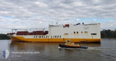
GRANDE GABON
Ro-Ro Cargo
Current Trip
| Time Travelled | 4 days |
|---|---|
| Remaining Time | --- |
| Distance Travelled | 1847.18 nm |
| Remaining Distance | --- |
| AVG Speed | 17.2 Knop |
| MAX Speed | 19.1 Knop |
| AVG Wind | 15.5 knots |
| MAX Wind | 29.3 knots |
| MIN Temp | 17.9°C / 64.22°F |
| MAX Temp | 27.3°C / 81.14°F |
| Djupgående | 9 m |
| Position mottagen | 15 h, 52 m sen |
Current Position
| Longitud | -17.61904° |
|---|---|
| Latitude | 11.06352° |
| Status | Under way using engine |
| Fart | 17.5 Knop |
| Kurs | 178.7° |
| Område | North Atlantic Ocean |
| Station | T-AIS |
| Position mottagen | 15 h, 52 m sen |
Info
Information
The current position of GRANDE GABON is in North Atlantic Ocean with coordinates 11.06352° / -17.61904° as reported on 2026-01-05 11:20 by AIS to our vessel tracker app. The vessel's current speed is 17.5 Knop and is heading at the port of NASSIT. The estimated time of arrival as calculated by MyShipTracking vessel tracking app is 2026-01-06 08:30 LT
The vessel GRANDE GABON (IMO: 9437933, MMSI: 247304600) is a Ro-Ro Cargo that was built in 2011 ( 15 År gammal ). It's sailing under the flag of [IT] Italy.
In this page you can find informations about the vessels current position, last detected port calls, and current voyage information. If the vessels is not in coverage by AIS you will find the latest position.
The current position of GRANDE GABON is detected by our AIS receivers and we are not responsible for the reliability of the data. The last position was recorded while the vessel was in Coverage by the Ais receivers of our vessel tracking app.
The current draught of GRANDE GABON as reported by AIS is 9 meters
Weather
| Temperature | 27.3°C / 81.14°F |
|---|---|
| Wind Speed | 11 knots |
| Direction | 280° W |
| Pressure | 1012.1 hPa |
| Humidity | 70.3 % |
| Cloud Coverage | 100 % |
Featured Company
Last Port Calls
| Port | Arrival | Departure | Time In Port |
|---|---|---|---|
| 2025-12-29 22:02 | 2026-01-01 18:10 | 2 d | |
| 2025-12-19 05:44 | 2025-12-22 21:58 | 3 d | |
| 2025-12-17 04:47 | 2025-12-18 01:04 | 20 h | |
| 2025-12-14 15:10 | 2025-12-16 00:55 | 1 d | |
| 2025-12-08 18:03 | 2025-12-09 20:47 | 1 d | |
| 2025-11-29 12:57 | 2025-12-01 14:45 | 2 d | |
| 2025-11-28 09:45 | 2025-11-29 00:05 | 14 h | |
| 2025-11-21 08:49 | 2025-11-22 08:50 | 1 d | |
| 2025-11-16 12:42 | 2025-11-17 23:58 | 1 d | |
| 2025-11-08 22:28 | 2025-11-12 06:45 | 3 d |
Last Trips
| Origin | Departure | Destination | Arrival | Distance | |
|---|---|---|---|---|---|
| 2025-12-22 21:58 | 2025-12-29 22:02 | 1749.71 nm | |||
| 2025-12-18 01:04 | 2025-12-19 05:44 | 382.33 nm | |||
| 2025-12-16 00:55 | 2025-12-17 04:47 | 144.07 nm | |||
| 2025-12-09 20:47 | 2025-12-14 15:10 | 1634.07 nm | |||
| 2025-12-01 14:45 | 2025-12-08 18:03 | 3023.18 nm | |||
| 2025-11-29 00:05 | 2025-11-29 12:57 | 158.03 nm | |||
| 2025-11-22 08:50 | 2025-11-28 09:45 | 1685.63 nm | |||
| 2025-11-17 23:58 | 2025-11-21 08:49 | 1390.34 nm | |||
| 2025-11-12 06:45 | 2025-11-16 12:42 | 1563.51 nm | |||
| 2025-11-06 22:07 | 2025-11-08 22:28 | 406.12 nm |
Events
| Tid | Event | Detaljer | Position / Dest | Information |
|---|---|---|---|---|
| 2026-01-05 11:27 | Status ändrad | Default Under way using engine |
11.02945 / -17.61833
MACAS>SLFNA
|
Fart: 17.5 kn Kurs: 178.7° |
| 2026-01-05 11:20 | Status ändrad | Under way using engine Default |
11.06352 / -17.61904
MACAS>SLFNA
|
Fart: 17.4 kn Kurs: 178° |
| 2026-01-05 11:20 | UTANFÖR täckningsområde |
11.06352 / -17.61904
North Atlantic Ocean
MACAS>SLFNA
|
Fart: 17.5 kn Kurs: 178.7° |
|
| 2026-01-05 10:40 | Status ändrad | Default Under way using engine |
11.25669 / -17.62583
MACAS>SLFNA
|
Fart: 17.3 kn Kurs: 177.1° |
| 2026-01-05 09:56 | Status ändrad | Under way using engine Default |
11.46745 / -17.63709
MACAS>SLFNA
|
Fart: 17.4 kn Kurs: 182° |
| 2026-01-05 09:53 | Status ändrad | Default Under way using engine |
11.48195 / -17.63687
MACAS>SLFNA
|
Fart: 17.3 kn Kurs: 179.8° |
| 2026-01-05 09:38 | Status ändrad | Under way using engine Default |
11.55354 / -17.63723
MACAS>SLFNA
|
Fart: 17 kn Kurs: 177° |
| 2026-01-05 08:58 | Status ändrad | Default Under way using engine |
11.74667 / -17.64333
MACAS>SLFNA
|
Fart: 17.2 kn Kurs: 178.9° |
| 2026-01-05 08:49 | Byter havsområde | Guinea Bissau part of the North Atlantic Ocean Senegalese part of the North Atlantic Ocean |
11.79249 / -17.64539
North Atlantic Ocean
MACAS>SLFNA
|
Fart: 17.1 kn Kurs: 179.1° |
| 2026-01-05 08:29 | Status ändrad | Under way using engine Default |
11.88418 / -17.64706
MACAS>SLFNA
|
Fart: 17.4 kn Kurs: 179° |