
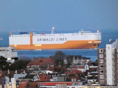
GRANDE TEXAS
Cargo
Current Trip
| Time Travelled | 10 h, 24 mins |
|---|---|
| Remaining Time | --- |
| Distance Travelled | 134.79 nm |
| Remaining Distance | --- |
| AVG Speed | 11.7 Noeuds |
| MAX Speed | 17.7 Noeuds |
| AVG Wind | 9.6 knots |
| MAX Wind | 14 knots |
| MIN Temp | 20.5°C / 68.9°F |
| MAX Temp | 21.6°C / 70.88°F |
| Tirant d eau | 8.2 m |
| Position reçue | 27 m depuis |
Current Position
| Longitude | 174.58481° |
|---|---|
| Latitude | -34.81418° |
| Etat | Under way using engine |
| Vitesse | 17.2 Noeuds |
| Parcours | 321.6° |
| Zone | South Pacific Ocean |
| Station | T-AIS |
| Position reçue | 27 m depuis |
Info
Information
The current position of GRANDE TEXAS is in South Pacific Ocean with coordinates -34.81418° / 174.58481° as reported on 2025-02-07 15:16 by AIS to our vessel tracker app. The vessel's current speed is 17.2 Noeuds and is heading at the port of SHANGHAI. The estimated time of arrival as calculated by MyShipTracking vessel tracking app is 2025-02-21 01:00 LT
The vessel GRANDE TEXAS (IMO: 9796365, MMSI: 247441100) is a Cargo It's sailing under the flag of [IT] Italy.
In this page you can find informations about the vessels current position, last detected port calls, and current voyage information. If the vessels is not in coverage by AIS you will find the latest position.
The current position of GRANDE TEXAS is detected by our AIS receivers and we are not responsible for the reliability of the data. The last position was recorded while the vessel was in Coverage by the Ais receivers of our vessel tracking app.
The current draught of GRANDE TEXAS as reported by AIS is 8.2 meters
Weather
| Temperature | 20.8°C / 69.44°F |
|---|---|
| Wind Speed | 12 knots |
| Direction | 65° ENE |
| Pressure | 1013.5 hPa |
| Humidity | 73.4 % |
| Cloud Coverage | 6 % |
Featured Company
Last Port Calls
| Port | Arrival | Departure | Time In Port |
|---|---|---|---|
| 2025-02-06 22:09 | 2025-02-07 05:20 | 7 h | |
| 2025-02-01 22:31 | 2025-02-02 15:40 | 17 h | |
| 2025-01-26 17:53 | 2025-01-28 10:19 | 1 d | |
| 2025-01-17 01:40 | 2025-01-18 01:33 | 23 h | |
| 2025-01-16 03:30 | 2025-01-16 15:07 | 11 h | |
| 2024-12-28 18:24 | 2024-12-30 18:01 | 1 d | |
| 2024-12-26 06:44 | 2024-12-27 01:33 | 18 h | |
| 2024-12-21 23:06 | 2024-12-23 07:01 | 1 d | |
| 2024-12-16 14:44 | 2024-12-19 17:23 | 3 d | |
| 2024-12-15 17:46 | 2024-12-16 12:37 | 18 h |
Most Visited Ports (Last year)
| Port | Arrivals | |
|---|---|---|
| 3 | ||
| 3 | ||
| 3 | ||
| 2 | ||
| 2 | ||
| 1 |
Last Trips
| Origin | Departure | Destination | Arrival | Distance | |
|---|---|---|---|---|---|
| 2025-02-03 02:40 | 2025-02-07 11:09 | 1677.00 nm | |||
| 2025-01-28 18:19 | 2025-02-02 09:31 | 1705.92 nm | |||
| 2025-01-18 05:33 | 2025-01-27 01:53 | 3403.53 nm | |||
| 2025-01-16 19:07 | 2025-01-17 05:40 | 134.56 nm | |||
| 2024-12-30 18:01 | 2025-01-16 07:30 | 6676.97 nm | |||
| 2024-12-27 01:33 | 2024-12-28 18:24 | 712.95 nm | |||
| 2024-12-23 08:01 | 2024-12-26 06:44 | 983.99 nm | |||
| 2024-12-19 18:23 | 2024-12-22 00:06 | 494.56 nm | |||
| 2024-12-16 13:37 | 2024-12-16 15:44 | 31.65 nm | |||
| 2024-12-15 16:47 | 2024-12-15 18:46 | 21.70 nm |
Events
| Heure | Evenement | Détails | Position/ Destination | Info |
|---|---|---|---|---|
| 2025-02-07 15:25 | Etat Changé | Default Under way using engine |
-34.78153 / 174.55547
NZAKL>CNSHG
|
Vitesse: 17.2 kn Parcours: 321.6° |
| 2025-02-07 15:16 | Etat Changé | Under way using engine Default |
-34.81643 / 174.58696
NZAKL>CNSHG
|
Vitesse: 17.2 kn Parcours: 322° |
| 2025-02-07 14:59 | Etat Changé | Default Under way using engine |
-34.88115 / 174.64706
NZAKL>CNSHG
|
Vitesse: 17 kn Parcours: 325.2° |
| 2025-02-07 14:55 | Etat Changé | Under way using engine Default |
-34.89791 / 174.66141
NZAKL>CNSHG
|
Vitesse: 17.3 kn Parcours: 324° |
| 2025-02-07 14:49 | Etat Changé | Default Under way using engine |
-34.91936 / 174.67981
NZAKL>CNSHG
|
Vitesse: 17.5 kn Parcours: 324° |
| 2025-02-07 14:45 | Etat Changé | Under way using engine Default |
-34.93426 / 174.69281
NZAKL>CNSHG
|
Vitesse: 17.5 kn Parcours: 324° |
| 2025-02-07 14:39 | Dans la zone couverte |
-34.93426 / 174.69281
South Pacific Ocean
NZAKL>CNSHG
|
Vitesse: 17.5 kn Parcours: 324° |
|
| 2025-02-07 13:45 | Etat Changé | Default Under way using engine |
-35.17100 / 174.90300
NZAKL>CNSHG
|
Vitesse: 17.4 kn Parcours: 323.8° |
| 2025-02-07 13:41 | Etat Changé | Under way using engine Default |
-35.18864 / 174.91881
NZAKL>CNSHG
|
Vitesse: 17.4 kn Parcours: 324° |
| 2025-02-07 13:41 | Hors de la zone couverte |
-35.18864 / 174.91881
South Pacific Ocean
NZAKL>CNSHG
|
Vitesse: 17.4 kn Parcours: 323.8° |