
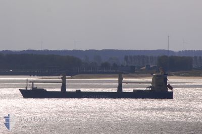
HAMMARLAND
General Cargo
Current Trip
| Time Travelled | 1 day |
|---|---|
| Remaining Time | --- |
| Distance Travelled | 110.28 nm |
| Remaining Distance | --- |
| AVG Speed | 10.2 Noeuds |
| MAX Speed | 12.1 Noeuds |
| AVG Wind | 5 knots |
| MAX Wind | 8.9 knots |
| MIN Temp | 18°C / 64.4°F |
| MAX Temp | 19.9°C / 67.82°F |
| Tirant d eau | 5.6 m |
| Position reçue | 3 h, 57 m depuis |
Current Position
| Longitude | 50.28210° |
|---|---|
| Latitude | 26.59996° |
| Etat | At anchor |
| Vitesse | 0.2 Noeuds |
| Parcours | 22° |
| Zone | Persian Gulf |
| Station | T-AIS |
| Position reçue | 3 h, 57 m depuis |
Info
Information
The current position of HAMMARLAND is in Persian Gulf with coordinates 26.59996° / 50.28210° as reported on 2025-02-12 08:32 by AIS to our vessel tracker app. The vessel's current speed is 0.2 Noeuds
The vessel HAMMARLAND (IMO: 9415052, MMSI: 305767000) is a General Cargo that was built in 2011 ( 14 Age ). It's sailing under the flag of [AG] Antigua Barbuda.
In this page you can find informations about the vessels current position, last detected port calls, and current voyage information. If the vessels is not in coverage by AIS you will find the latest position.
The current position of HAMMARLAND is detected by our AIS receivers and we are not responsible for the reliability of the data. The last position was recorded while the vessel was in Coverage by the Ais receivers of our vessel tracking app.
The current draught of HAMMARLAND as reported by AIS is 5.6 meters
Weather
| Temperature | 18.4°C / 65.12°F |
|---|---|
| Wind Speed | 3 knots |
| Direction | 97° E |
| Pressure | 1015.8 hPa |
| Humidity | 81 % |
| Cloud Coverage | 99 % |
Featured Company
Last Port Calls
| Port | Arrival | Departure | Time In Port |
|---|---|---|---|
| 2025-02-09 21:40 | 2025-02-11 13:31 | 1 d | |
| 2025-01-25 11:22 | 2025-01-27 09:53 | 1 d | |
| 2025-01-20 20:12 | 2025-01-23 01:12 | 2 d | |
| 2024-12-26 10:10 | 2024-12-30 18:48 | 4 d | |
| 2024-12-25 06:33 | 2024-12-26 08:53 | 1 d | |
| 2024-12-06 09:58 | 2024-12-23 16:36 | 17 d | |
| 2024-12-04 07:12 | 2024-12-06 09:44 | 2 d |
Last Trips
| Origin | Departure | Destination | Arrival | Distance | |
|---|---|---|---|---|---|
| 2025-01-27 09:53 | 2025-02-09 21:40 | 3633.49 nm | |||
| 2025-01-23 01:12 | 2025-01-25 11:22 | 580.98 nm | |||
| 2024-12-30 18:48 | 2025-01-20 20:12 | 618.84 nm | |||
| 2024-12-26 08:53 | 2024-12-26 10:10 | 9.51 nm | |||
| 2024-12-23 16:36 | 2024-12-25 06:33 | 49.23 nm | |||
| 2024-12-06 09:44 | 2024-12-06 09:58 | 0.32 nm |
Events
| Heure | Evenement | Détails | Position/ Destination | Info |
|---|---|---|---|---|
| 2025-02-12 08:38 | Etat Changé | Default At anchor |
26.59990 / 50.28244
SA DMN
|
Vitesse: 0.2 kn Parcours: 22° |
| 2025-02-12 08:32 | Hors de la zone couverte |
26.59996 / 50.28210
Persian Gulf
|
Vitesse: 0.2 kn Parcours: 122.3° |
|
| 2025-02-12 04:59 | Etat Changé | At anchor Default |
26.60164 / 50.28141
SA DMN
|
Vitesse: Parcours: 108° |
| 2025-02-12 04:53 | Etat Changé | Default At anchor |
26.60158 / 50.28141
SA DMN
|
Vitesse: Parcours: 108° |
| 2025-02-12 03:47 | Etat Changé | At anchor Default |
26.60117 / 50.28130
SA DMN
|
Vitesse: Parcours: 85° |
| 2025-02-12 03:44 | Etat Changé | Default At anchor |
26.60116 / 50.28130
SA DMN
|
Vitesse: Parcours: 82° |
| 2025-02-12 03:23 | Etat Changé | At anchor Default |
26.60071 / 50.28135
SA DMN
|
Vitesse: 0.1 kn Parcours: 51° |
| 2025-02-12 03:17 | Etat Changé | Default At anchor |
26.60041 / 50.28154
SA DMN
|
Vitesse: 0.1 kn Parcours: 51° |
| 2025-02-12 03:17 | Etat Changé | At anchor Default |
26.60041 / 50.28154
SA DMN
|
Vitesse: 0.1 kn Parcours: 51° |
| 2025-02-12 02:59 | Etat Changé | Default At anchor |
26.60030 / 50.28169
SA DMN
|
Vitesse: Parcours: 59° |