
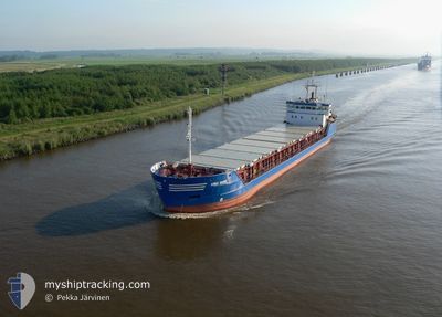
HAV STREYM
General Cargo
Current Trip
| Trip Time | 3 days |
|---|---|
| Trip Distance | 724.26 nm |
| AVG Speed | 9.8 Noeuds |
| MAX Speed | 9.8 Noeuds |
| Tirant d eau | 5.2 m |
| AVG Wind | 14 knots |
| MAX Wind | 28 knots |
| MIN Temp | 4.4°C / 39.92°F |
| MAX Temp | 10°C / 50°F |
| Position reçue | 3 d depuis |
Current Position
| Longitude | -6.69338° |
|---|---|
| Latitude | 61.98803° |
| Etat | Under way using engine |
| Vitesse | 9.7 Noeuds |
| Parcours | 341.5° |
| Zone | North Atlantic Ocean |
| Station | T-AIS |
| Position reçue | 3 d depuis |
Info
Information
The current position of HAV STREYM is in North Atlantic Ocean with coordinates 61.98803° / -6.69338° as reported on 2025-02-02 04:58 by AIS to our vessel tracker app. The vessel's current speed is 9.7 Noeuds and is currently inside the port of RUNAVIK.
The vessel HAV STREYM (IMO: 9126625, MMSI: 231251000) is a General Cargo that was built in 1996 ( 29 Age ). It's sailing under the flag of [FO] Faroe Is.
In this page you can find informations about the vessels current position, last detected port calls, and current voyage information. If the vessels is not in coverage by AIS you will find the latest position.
The current position of HAV STREYM is detected by our AIS receivers and we are not responsible for the reliability of the data. The last position was recorded while the vessel was in Coverage by the Ais receivers of our vessel tracking app.
The current draught of HAV STREYM as reported by AIS is 5.2 meters
Weather
| Temperature | 6.3°C / 43.34°F |
|---|---|
| Wind Speed | 25 knots |
| Direction | 226° SW |
| Pressure | 1020.3 hPa |
| Humidity | 77.6 % |
| Cloud Coverage | 34 % |
Featured Company
Last Port Calls
| Port | Arrival | Departure | Time In Port |
|---|---|---|---|
| 2025-02-02 06:01 | |||
| 2025-01-29 12:11 | 2025-01-30 00:26 | 12 h | |
| 2025-01-27 22:53 | 2025-01-28 21:16 | 22 h | |
| 2025-01-23 20:09 | |||
| 2025-01-22 18:04 | 2025-01-23 01:09 | 7 h | |
| 2025-01-21 23:56 | 2025-01-22 15:38 | 15 h | |
| 2025-01-19 21:17 | 2025-01-20 04:59 | 7 h | |
| 2025-01-19 12:21 | 2025-01-19 17:27 | 5 h | |
| 2025-01-08 23:04 | 2025-01-10 19:37 | 1 d | |
| 2025-01-05 15:06 | 2025-01-07 05:51 | 1 d |
Last Trips
| Origin | Departure | Destination | Arrival | Distance | |
|---|---|---|---|---|---|
| 2025-01-30 01:26 | 2025-02-02 06:01 | 724.26 nm | |||
| 2025-01-28 22:16 | 2025-01-29 13:11 | 131.31 nm | |||
| 2025-01-23 20:09 | 2025-01-27 23:53 | 814.63 nm | |||
| 2025-01-22 15:38 | 2025-01-22 18:04 | 20.43 nm | |||
| 2025-01-20 05:59 | 2025-01-21 23:56 | 395.55 nm | |||
| 2025-01-19 18:27 | 2025-01-19 22:17 | 36.91 nm | |||
| 2025-01-10 20:37 | 2025-01-19 13:21 | 1503.21 nm | |||
| 2025-01-07 06:51 | 2025-01-09 00:04 | 241.72 nm | |||
| 2025-01-02 21:20 | 2025-01-05 16:06 | 473.74 nm | |||
| 2024-12-28 02:58 | 2024-12-31 12:07 | 753.72 nm |
Events
| Heure | Evenement | Détails | Position/ Destination | Info |
|---|---|---|---|---|
| 2025-02-02 06:02 | Arret |
62.11195 / -6.72838
[FO] RUNAVIK
|
Vitesse: Parcours: 45° |
|
| 2025-02-02 06:01 | Port d'arrivée |
|
62.11195 / -6.72838
[FO] RUNAVIK
|
Vitesse: 3.4 kn Parcours: 110° |
| 2025-02-02 05:06 | Etat Changé | Default Under way using engine |
62.00857 / -6.70796
GRUNDARTANGI
|
Vitesse: 9.7 kn Parcours: 341.5° |
| 2025-02-02 04:58 | Hors de la zone couverte |
61.98803 / -6.69338
North Atlantic Ocean
GRUNDARTANGI
|
Vitesse: 9.7 kn Parcours: 341.5° |
|
| 2025-02-02 04:54 | Changement de zone | Faeroe Islands part of the North Atlantic Ocean United Kingdom part of the North Atlantic Ocean |
61.97831 / -6.68941
North Atlantic Ocean
GRUNDARTANGI
|
Vitesse: 8.5 kn Parcours: 352.1° |
| 2025-02-02 04:53 | Etat Changé | Under way using engine Default |
61.97539 / -6.68835
GRUNDARTANGI
|
Vitesse: 8.2 kn Parcours: 347° |
| 2025-02-02 04:53 | Dans la zone couverte |
61.97831 / -6.68941
North Atlantic Ocean
GRUNDARTANGI
|
Vitesse: 8.5 kn Parcours: 352.1° |
|
| 2025-02-01 08:55 | Etat Changé | Default Under way using engine |
59.28797 / -4.04271
GRUNDARTANGI
|
Vitesse: 9.5 kn Parcours: 336.4° |
| 2025-02-01 08:49 | Hors de la zone couverte |
59.27396 / -4.03020
North Atlantic Ocean
GRUNDARTANGI
|
Vitesse: 9.5 kn Parcours: 336.4° |
|
| 2025-02-01 05:10 | Changement de zone | United Kingdom part of the North Atlantic Ocean United Kingdom part of the North Sea |
58.76745 / -3.41748
North Atlantic Ocean
GRUNDARTANGI
|
Vitesse: 12.7 kn Parcours: 297.8° |