
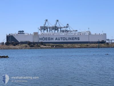
HOEGH TRANSPORTER
Vehicles Carrier
Current Trip
| Trip Time | 16 h, 32 mins |
|---|---|
| Trip Distance | 221.69 nm |
| AVG Speed | 13.4 Noeuds |
| MAX Speed | 16.9 Noeuds |
| Tirant d eau | 8.4 m |
| AVG Wind | 12.2 knots |
| MAX Wind | 33.8 knots |
| MIN Temp | 2.8°C / 37.04°F |
| MAX Temp | 10.2°C / 50.36°F |
| Position reçue | 1 d depuis |
Current Position
| Longitude | 139.71581° |
|---|---|
| Latitude | 34.69478° |
| Etat | Under way using engine |
| Vitesse | 16.2 Noeuds |
| Parcours | 246.8° |
| Zone | North Pacific Ocean |
| Station | T-AIS |
| Position reçue | 1 d depuis |
Info
Information
The current position of HOEGH TRANSPORTER is in North Pacific Ocean with coordinates 34.69478° / 139.71581° as reported on 2025-02-10 15:12 by AIS to our vessel tracker app. The vessel's current speed is 16.2 Noeuds and is currently inside the port of OMAEZAKI.
The vessel HOEGH TRANSPORTER (IMO: 9176395, MMSI: 257712000) is a Vehicles Carrier that was built in 1999 ( 26 Age ). It's sailing under the flag of [NO] Norway.
In this page you can find informations about the vessels current position, last detected port calls, and current voyage information. If the vessels is not in coverage by AIS you will find the latest position.
The current position of HOEGH TRANSPORTER is detected by our AIS receivers and we are not responsible for the reliability of the data. The last position was recorded while the vessel was in Coverage by the Ais receivers of our vessel tracking app.
The current draught of HOEGH TRANSPORTER as reported by AIS is 8.4 meters
Weather
| Temperature | 8.9°C / 48.02°F |
|---|---|
| Wind Speed | 14 knots |
| Direction | 259° W |
| Pressure | 1019.6 hPa |
| Humidity | 71.9 % |
| Cloud Coverage | 70 % |
Featured Company
Last Port Calls
| Port | Arrival | Departure | Time In Port |
|---|---|---|---|
| 2025-02-10 21:45 | |||
| 2025-02-09 07:25 | 2025-02-10 05:13 | 21 h | |
| 2025-02-07 21:44 | 2025-02-08 05:30 | 7 h | |
| 2025-01-22 23:22 | 2025-01-26 06:50 | 3 d | |
| 2025-01-18 17:21 | 2025-01-21 08:52 | 2 d | |
| 2025-01-12 22:54 | 2025-01-14 00:24 | 1 d | |
| 2024-12-14 05:26 | 2024-12-15 01:12 | 19 h | |
| 2024-12-03 05:24 | 2024-12-03 15:32 | 10 h |
Most Visited Ports (Last year)
| Port | Arrivals | |
|---|---|---|
| 4 | ||
| 2 | ||
| 2 | ||
| 2 | ||
| 2 | ||
| 2 |
Last Trips
| Origin | Departure | Destination | Arrival | Distance | |
|---|---|---|---|---|---|
| 2025-02-10 14:13 | 2025-02-11 06:45 | 221.69 nm | |||
| 2025-02-08 14:30 | 2025-02-09 16:25 | 314.98 nm | |||
| 2025-01-26 17:50 | 2025-02-08 06:44 | 4540.07 nm | |||
| 2025-01-21 19:52 | 2025-01-23 10:22 | 583.04 nm | |||
| 2025-01-14 13:24 | 2025-01-19 04:21 | 1704.79 nm | |||
| 2024-12-14 20:12 | 2025-01-13 11:54 | 8963.64 nm | |||
| 2024-12-03 16:32 | 2024-12-14 00:26 | 3638.31 nm | |||
| 2024-11-30 18:11 | 2024-12-03 06:24 | 596.26 nm |
Events
| Heure | Evenement | Détails | Position/ Destination | Info |
|---|---|---|---|---|
| 2025-02-10 21:57 | Arret |
34.61865 / 138.22034
[JP] OMAEZAKI
|
Vitesse: 0.2 kn Parcours: 213° |
|
| 2025-02-10 21:45 | Port d'arrivée |
|
34.62422 / 138.22639
[JP] OMAEZAKI
|
Vitesse: 6.9 kn Parcours: 203° |
| 2025-02-10 15:17 | Etat Changé | Default Under way using engine |
34.68556 / 139.69087
JP OMZ
|
Vitesse: 16.2 kn Parcours: 246.8° |
| 2025-02-10 15:12 | Hors de la zone couverte |
34.69478 / 139.71581
North Pacific Ocean
JP OMZ
|
Vitesse: 16.2 kn Parcours: 246.8° |
|
| 2025-02-10 14:34 | Etat Changé | Under way using engine Default |
34.75035 / 139.88625
JP OMZ
|
Vitesse: 12.9 kn Parcours: 250° |
| 2025-02-10 14:29 | Etat Changé | Default Under way using engine |
34.75672 / 139.90669
JP OMZ
|
Vitesse: 12.4 kn Parcours: 249.2° |
| 2025-02-10 08:07 | Etat Changé | Under way using engine Default |
35.82274 / 141.06599
JP OMZ
|
Vitesse: 14.8 kn Parcours: 148° |
| 2025-02-10 08:07 | Dans la zone couverte |
35.82274 / 141.06599
North Pacific Ocean
JP OMZ
|
Vitesse: 14.8 kn Parcours: 192.6° |
|
| 2025-02-10 08:07 | Tirant d'eau modifié | 8.4 7.7 |
35.89108 / 141.04140
JP OMZ
|
Vitesse: 14.8 kn Parcours: 148° |
| 2025-02-10 08:07 | Changement de destination | JP OMZ JP HIC |
35.89108 / 141.04140
JP OMZ
|
Vitesse: 14.8 kn Parcours: 148° |