

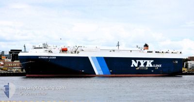
HYPERION LEADER
Vehicles Carrier

Current Trip
| Time Travelled | 5 days |
|---|---|
| Remaining Time | 6 days |
| Distance Travelled | 1765.51 nm |
| Remaining Distance | 2886.72 nm |
| AVG Speed | 11.7 Noeuds |
| MAX Speed | 19.1 Noeuds |
| AVG Wind | 23.3 knots |
| MAX Wind | 40.7 knots |
| MIN Temp | 10°C / 50°F |
| MAX Temp | 19.3°C / 66.74°F |
| Tirant d eau | 7.3 m |
| Position reçue | 1 d depuis |
Current Position
| Longitude | 116.69935° |
|---|---|
| Latitude | -35.48331° |
| Etat | Under way using engine |
| Vitesse | 12.2 Noeuds |
| Parcours | 272° |
| Zone | Indian Ocean |
| Station | T-AIS |
| Position reçue | 1 d depuis |
Information
The current position of HYPERION LEADER is in Indian Ocean with coordinates -35.48331° / 116.69935° as reported on 2025-06-10 02:21 by AIS to our vessel tracker app. The vessel's current speed is 12.2 Noeuds and is heading at the port of LAEM CHABANG. The estimated time of arrival as calculated by MyShipTracking vessel tracking app is 2025-06-18 01:25 LT
The vessel HYPERION LEADER (IMO: 9403279, MMSI: 431578000) is a Vehicles Carrier that was built in 2010 ( 15 Age ). It's sailing under the flag of [JP] Japan.
In this page you can find informations about the vessels current position, last detected port calls, and current voyage information. If the vessels is not in coverage by AIS you will find the latest position.
The current position of HYPERION LEADER is detected by our AIS receivers and we are not responsible for the reliability of the data. The last position was recorded while the vessel was in Coverage by the Ais receivers of our vessel tracking app.
The current draught of HYPERION LEADER as reported by AIS is 7.3 meters
Weather
| Temperature | 17°C / 62.6°F |
|---|---|
| Wind Speed | 8 knots |
| Direction | 190° S |
| Pressure | 1024 hPa |
| Humidity | 58.2 % |
| Cloud Coverage | 100 % |


Featured Company
Last Port Calls
| Port | Arrival | Departure | Time In Port |
|---|---|---|---|
| 2025-06-04 04:14 | 2025-06-05 04:33 | 1 d | |
| 2025-06-02 02:20 | 2025-06-02 14:33 | 12 h | |
| 2025-05-30 23:18 | 2025-05-31 12:34 | 13 h | |
| 2025-05-17 23:29 | 2025-05-18 06:06 | 6 h | |
| 2025-05-16 10:42 | 2025-05-17 09:02 | 22 h | |
| 2025-05-15 21:54 | 2025-05-16 07:50 | 9 h | |
| 2025-05-13 22:42 | 2025-05-14 06:38 | 7 h | |
| 2025-05-12 13:58 | 2025-05-13 14:49 | 1 d | |
| 2025-05-11 22:51 | 2025-05-12 07:06 | 8 h | |
| 2025-04-18 03:02 | 2025-05-02 08:14 | 14 d |
Most Visited Ports (Last year)
| Port | Arrivals | |
|---|---|---|
| 6 | ||
| 5 | ||
| 3 | ||
| 3 | ||
| 2 | ||
| 2 |
Last Trips
| Origin | Departure | Destination | Arrival | Distance | |
|---|---|---|---|---|---|
| 2025-06-03 00:33 | 2025-06-04 14:14 | 565.23 nm | |||
| 2025-05-31 22:34 | 2025-06-02 12:20 | 573.24 nm | |||
| 2025-05-18 15:06 | 2025-05-31 09:18 | 3967.93 nm | |||
| 2025-05-17 18:02 | 2025-05-18 08:29 | 215.98 nm | |||
| 2025-05-16 16:50 | 2025-05-16 19:42 | 41.93 nm | |||
| 2025-05-14 15:38 | 2025-05-16 06:54 | 433.70 nm | |||
| 2025-05-13 23:49 | 2025-05-14 07:42 | 113.75 nm | |||
| 2025-05-12 16:06 | 2025-05-12 22:58 | 96.46 nm | |||
| 2025-05-02 16:14 | 2025-05-12 07:51 | 1335.59 nm | |||
| 2025-04-03 15:33 | 2025-04-18 11:02 | 4868.76 nm |
Events
| Heure | Evenement | Détails | Position/ Destination | Info |
|---|---|---|---|---|
| 2025-06-10 02:29 | Etat Changé | Default Under way using engine |
-35.48262 / 116.66909
TH LCH
|
Vitesse: 12.2 kn Parcours: 272° |
| 2025-06-10 02:21 | Hors de la zone couverte |
-35.48331 / 116.69935
Indian Ocean
TH LCH
|
Vitesse: 12.2 kn Parcours: 272° |
|
| 2025-06-09 17:36 | Etat Changé | Under way using engine Default |
-35.62108 / 118.64525
TH LCH
|
Vitesse: 10.4 kn Parcours: 276° |
| 2025-06-09 17:32 | Etat Changé | Default Under way using engine |
-35.62214 / 118.65897
TH LCH
|
Vitesse: 10.7 kn Parcours: 272.3° |
| 2025-06-09 17:03 | Etat Changé | Under way using engine Default |
-35.62833 / 118.76402
TH LCH
|
Vitesse: 10.9 kn Parcours: 276° |
| 2025-06-09 16:29 | Etat Changé | Default Under way using engine |
-35.63403 / 118.89389
TH LCH
|
Vitesse: 11.5 kn Parcours: 271.7° |
| 2025-06-09 16:22 | Etat Changé | Under way using engine Default |
-35.63489 / 118.92094
TH LCH
|
Vitesse: 11.6 kn Parcours: 274° |
| 2025-06-09 16:15 | Etat Changé | Default Under way using engine |
-35.63628 / 118.94673
TH LCH
|
Vitesse: 11.7 kn Parcours: 275.6° |
| 2025-06-09 16:04 | Detecté en mer | Australian part of the Indian Ocean |
-35.63882 / 118.99065
Indian Ocean
TH LCH
|
Vitesse: 11.7 kn Parcours: 273.2° |
| 2025-06-09 16:04 | Etat Changé | Under way using engine Default |
-35.63898 / 118.99337
TH LCH
|
Vitesse: 11.8 kn Parcours: 275° |