
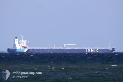
IONIC ANAX
Tanker
Current Trip
| Trip Time | 14 days |
|---|---|
| Trip Distance | 1980.52 nm |
| AVG Speed | 10.3 Noeuds |
| MAX Speed | 14.4 Noeuds |
| Tirant d eau | 8.4 m |
| AVG Wind | 13.7 knots |
| MAX Wind | 23 knots |
| MIN Temp | 12.6°C / 54.68°F |
| MAX Temp | 32.3°C / 90.14°F |
| Position reçue | 3 d depuis |
Current Position
| Longitude | -70.46808° |
|---|---|
| Latitude | 12.51633° |
| Etat | Under way using engine |
| Vitesse | 13.7 Noeuds |
| Parcours | 262.2° |
| Zone | Caribbean Sea |
| Station | T-AIS |
| Position reçue | 3 d depuis |
Info
Information
The current position of IONIC ANAX is in Caribbean Sea with coordinates 12.51633° / -70.46808° as reported on 2025-12-09 19:55 by AIS to our vessel tracker app. The vessel's current speed is 13.7 Noeuds and is currently inside the port of BAJO GRANDE.
The vessel IONIC ANAX (IMO: 9802152, MMSI: 538007411) is a Tanker It's sailing under the flag of [MH] Marshall Is.
In this page you can find informations about the vessels current position, last detected port calls, and current voyage information. If the vessels is not in coverage by AIS you will find the latest position.
The current position of IONIC ANAX is detected by our AIS receivers and we are not responsible for the reliability of the data. The last position was recorded while the vessel was in Coverage by the Ais receivers of our vessel tracking app.
The current draught of IONIC ANAX as reported by AIS is 8.4 meters
Weather
| Temperature | 26.6°C / 79.88°F |
|---|---|
| Wind Speed | 5 knots |
| Direction | 39° NE |
| Pressure | 1011.5 hPa |
| Humidity | 71.2 % |
| Cloud Coverage | 53 % |
Featured Company
Last Port Calls
| Port | Arrival | Departure | Time In Port |
|---|---|---|---|
| 2025-12-11 16:07 | |||
| 2025-11-25 21:07 | 2025-11-27 10:18 | 1 d | |
| 2025-11-24 16:23 | 2025-11-25 20:35 | 1 d | |
| 2025-10-23 10:06 | 2025-10-30 15:10 | 7 d | |
| 2025-10-14 22:35 | 2025-10-18 06:11 | 3 d | |
| 2025-10-04 16:50 |
Most Visited Ports (Last year)
| Port | Arrivals | |
|---|---|---|
| 8 | ||
| 3 | ||
| 3 | ||
| 2 | ||
| 1 | ||
| 1 |
Last Trips
| Origin | Departure | Destination | Arrival | Distance | |
|---|---|---|---|---|---|
| 2025-11-27 10:18 | 2025-12-11 16:07 | 1980.52 nm | |||
| 2025-11-25 20:35 | 2025-11-25 21:07 | 1.89 nm | |||
| 2025-10-30 15:10 | 2025-11-24 16:23 | 4181.93 nm | |||
| 2025-10-18 06:11 | 2025-10-23 10:06 | 704.09 nm | |||
| 2025-09-20 08:42 | 2025-10-14 22:35 | 3767.35 nm | |||
| 2025-09-20 08:42 | 2025-10-04 16:50 | 1967.84 nm |
Events
| Heure | Evenement | Détails | Position/ Destination | Info |
|---|---|---|---|---|
| 2025-12-11 20:31 | Arret |
10.51084 / -71.60804
[VE] BAJO GRANDE
|
Vitesse: 0.3 kn Parcours: 49° |
|
| 2025-12-11 20:07 | Port d'arrivée |
|
10.51061 / -71.60558
[VE] BAJO GRANDE
|
Vitesse: 1.7 kn Parcours: 327° |
| 2025-12-11 18:55 | Démarrage | 1.42 nm, South East of MARACAIBO |
10.61323 / -71.58779
USGOP>VEBJV
|
Vitesse: 4.7 kn Parcours: 207° |
| 2025-12-10 18:58 | Arret | 1.67 nm, South East of MARACAIBO |
10.61333 / -71.58167
USGOP>VEBJV
|
Vitesse: Parcours: -1° |
| 2025-12-09 20:03 | Etat Changé | Default Under way using engine |
12.51215 / -70.49614
USGOP>VEBJV
|
Vitesse: 13.7 kn Parcours: 262.2° |
| 2025-12-09 19:55 | Hors de la zone couverte |
12.51633 / -70.46808
Caribbean Sea
|
Vitesse: 13.7 kn Parcours: 262.2° |
|
| 2025-12-09 19:44 | Changement de zone | Venezuelan part of the Caribbean Sea Aruban part of the Caribbean Sea |
12.52224 / -70.42435
Caribbean Sea
|
Vitesse: 13.8 kn Parcours: 262.2° |
| 2025-12-09 17:53 | Démarrage |
12.60209 / -70.09356
USGOP>VEBJV
|
Vitesse: 3.2 kn Parcours: 276° |
|
| 2025-12-09 17:36 | Etat Changé | Under way using engine At anchor |
12.60670 / -70.08847
USGOP>VEBJV
|
Vitesse: 0.1 kn Parcours: 112° |
| 2025-12-09 16:36 | Etat Changé | At anchor Default |
12.60637 / -70.08988
USGOP>VEBJV
|
Vitesse: 0.2 kn Parcours: 107° |