
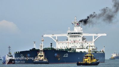
JALADI
Crude Oil Tanker
Current Trip
| Time Travelled | 9 h, 38 mins |
|---|---|
| Remaining Time | 4 h, 42 mins |
| Distance Travelled | 100.09 nm |
| Remaining Distance | 65.40 nm |
| AVG Speed | 12.2 Noeuds |
| MAX Speed | 14 Noeuds |
| AVG Wind | 2.6 knots |
| MAX Wind | 9 knots |
| MIN Temp | 22.9°C / 73.22°F |
| MAX Temp | 24.5°C / 76.1°F |
| Tirant d eau | 11.3 m |
| Position reçue | 2 d depuis |
Current Position
| Longitude | 37.99131° |
|---|---|
| Latitude | 22.95925° |
| Etat | Under way using engine |
| Vitesse | 2.2 Noeuds |
| Parcours | 284° |
| Zone | Red Sea |
| Station | T-AIS |
| Position reçue | 2 d depuis |
Info
Information
The current position of JALADI is in Red Sea with coordinates 22.95925° / 37.99131° as reported on 2025-02-03 01:23 by AIS to our vessel tracker app. The vessel's current speed is 2.2 Noeuds and is heading at the port of YANBU. The estimated time of arrival as calculated by MyShipTracking vessel tracking app is 2025-02-05 18:24 LT
The vessel JALADI (IMO: 9384227, MMSI: 403591000) is a Crude Oil Tanker that was built in 2009 ( 16 Age ). It's sailing under the flag of [SA] Saudi Arabia.
In this page you can find informations about the vessels current position, last detected port calls, and current voyage information. If the vessels is not in coverage by AIS you will find the latest position.
The current position of JALADI is detected by our AIS receivers and we are not responsible for the reliability of the data. The last position was recorded while the vessel was in Coverage by the Ais receivers of our vessel tracking app.
The current draught of JALADI as reported by AIS is 11.3 meters
Weather
| Temperature | 23.2°C / 73.76°F |
|---|---|
| Wind Speed | 11 knots |
| Direction | 338° NNW |
| Pressure | 1011.8 hPa |
| Humidity | 67.7 % |
| Cloud Coverage | 35 % |
Featured Company
Last Port Calls
| Port | Arrival | Departure | Time In Port |
|---|---|---|---|
| 2025-02-03 18:04 | 2025-02-05 04:04 | 1 d | |
| 2025-01-18 19:01 | 2025-01-20 06:55 | 1 d | |
| 2025-01-04 14:51 | 2025-01-07 20:46 | 3 d | |
| 2024-12-19 18:21 | 2024-12-21 16:21 | 1 d |
Most Visited Ports (Last year)
| Port | Arrivals | |
|---|---|---|
| 14 | ||
| 7 | ||
| 1 | ||
| 1 |
Last Trips
| Origin | Departure | Destination | Arrival | Distance | |
|---|---|---|---|---|---|
| 2025-01-20 06:55 | 2025-02-03 18:04 | 1632.85 nm | |||
| 2025-01-07 20:46 | 2025-01-18 19:01 | 1225.25 nm | |||
| 2024-12-21 16:21 | 2025-01-04 14:51 | 1253.25 nm | |||
| 2024-11-28 12:43 | 2024-12-19 18:21 | 1366.21 nm |
Events
| Heure | Evenement | Détails | Position/ Destination | Info |
|---|---|---|---|---|
| 2025-02-05 01:04 | Démarrage | 0.7 nm, West of AL MUAJJIZ |
23.80472 / 38.39440
SA YNB
|
Vitesse: 4.1 kn Parcours: 206° |
| 2025-02-05 01:04 | PORT DE DEPART |
|
23.80472 / 38.39440
SA YNB
|
Vitesse: 1.2 kn Parcours: 295° |
| 2025-02-03 15:12 | Arret |
23.80526 / 38.40316
[SA] AL MUAJJIZ
|
Vitesse: 0.3 kn Parcours: 313° |
|
| 2025-02-03 15:04 | Port d'arrivée |
|
23.80465 / 38.40276
[SA] AL MUAJJIZ
|
Vitesse: 0.5 kn Parcours: 306° |
| 2025-02-03 01:43 | Etat Changé | Default Under way using engine |
22.95069 / 37.98283
SA YNB
|
Vitesse: 2.2 kn Parcours: 284° |
| 2025-02-03 01:23 | Hors de la zone couverte |
22.95925 / 37.99131
Red Sea
|
Vitesse: 2.2 kn Parcours: 221.6° |
|
| 2025-02-03 01:20 | Etat Changé | Under way using engine Default |
22.96095 / 37.99297
SA YNB
|
Vitesse: 2.3 kn Parcours: 286° |
| 2025-02-03 01:02 | Etat Changé | Default Under way using engine |
22.96940 / 38.00100
SA YNB
|
Vitesse: 2.2 kn Parcours: 294° |
| 2025-02-03 00:53 | Etat Changé | Under way using engine Default |
22.97342 / 38.00473
SA YNB
|
Vitesse: 2.3 kn Parcours: 291° |
| 2025-02-03 00:32 | Etat Changé | Default Under way using engine |
22.98411 / 38.01405
SA YNB
|
Vitesse: 2.4 kn Parcours: 284° |