
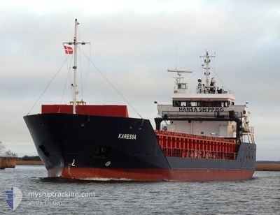
KARESSA
General Cargo
Current Trip
| Time Travelled | 2 days |
|---|---|
| Remaining Time | 2 days |
| Distance Travelled | 571.61 nm |
| Remaining Distance | 523.25 nm |
| AVG Speed | 10.7 Noeuds |
| MAX Speed | 12.4 Noeuds |
| AVG Wind | 11.5 knots |
| MAX Wind | 17.3 knots |
| MIN Temp | -10.7°C / 12.74°F |
| MAX Temp | 0.5°C / 32.9°F |
| Tirant d eau | 6.1 m |
| Position reçue | 1 m depuis |
Current Position
| Longitude | 24.44431° |
|---|---|
| Latitude | 59.66846° |
| Etat | Under way using engine |
| Vitesse | 10.3 Noeuds |
| Parcours | 242° |
| Zone | Gulf of Finland |
| Station | T-AIS |
| Position reçue | 1 m depuis |
Info
Information
The current position of KARESSA is in Gulf of Finland with coordinates 59.66846° / 24.44431° as reported on 2025-02-14 14:13 by AIS to our vessel tracker app. The vessel's current speed is 10.3 Noeuds and is heading at the port of SZCZECIN. The estimated time of arrival as calculated by MyShipTracking vessel tracking app is 2025-02-16 16:36 LT
The vessel KARESSA (IMO: 9341770, MMSI: 305912000) is a General Cargo that was built in 2006 ( 19 Age ). It's sailing under the flag of [AG] Antigua Barbuda.
In this page you can find informations about the vessels current position, last detected port calls, and current voyage information. If the vessels is not in coverage by AIS you will find the latest position.
The current position of KARESSA is detected by our AIS receivers and we are not responsible for the reliability of the data. The last position was recorded while the vessel was in Coverage by the Ais receivers of our vessel tracking app.
The current draught of KARESSA as reported by AIS is 6.1 meters
Weather
| Temperature | -4.4°C / 24.08°F |
|---|---|
| Wind Speed | 8 knots |
| Direction | 4° N |
| Pressure | 1021 hPa |
| Humidity | 68 % |
| Cloud Coverage | 100 % |
Featured Company
Last Port Calls
| Port | Arrival | Departure | Time In Port |
|---|---|---|---|
| 2025-02-07 06:25 | 2025-02-11 18:36 | 4 d | |
| 2025-01-31 15:37 | 2025-02-04 19:13 | 4 d | |
| 2025-01-12 15:32 | 2025-01-14 10:23 | 1 d | |
| 2025-01-10 19:27 | 2025-01-12 15:17 | 1 d | |
| 2024-12-29 19:43 | 2025-01-04 09:04 | 5 d | |
| 2024-12-26 06:21 | 2024-12-27 08:14 | 1 d | |
| 2024-12-18 22:59 | 2024-12-20 13:41 | 1 d | |
| 2024-12-16 20:29 | 2024-12-18 21:43 | 2 d | |
| 2024-12-12 17:00 | 2024-12-13 18:39 | 1 d | |
| 2024-12-10 08:42 | 2024-12-11 13:52 | 1 d |
Last Trips
| Origin | Departure | Destination | Arrival | Distance | |
|---|---|---|---|---|---|
| 2025-02-04 22:13 | 2025-02-07 07:25 | 568.33 nm | |||
| 2025-01-14 11:23 | 2025-01-31 18:37 | 1693.00 nm | |||
| 2025-01-12 16:17 | 2025-01-12 16:32 | 0.60 nm | |||
| 2025-01-04 11:04 | 2025-01-10 20:27 | 961.73 nm | |||
| 2024-12-27 10:14 | 2024-12-29 21:43 | 413.28 nm | |||
| 2024-12-20 14:41 | 2024-12-26 08:21 | 1285.78 nm | |||
| 2024-12-18 22:43 | 2024-12-18 23:59 | 6.85 nm | |||
| 2024-12-13 19:39 | 2024-12-16 21:29 | 474.05 nm | |||
| 2024-12-11 14:52 | 2024-12-12 18:00 | 333.31 nm | |||
| 2024-12-08 10:08 | 2024-12-10 09:42 | 505.49 nm |
Events
| Heure | Evenement | Détails | Position/ Destination | Info |
|---|---|---|---|---|
| 2025-02-14 12:14 | Detecté en mer | Estonian part of the Gulf of Finland |
59.84876 / 24.98249
Gulf of Finland
PLSZZ
|
Vitesse: 10.7 kn Parcours: 252.6° |
| 2025-02-14 12:14 | Etat Changé | Under way using engine Default |
59.84876 / 24.98249
PLSZZ
|
Vitesse: 10.7 kn Parcours: 253° |
| 2025-02-14 12:09 | Dans la zone couverte |
59.84876 / 24.98249
Gulf of Finland
PLSZZ
|
Vitesse: 10.7 kn Parcours: 252.6° |
|
| 2025-02-14 11:17 | Etat Changé | Default Under way using engine |
59.89790 / 25.30634
PLSZZ
|
Vitesse: 10.6 kn Parcours: 256.4° |
| 2025-02-14 11:10 | Hors de la zone couverte |
59.90288 / 25.34943
Gulf of Finland
PLSZZ
|
Vitesse: 10.6 kn Parcours: 256.4° |
|
| 2025-02-14 11:02 | Etat Changé | Under way using engine Default |
59.90876 / 25.39676
PLSZZ
|
Vitesse: 10.5 kn Parcours: 254° |
| 2025-02-14 10:57 | Etat Changé | Default Under way using engine |
59.91181 / 25.41947
PLSZZ
|
Vitesse: 10.5 kn Parcours: 254.6° |
| 2025-02-14 10:47 | Etat Changé | Under way using engine Default |
59.92108 / 25.48091
PLSZZ
|
Vitesse: 10.6 kn Parcours: 251° |
| 2025-02-14 10:41 | Etat Changé | Default Under way using engine |
59.92602 / 25.50966
PLSZZ
|
Vitesse: 10.5 kn Parcours: 251° |
| 2025-02-14 10:36 | Etat Changé | Under way using engine Default |
59.93110 / 25.53909
PLSZZ
|
Vitesse: 10.6 kn Parcours: 251° |