
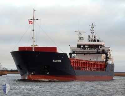
KARESSA
General Cargo
Current Trip
| Time Travelled | 8 h, 16 mins |
|---|---|
| Remaining Time | 1 day |
| Distance Travelled | 80.54 морская миля |
| Remaining Distance | 424.62 морская миля |
| AVG Speed | 10 Узлы |
| MAX Speed | 12.4 Узлы |
| AVG Wind | 15.8 knots |
| MAX Wind | 17 knots |
| MIN Temp | -0.9°C / 30.38°F |
| MAX Temp | -0.1°C / 31.82°F |
| Осадка | 3.6 м |
| Позиция Получена | 2 h, 28 m тому назад |
Current Position
| Долгота | 19.50462° |
|---|---|
| Широта | 55.24013° |
| Статус | Under way using engine |
| Скорость | 11.8 Узлы |
| Курс | 28.2° |
| Район | Baltic Sea |
| Станция | T-AIS |
| Позиция Получена | 2 h, 28 m тому назад |
Info
Information
The current position of KARESSA is in Baltic Sea with coordinates 55.24013° / 19.50462° as reported on 2025-02-12 00:23 by AIS to our vessel tracker app. The vessel's current speed is 11.8 Узлы and is heading at the port of KOTKA. The estimated time of arrival as calculated by MyShipTracking vessel tracking app is 2025-02-13 13:26 LT
The vessel KARESSA (IMO: 9341770, MMSI: 305912000) is a General Cargo that was built in 2006 ( 19 лет ). It's sailing under the flag of [AG] Antigua Barbuda.
In this page you can find informations about the vessels current position, last detected port calls, and current voyage information. If the vessels is not in coverage by AIS you will find the latest position.
The current position of KARESSA is detected by our AIS receivers and we are not responsible for the reliability of the data. The last position was recorded while the vessel was in Coverage by the Ais receivers of our vessel tracking app.
The current draught of KARESSA as reported by AIS is 3.6 meters
Weather
| Temperature | -0.3°C / 31.46°F |
|---|---|
| Wind Speed | 14 knots |
| Direction | 142° SE |
| Pressure | 1035.3 hPa |
| Humidity | 65.7 % |
| Cloud Coverage | 13 % |
Featured Company
Last Port Calls
| Port | Arrival | Departure | Time In Port |
|---|---|---|---|
| 2025-02-07 06:25 | 2025-02-11 18:36 | 4 d | |
| 2025-01-31 15:37 | 2025-02-04 19:13 | 4 d | |
| 2025-01-12 15:32 | 2025-01-14 10:23 | 1 d | |
| 2025-01-10 19:27 | 2025-01-12 15:17 | 1 d | |
| 2024-12-29 19:43 | 2025-01-04 09:04 | 5 d | |
| 2024-12-26 06:21 | 2024-12-27 08:14 | 1 d | |
| 2024-12-18 22:59 | 2024-12-20 13:41 | 1 d | |
| 2024-12-16 20:29 | 2024-12-18 21:43 | 2 d | |
| 2024-12-12 17:00 | 2024-12-13 18:39 | 1 d | |
| 2024-12-10 08:42 | 2024-12-11 13:52 | 1 d |
Last Trips
| Origin | Departure | Destination | Arrival | Distance | |
|---|---|---|---|---|---|
| 2025-02-04 22:13 | 2025-02-07 07:25 | 568.33 морская миля | |||
| 2025-01-14 11:23 | 2025-01-31 18:37 | 1693.00 морская миля | |||
| 2025-01-12 16:17 | 2025-01-12 16:32 | 0.60 морская миля | |||
| 2025-01-04 11:04 | 2025-01-10 20:27 | 961.73 морская миля | |||
| 2024-12-27 10:14 | 2024-12-29 21:43 | 413.28 морская миля | |||
| 2024-12-20 14:41 | 2024-12-26 08:21 | 1285.78 морская миля | |||
| 2024-12-18 22:43 | 2024-12-18 23:59 | 6.85 морская миля | |||
| 2024-12-13 19:39 | 2024-12-16 21:29 | 474.05 морская миля | |||
| 2024-12-11 14:52 | 2024-12-12 18:00 | 333.31 морская миля | |||
| 2024-12-08 10:08 | 2024-12-10 09:42 | 505.49 морская миля |
Events
| Время | Событие | Детали | Позиция / Направление | Информация |
|---|---|---|---|---|
| 2025-02-12 00:27 | Статус изменился | Default Under way using engine |
55.24925 / 19.51320
KOTKA
|
Скорость: 11.8 kn Курс: 28.2° |
| 2025-02-12 00:23 | Вне покрытия |
55.24013 / 19.50462
Baltic Sea
KOTKA
|
Скорость: 11.8 kn Курс: 28.2° |
|
| 2025-02-11 23:56 | Статус изменился | Under way using engine Default |
55.16270 / 19.43216
KOTKA
|
Скорость: 11.7 kn Курс: 25° |
| 2025-02-11 23:45 | Статус изменился | Default Under way using engine |
55.13221 / 19.40379
KOTKA
|
Скорость: 11.5 kn Курс: 29° |
| 2025-02-11 23:27 | Статус изменился | Under way using engine Default |
55.08033 / 19.35538
KOTKA
|
Скорость: 11.2 kn Курс: 28° |
| 2025-02-11 23:09 | Статус изменился | Default Under way using engine |
55.02878 / 19.30696
KOTKA
|
Скорость: 11.5 kn Курс: 27.7° |
| 2025-02-11 22:52 | Обнаружено в море | Russian part of the Baltic Sea |
54.98320 / 19.26469
Baltic Sea
KOTKA
|
Скорость: 11.3 kn Курс: 27° |
| 2025-02-11 20:14 | Пункт назначения изменился | KOTKA GDANSK |
54.53865 / 18.82135
KOTKA
|
Скорость: 12 kn Курс: 43.2° |
| 2025-02-11 20:14 | ETA изменился | 2025/02/13 13:00 2025/02/07 05:00 |
54.53865 / 18.82135
KOTKA
|
Скорость: 12 kn Курс: 43.2° |
| 2025-02-11 19:37 | Начало движения | 5.05 nm, North of GDANSK |
54.46462 / 18.67684
GDANSK
|
Скорость: 5.2 kn Курс: 67.9° |