
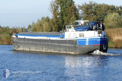
KERIZEL
Cargo
Current Trip
NERGENSHUIZEN
| Time Travelled | 2 days |
|---|---|
| Remaining Time | --- |
| Distance Travelled | 19.60 nm |
| Remaining Distance | --- |
| AVG Speed | 5.9 Noeuds |
| MAX Speed | 6.7 Noeuds |
| AVG Wind | 11.3 knots |
| MAX Wind | 12 knots |
| MIN Temp | 0.1°C / 32.18°F |
| MAX Temp | 4.2°C / 39.56°F |
| Tirant d eau | 1.8 m |
| Position reçue | 1 d depuis |
Current Position
| Longitude | 3.49805° |
|---|---|
| Latitude | 50.79203° |
| Etat | Default |
| Vitesse | 3.8 Noeuds |
| Parcours | 231.3° |
| Zone | North Sea |
| Station | T-AIS |
| Position reçue | 1 d depuis |
Info
Information
The current position of KERIZEL is in North Sea with coordinates 50.79203° / 3.49805° as reported on 2026-01-03 08:25 by AIS to our vessel tracker app. The vessel's current speed is 3.8 Noeuds
The vessel KERIZEL (MMSI: 244250579) is a Cargo It's sailing under the flag of [NL] Netherlands.
In this page you can find informations about the vessels current position, last detected port calls, and current voyage information. If the vessels is not in coverage by AIS you will find the latest position.
The current position of KERIZEL is detected by our AIS receivers and we are not responsible for the reliability of the data. The last position was recorded while the vessel was in Coverage by the Ais receivers of our vessel tracking app.
The current draught of KERIZEL as reported by AIS is 1.8 meters
Weather
| Temperature | 0.5°C / 32.9°F |
|---|---|
| Wind Speed | 11 knots |
| Direction | 278° W |
| Pressure | 1005 hPa |
| Humidity | 88 % |
| Cloud Coverage | 90 % |
Featured Company
Most Visited Ports (Last year)
| Port | Arrivals | |
|---|---|---|
| 15 | ||
| 10 | ||
| 4 | ||
| 2 | ||
| 2 | ||
| 1 |
Events
| Heure | Evenement | Détails | Position/ Destination | Info |
|---|---|---|---|---|
| 2026-01-03 08:25 | Hors de la zone couverte |
50.79203 / 3.49805
North Sea
|
Vitesse: 3.8 kn Parcours: 231.3° |
|
| 2026-01-03 07:24 | Dans la zone couverte |
50.84354 / 3.61018
North Sea
|
Vitesse: 0.6 kn Parcours: 218.2° |
|
| 2026-01-02 15:59 | Hors de la zone couverte |
50.84555 / 3.61240
North Sea
|
Vitesse: 4.6 kn Parcours: 220.8° |
|
| 2026-01-02 14:36 | Démarrage | 7.25 nm, South East of DEINZE |
50.91428 / 3.67402
NERGENSHUIZEN
|
Vitesse: 6.3 kn Parcours: 109.3° |
| 2026-01-02 14:22 | Arret | 6.94 nm, South East of DEINZE |
50.91698 / 3.66707
NERGENSHUIZEN
|
Vitesse: Parcours: 511° |
| 2026-01-02 13:48 | Dans la zone couverte |
50.95383 / 3.65145
North Sea
|
Vitesse: 6.5 kn Parcours: 225.6° |
|
| 2026-01-02 12:37 | Hors de la zone couverte |
51.03386 / 3.68742
North Sea
|
Vitesse: 6.5 kn Parcours: 120.3° |
|
| 2026-01-02 12:37 | PORT DE DEPART |
|
51.03386 / 3.68742
NERGENSHUIZEN
|
Vitesse: 6.6 kn Parcours: 139.2° |
| 2026-01-02 12:03 | Démarrage |
51.08832 / 3.66361
[BE] GENT
|
Vitesse: 6.3 kn Parcours: 249.7° |
|
| 2026-01-02 11:52 | Arret |
51.08928 / 3.66862
[BE] GENT
|
Vitesse: 0.1 kn Parcours: 511° |