
LINK GALAXY
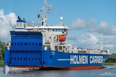
Ro-Ro Cargo
Current Trip
| Time Travelled | 19 h, 24 mins |
|---|---|
| Remaining Time | 1 h, 34 mins |
| Distance Travelled | 219.15 nm |
| Remaining Distance | 34.21 nm |
| AVG Speed | 12.3 Noeuds |
| MAX Speed | 15.5 Noeuds |
| AVG Wind | 6.2 knots |
| MAX Wind | 11 knots |
| MIN Temp | -16.1°C / 3.02°F |
| MAX Temp | -0.2°C / 31.64°F |
| Tirant d eau | 5.2 m |
| Position reçue | 2 m depuis |
Current Position
| Longitude | 7.82286° |
|---|---|
| Latitude | 63.01659° |
| Etat | At anchor |
| Vitesse | 0.2 Noeuds |
| Parcours | 116° |
| Zone | Norwegian Sea |
| Station | T-AIS |
| Position reçue | 2 m depuis |
Info
Information
The current position of LINK GALAXY is in Norwegian Sea with coordinates 63.01659° / 7.82286° as reported on 2026-01-08 10:28 by AIS to our vessel tracker app. The vessel's current speed is 0.2 Noeuds and is heading at the port of SUNNDALSORA. The estimated time of arrival as calculated by MyShipTracking vessel tracking app is 2026-01-08 13:04 LT
The vessel LINK GALAXY (IMO: 8820860, MMSI: 257306000) is a Ro-Ro Cargo that was built in 1991 ( 35 Age ). It's sailing under the flag of [NO] Norway.
In this page you can find informations about the vessels current position, last detected port calls, and current voyage information. If the vessels is not in coverage by AIS you will find the latest position.
The current position of LINK GALAXY is detected by our AIS receivers and we are not responsible for the reliability of the data. The last position was recorded while the vessel was in Coverage by the Ais receivers of our vessel tracking app.
The current draught of LINK GALAXY as reported by AIS is 5.2 meters
Weather
| Temperature | -7.8°C / 17.96°F |
|---|---|
| Wind Speed | 6 knots |
| Direction | 178° S |
| Pressure | 1005 hPa |
| Humidity | 65.6 % |
| Cloud Coverage | 100 % |
Featured Company
Last Port Calls
| Port | Arrival | Departure | Time In Port |
|---|---|---|---|
| 2026-01-07 07:08 | 2026-01-07 16:06 | 8 h | |
| 2026-01-06 06:42 | 2026-01-06 22:30 | 15 h | |
| 2026-01-05 11:24 | 2026-01-05 13:52 | 2 h | |
| 2026-01-03 08:08 | 2026-01-05 08:14 | 2 d | |
| 2026-01-03 06:01 | 2026-01-03 06:28 | 26 m | |
| 2025-12-30 15:36 | 2025-12-31 12:16 | 20 h | |
| 2025-12-28 09:41 | 2025-12-28 12:14 | 2 h | |
| 2025-12-27 07:54 | 2025-12-27 10:41 | 2 h | |
| 2025-12-25 17:43 | 2025-12-26 00:17 | 6 h | |
| 2025-12-23 06:41 | 2025-12-23 13:38 | 6 h |
Most Visited Ports (Last year)
| Port | Arrivals | |
|---|---|---|
| 53 | ||
| 26 | ||
| 26 | ||
| 25 | ||
| 24 | ||
| 23 |
Last Trips
| Origin | Departure | Destination | Arrival | Distance | |
|---|---|---|---|---|---|
| 2026-01-06 22:30 | 2026-01-07 07:08 | 59.76 nm | |||
| 2026-01-05 13:52 | 2026-01-06 06:42 | 182.10 nm | |||
| 2026-01-05 08:14 | 2026-01-05 11:24 | 41.26 nm | |||
| 2026-01-03 06:28 | 2026-01-03 08:08 | 10.49 nm | |||
| 2025-12-31 12:16 | 2026-01-03 06:01 | 545.37 nm | |||
| 2025-12-28 12:14 | 2025-12-30 15:36 | 364.69 nm | |||
| 2025-12-27 10:41 | 2025-12-28 09:41 | 263.62 nm | |||
| 2025-12-26 00:17 | 2025-12-27 07:54 | 333.12 nm | |||
| 2025-12-23 13:38 | 2025-12-25 17:43 | 306.61 nm | |||
| 2025-12-22 12:57 | 2025-12-23 06:41 | 182.64 nm |
Events
| Heure | Evenement | Détails | Position/ Destination | Info |
|---|---|---|---|---|
| 2026-01-08 08:51 | Arret | 3.68 nm, North East of HOGSET |
63.01642 / 7.82353
NOSUN
|
Vitesse: 0.3 kn Parcours: 117° |
| 2026-01-08 08:45 | Etat Changé | At anchor Under way using engine |
63.01653 / 7.82265
NOSUN
|
Vitesse: 1.4 kn Parcours: 109° |
| 2026-01-07 15:06 | PORT DE DEPART |
|
61.20617 / 6.06459
NOSUN
|
Vitesse: 8.6 kn Parcours: 180° |
| 2026-01-07 15:04 | Démarrage |
61.21286 / 6.06493
[NO] HOYANGER
|
Vitesse: 8.6 kn Parcours: 180° |
|
| 2026-01-07 14:48 | Tirant d'eau modifié | 5.2 5.4 |
61.21719 / 6.06731
[NO] HOYANGER
|
Vitesse: Parcours: 213° |
| 2026-01-07 14:48 | Changement de destination | NOSUN NOHYR |
61.21719 / 6.06731
[NO] HOYANGER
|
Vitesse: Parcours: 213° |
| 2026-01-07 14:48 | Changement d'ETA | 2026/01/08 16:00 2026/01/07 06:15 |
61.21719 / 6.06731
[NO] HOYANGER
|
Vitesse: Parcours: 213° |
| 2026-01-07 14:41 | Etat Changé | Under way using engine At anchor |
61.21718 / 6.06731
[NO] HOYANGER
|
Vitesse: Parcours: 213° |
| 2026-01-07 06:45 | Etat Changé | At anchor Under way using engine |
61.21718 / 6.06733
[NO] HOYANGER
|
Vitesse: Parcours: 212° |
| 2026-01-07 06:24 | Arret |
61.21718 / 6.06729
[NO] HOYANGER
|
Vitesse: Parcours: 207° |