

LINK GALAXY
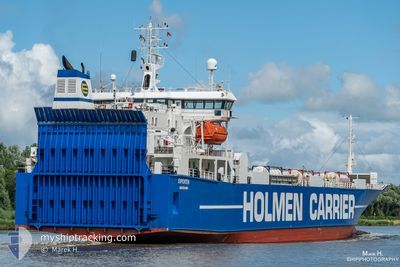
Ro-Ro Cargo

Current Trip
| Time Travelled | 1 day |
|---|---|
| Remaining Time | 7 h, 16 mins |
| Distance Travelled | 282.10 nm |
| Remaining Distance | 75.98 nm |
| AVG Speed | 10.3 Knopen |
| MAX Speed | 17 Knopen |
| AVG Wind | 13.7 knots |
| MAX Wind | 23.6 knots |
| MIN Temp | 7.9°C / 46.22°F |
| MAX Temp | 13.1°C / 55.58°F |
| Diepgang | 5.9 M |
| Positie ontvangen | Nu |
Current Position
| Lengtegraad | 13.34119° |
|---|---|
| Breedtegraat | 54.93351° |
| Status | Under way using engine |
| Snelheid | 9.4 Knopen |
| Koers | 148° |
| Gebied | Baltic Sea |
| Station | T-AIS |
| Positie ontvangen | Nu |
Information
The current position of LINK GALAXY is in Baltic Sea with coordinates 54.93351° / 13.34119° as reported on 2025-06-03 12:19 by AIS to our vessel tracker app. The vessel's current speed is 9.4 Knopen and is heading at the port of SWINOUJSCIE. The estimated time of arrival as calculated by MyShipTracking vessel tracking app is 2025-06-03 21:35 LT
The vessel LINK GALAXY (IMO: 8820860, MMSI: 257306000) is a Ro-Ro Cargo that was built in 1991 ( 34 Jaar oud ). It's sailing under the flag of [NO] Norway.
In this page you can find informations about the vessels current position, last detected port calls, and current voyage information. If the vessels is not in coverage by AIS you will find the latest position.
The current position of LINK GALAXY is detected by our AIS receivers and we are not responsible for the reliability of the data. The last position was recorded while the vessel was in Coverage by the Ais receivers of our vessel tracking app.
The current draught of LINK GALAXY as reported by AIS is 5.9 meters
Weather
| Temperature | 13°C / 55.4°F |
|---|---|
| Wind Speed | 3 knots |
| Direction | 215° SW |
| Pressure | 1013.5 hPa |
| Humidity | 81.6 % |
| Cloud Coverage | 1 % |


Featured Company
Last Port Calls
| Port | Arrival | Departure | Time In Port |
|---|---|---|---|
| 2025-06-01 08:45 | 2025-06-02 08:01 | 23 h | |
| 2025-05-31 08:50 | 2025-05-31 10:22 | 1 h | |
| 2025-05-29 17:47 | 2025-05-30 02:57 | 9 h | |
| 2025-05-28 10:00 | 2025-05-28 11:51 | 1 h | |
| 2025-05-27 06:45 | 2025-05-27 11:20 | 4 h | |
| 2025-05-24 14:52 | 2025-05-24 19:31 | 4 h | |
| 2025-05-23 17:13 | 2025-05-23 18:49 | 1 h | |
| 2025-05-22 14:17 | 2025-05-22 18:48 | 4 h | |
| 2025-05-20 21:36 | 2025-05-21 14:40 | 17 h | |
| 2025-05-18 23:38 | 2025-05-19 08:37 | 8 h |
Most Visited Ports (Last year)
| Port | Arrivals | |
|---|---|---|
| 51 | ||
| 25 | ||
| 24 | ||
| 24 | ||
| 22 | ||
| 21 |
Last Trips
| Origin | Departure | Destination | Arrival | Distance | |
|---|---|---|---|---|---|
| 2025-05-31 10:22 | 2025-06-01 08:45 | 262.69 nm | |||
| 2025-05-30 02:57 | 2025-05-31 08:50 | 318.51 nm | |||
| 2025-05-28 11:51 | 2025-05-29 17:47 | 45.44 nm | |||
| 2025-05-27 11:20 | 2025-05-28 10:00 | 258.05 nm | |||
| 2025-05-24 19:31 | 2025-05-27 06:45 | 211.97 nm | |||
| 2025-05-23 18:49 | 2025-05-24 14:52 | 2.82 nm | |||
| 2025-05-22 18:48 | 2025-05-23 17:13 | 272.32 nm | |||
| 2025-05-21 14:40 | 2025-05-22 14:17 | 299.51 nm | |||
| 2025-05-19 08:37 | 2025-05-20 21:36 | 358.35 nm | |||
| 2025-05-17 11:39 | 2025-05-18 23:38 | 262.97 nm |
Events
| Tijd | Evenement | Details | Positie / Bestemming | Info |
|---|---|---|---|---|
| 2025-06-03 12:09 | Status Changed | Under way using engine Default |
54.95565 / 13.31719
SWINOUJSCIE
|
Snelheid: 9.9 kn Koers: 148° |
| 2025-06-03 12:03 | Status Changed | Default Under way using engine |
54.97096 / 13.30074
SWINOUJSCIE
|
Snelheid: 10 kn Koers: 149.1° |
| 2025-06-03 11:47 | Wijzig zee gebeid | German part of the Baltic Sea Swedish part of the Baltic Sea |
55.00891 / 13.26049
Baltic Sea
SWINOUJSCIE
|
Snelheid: 10 kn Koers: 149.1° |
| 2025-06-03 08:58 | Wijzig zee gebeid | Swedish part of the Baltic Sea Danish part of the Baltic Sea |
55.29968 / 12.64580
Baltic Sea
SWINOUJSCIE
|
Snelheid: 9.4 kn Koers: 153.3° |
| 2025-06-03 08:49 | Wijzig zee gebeid | Danish part of the Baltic Sea Danish part of the Kattegat |
55.32109 / 12.63751
Baltic Sea
SWINOUJSCIE
|
Snelheid: 9.5 kn Koers: 191.8° |
| 2025-06-03 08:46 | Wijzig zee gebeid | Danish part of the Kattegat Swedish part of the Kattegat |
55.32893 / 12.64030
Kattegat
SWINOUJSCIE
|
Snelheid: 9.5 kn Koers: 191.2° |
| 2025-06-03 07:55 | Wijzig zee gebeid | Swedish part of the Kattegat Danish part of the Kattegat |
55.46459 / 12.67936
Kattegat
SWINOUJSCIE
|
Snelheid: 9.7 kn Koers: 189.1° |
| 2025-06-03 06:23 | Start beweging | 4.7 nm, North East of COPENHAGEN |
55.74967 / 12.71132
SWINOUJSCIE
|
Snelheid: 7.4 kn Koers: 220.6° |
| 2025-06-03 06:20 | Status Changed | Under way using engine At anchor |
55.75092 / 12.71489
SWINOUJSCIE
|
Snelheid: 0.1 kn Koers: 283° |
| 2025-06-03 05:52 | Stop beweging | 4.83 nm, North East of COPENHAGEN |
55.75139 / 12.71340
SWINOUJSCIE
|
Snelheid: 0.3 kn Koers: 203° |