
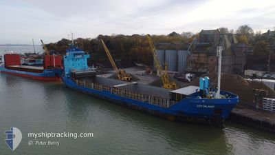
LOTTALAND
General Cargo
Current Trip
| Time Travelled | 2 days |
|---|---|
| Remaining Time | --- |
| Distance Travelled | 528.79 nm |
| Remaining Distance | --- |
| AVG Speed | 10.2 Noeuds |
| MAX Speed | 11 Noeuds |
| AVG Wind | 15.4 knots |
| MAX Wind | 24 knots |
| MIN Temp | 1.4°C / 34.52°F |
| MAX Temp | 3.6°C / 38.48°F |
| Tirant d eau | 4.3 m |
| Position reçue | Maintenant |
Current Position
| Longitude | 13.28884° |
|---|---|
| Latitude | 54.91751° |
| Etat | Under way using engine |
| Vitesse | 9.7 Noeuds |
| Parcours | 251.6° |
| Zone | Baltic Sea |
| Station | T-AIS |
| Position reçue | Maintenant |
Info
Information
The current position of LOTTALAND is in Baltic Sea with coordinates 54.91751° / 13.28884° as reported on 2025-02-07 21:51 by AIS to our vessel tracker app. The vessel's current speed is 9.7 Noeuds and is heading at the port of PAPENBURG. The estimated time of arrival as calculated by MyShipTracking vessel tracking app is 2025-02-09 10:00 LT
The vessel LOTTALAND (IMO: 9155975, MMSI: 275504000) is a General Cargo that was built in 1997 ( 28 Age ). It's sailing under the flag of [LV] Latvia.
In this page you can find informations about the vessels current position, last detected port calls, and current voyage information. If the vessels is not in coverage by AIS you will find the latest position.
The current position of LOTTALAND is detected by our AIS receivers and we are not responsible for the reliability of the data. The last position was recorded while the vessel was in Coverage by the Ais receivers of our vessel tracking app.
The current draught of LOTTALAND as reported by AIS is 4.3 meters
Weather
| Temperature | 2.8°C / 37.04°F |
|---|---|
| Wind Speed | 23 knots |
| Direction | 121° ESE |
| Pressure | 1036.5 hPa |
| Humidity | 70.5 % |
| Cloud Coverage | 100 % |
Featured Company
Last Port Calls
| Port | Arrival | Departure | Time In Port |
|---|---|---|---|
| 2025-02-04 18:01 | 2025-02-05 17:41 | 23 h | |
| 2025-02-03 04:08 | 2025-02-04 07:16 | 1 d | |
| 2025-01-29 02:26 | 2025-01-31 03:56 | 2 d | |
| 2025-01-23 08:54 | 2025-01-25 09:10 | 2 d | |
| 2025-01-21 06:53 | 2025-01-21 23:58 | 17 h | |
| 2025-01-16 07:54 | 2025-01-18 00:41 | 1 d | |
| 2025-01-12 19:13 | 2025-01-15 18:29 | 2 d | |
| 2025-01-08 23:49 | 2025-01-10 11:38 | 1 d | |
| 2025-01-05 18:08 | 2025-01-08 01:20 | 2 d | |
| 2024-12-19 17:45 | 2024-12-23 13:29 | 3 d |
Last Trips
| Origin | Departure | Destination | Arrival | Distance | |
|---|---|---|---|---|---|
| 2025-02-04 09:16 | 2025-02-04 20:01 | 114.27 nm | |||
| 2025-01-31 04:56 | 2025-02-03 06:08 | 680.98 nm | |||
| 2025-01-25 11:10 | 2025-01-29 03:26 | 678.65 nm | |||
| 2025-01-22 01:58 | 2025-01-23 10:54 | 327.05 nm | |||
| 2025-01-18 01:41 | 2025-01-21 08:53 | 779.25 nm | |||
| 2025-01-15 19:29 | 2025-01-16 08:54 | 53.09 nm | |||
| 2025-01-10 13:38 | 2025-01-12 20:13 | 569.74 nm | |||
| 2025-01-08 02:20 | 2025-01-09 01:49 | 233.97 nm | |||
| 2024-12-23 15:29 | 2025-01-05 19:08 | 495.67 nm | |||
| 2024-12-19 19:25 | 2024-12-19 19:45 | 1.16 nm |
Events
| Heure | Evenement | Détails | Position/ Destination | Info |
|---|---|---|---|---|
| 2025-02-07 20:01 | Detecté en mer | German part of the Baltic Sea |
55.01792 / 13.78131
Baltic Sea
DEPAP VIA NOK
|
Vitesse: 10.3 kn Parcours: 251.7° |
| 2025-02-07 15:37 | Detecté en mer | Swedish part of the Baltic Sea |
55.47583 / 14.70811
Baltic Sea
DEPAP VIA NOK
|
Vitesse: 9.7 kn Parcours: 239.5° |
| 2025-02-07 13:34 | Changement de zone | Danish part of the Kattegat Swedish part of the Baltic Sea |
55.64482 / 15.22428
Kattegat
DEPAP VIA NOK
|
Vitesse: 10.2 kn Parcours: 238° |
| 2025-02-07 08:59 | Etat Changé | Under way using engine Default |
56.03686 / 16.38883
DEPAP VIA NOK
|
Vitesse: 10.3 kn Parcours: 239° |
| 2025-02-07 08:53 | Etat Changé | Default Under way using engine |
56.04568 / 16.41525
DEPAP VIA NOK
|
Vitesse: 10.3 kn Parcours: 238.6° |
| 2025-02-07 06:30 | Etat Changé | Under way using engine Default |
56.33940 / 16.85843
DEPAP VIA NOK
|
Vitesse: 9.9 kn Parcours: 202° |
| 2025-02-07 06:30 | Dans la zone couverte |
56.33850 / 16.85781
Baltic Sea
DEPAP VIA NOK
|
Vitesse: 9.9 kn Parcours: 200.9° |
|
| 2025-02-07 04:29 | Etat Changé | Default Under way using engine |
56.64894 / 17.09062
DEPAP VIA NOK
|
Vitesse: 9.8 kn Parcours: 202° |
| 2025-02-07 04:22 | Etat Changé | Under way using engine Default |
56.66676 / 17.10384
DEPAP VIA NOK
|
Vitesse: 9.8 kn Parcours: 202° |
| 2025-02-07 04:22 | Hors de la zone couverte |
56.66676 / 17.10384
Baltic Sea
DEPAP VIA NOK
|
Vitesse: 9.8 kn Parcours: 202° |