
LYDIA
Cargo
Current Trip
VERDER
| Time Travelled | 1 day |
|---|---|
| Remaining Time | --- |
| Distance Travelled | 134.85 nm |
| Remaining Distance | --- |
| AVG Speed | 8.6 Noeuds |
| MAX Speed | 11.7 Noeuds |
| AVG Wind | 8.7 knots |
| MAX Wind | 12 knots |
| MIN Temp | -1.3°C / 29.66°F |
| MAX Temp | 2.9°C / 37.22°F |
| Tirant d eau | 3 m |
| Position reçue | 7 h, 24 m depuis |
Current Position
| Longitude | 4.77131° |
|---|---|
| Latitude | 51.79382° |
| Etat | Under way using engine |
| Vitesse | 9 Noeuds |
| Parcours | 235.7° |
| Zone | North Sea |
| Station | T-AIS |
| Position reçue | 7 h, 24 m depuis |
Info
Information
The current position of LYDIA is in North Sea with coordinates 51.79382° / 4.77131° as reported on 2026-01-08 11:23 by AIS to our vessel tracker app. The vessel's current speed is 9 Noeuds
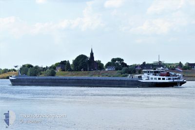
The vessel LYDIA (MMSI: 244700206) is a Cargo It's sailing under the flag of [NL] Netherlands.
In this page you can find informations about the vessels current position, last detected port calls, and current voyage information. If the vessels is not in coverage by AIS you will find the latest position.
The current position of LYDIA is detected by our AIS receivers and we are not responsible for the reliability of the data. The last position was recorded while the vessel was in Coverage by the Ais receivers of our vessel tracking app.
The current draught of LYDIA as reported by AIS is 3 meters
Weather
| Temperature | 2.8°C / 37.04°F |
|---|---|
| Wind Speed | 11 knots |
| Direction | 134° SE |
| Pressure | 998.3 hPa |
| Humidity | 98.4 % |
| Cloud Coverage | 100 % |
Featured Company
Last Port Calls
| Port | Arrival | Departure | Time In Port |
|---|---|---|---|
| 2026-01-05 15:07 | 2026-01-07 18:19 | 2 d | |
| 2025-12-29 20:51 | 2025-12-29 21:15 | 24 m | |
| 2025-12-29 11:25 | 2025-12-29 18:49 | 7 h | |
| 2025-12-29 09:00 | 2025-12-29 09:58 | 58 m | |
| 2025-12-17 10:31 | 2025-12-17 16:38 | 6 h | |
| 2025-12-16 02:57 | 2025-12-16 04:58 | 2 h | |
| 2025-12-13 13:56 | 2025-12-15 10:34 | 1 d | |
| 2025-12-11 23:33 | 2025-12-12 01:26 | 1 h | |
| 2025-12-10 14:57 | 2025-12-10 16:48 | 1 h | |
| 2025-12-05 21:28 | 2025-12-05 23:24 | 1 h |
Last Trips
| Origin | Departure | Destination | Arrival | Distance | |
|---|---|---|---|---|---|
| 2025-12-29 21:15 | 2026-01-05 15:07 | 141.87 nm | |||
| 2025-12-29 18:49 | 2025-12-29 20:51 | 17.99 nm | |||
| 2025-12-29 09:58 | 2025-12-29 11:25 | 17.46 nm | |||
| 2025-12-17 16:38 | 2025-12-29 09:00 | 140.32 nm | |||
| 2025-12-16 04:58 | 2025-12-17 10:31 | 41.88 nm | |||
| 2025-12-15 10:34 | 2025-12-16 02:57 | 105.12 nm | |||
| 2025-12-12 01:26 | 2025-12-13 13:56 | 93.79 nm | |||
| 2025-12-10 16:48 | 2025-12-11 23:33 | 42.04 nm | |||
| 2025-12-05 23:24 | 2025-12-10 14:57 | 127.53 nm | |||
| 2025-12-05 15:58 | 2025-12-05 21:28 | 37.78 nm |
Events
| Heure | Evenement | Détails | Position/ Destination | Info |
|---|---|---|---|---|
| 2026-01-08 13:37 | Arret | 1.15 nm, West of WILLEMSTAD |
51.68992 / 4.40974
VERDER
|
Vitesse: Parcours: 229° |
| 2026-01-08 11:28 | Etat Changé | Default Under way using engine |
51.78493 / 4.75655
VERDER
|
Vitesse: 9 kn Parcours: 235.7° |
| 2026-01-08 11:23 | Etat Changé | Under way using engine Default |
51.79382 / 4.77131
VERDER
|
Vitesse: 8.9 kn Parcours: 244° |
| 2026-01-08 11:23 | Hors de la zone couverte |
51.79382 / 4.77131
North Sea
|
Vitesse: 9 kn Parcours: 235.7° |
|
| 2026-01-08 10:52 | Etat Changé | Default Under way using engine |
51.81548 / 4.88198
VERDER
|
Vitesse: 9.3 kn Parcours: 247.3° |
| 2026-01-08 04:26 | Dans la zone couverte |
51.83897 / 6.17162
North Sea
|
Vitesse: 8.8 kn Parcours: 307.2° |
|
| 2026-01-07 19:01 | Hors de la zone couverte |
51.57080 / 6.60076
North Sea
|
Vitesse: 8.7 kn Parcours: 322.9° |
|
| 2026-01-07 17:46 | Dans la zone couverte |
51.48302 / 6.68017
North Sea
|
Vitesse: 8.5 kn Parcours: 13.4° |
|
| 2026-01-07 17:19 | PORT DE DEPART |
|
51.48302 / 6.68017
VERDER
|
Vitesse: Parcours: 262° |
| 2026-01-07 10:06 | Hors de la zone couverte |
51.42889 / 6.73182
North Sea
[DE] DUISBURG
|
Vitesse: Parcours: 286.7° |