
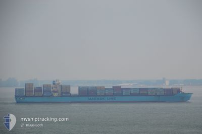
MAERSK OHIO
Container Ship
Current Trip
| Time Travelled | 17 h, 59 mins |
|---|---|
| Remaining Time | 9 h, 5 mins |
| Distance Travelled | 284.44 nm |
| Remaining Distance | 184.86 nm |
| AVG Speed | 14.6 Noeuds |
| MAX Speed | 21.6 Noeuds |
| AVG Wind | 17.2 knots |
| MAX Wind | 21.9 knots |
| MIN Temp | 2.3°C / 36.14°F |
| MAX Temp | 13.1°C / 55.58°F |
| Tirant d eau | 10.6 m |
| Position reçue | 15 h, 30 m depuis |
Current Position
| Longitude | -75.75366° |
|---|---|
| Latitude | 36.80733° |
| Etat | Under way using engine |
| Vitesse | 7.8 Noeuds |
| Parcours | 99.6° |
| Zone | North Atlantic Ocean |
| Station | T-AIS |
| Position reçue | 15 h, 30 m depuis |
Info
Information
The current position of MAERSK OHIO is in North Atlantic Ocean with coordinates 36.80733° / -75.75366° as reported on 2025-02-14 11:50 by AIS to our vessel tracker app. The vessel's current speed is 7.8 Noeuds and is heading at the port of CHARLESTON. The estimated time of arrival as calculated by MyShipTracking vessel tracking app is 2025-02-15 12:26 LT
The vessel MAERSK OHIO (IMO: 9298698, MMSI: 367775000) is a Container Ship that was built in 2006 ( 19 Age ). It's sailing under the flag of [US] USA.
In this page you can find informations about the vessels current position, last detected port calls, and current voyage information. If the vessels is not in coverage by AIS you will find the latest position.
The current position of MAERSK OHIO is detected by our AIS receivers and we are not responsible for the reliability of the data. The last position was recorded while the vessel was in Coverage by the Ais receivers of our vessel tracking app.
The current draught of MAERSK OHIO as reported by AIS is 10.6 meters
Weather
| Temperature | 13°C / 55.4°F |
|---|---|
| Wind Speed | 13 knots |
| Direction | 81° E |
| Pressure | 1034.3 hPa |
| Humidity | 62.6 % |
| Cloud Coverage | 79 % |
Featured Company
Last Port Calls
| Port | Arrival | Departure | Time In Port |
|---|---|---|---|
| 2025-02-13 14:15 | 2025-02-14 09:22 | 19 h | |
| 2025-02-01 13:05 | 2025-02-03 13:05 | 1 d | |
| 2025-01-30 12:42 | 2025-01-31 08:50 | 20 h | |
| 2025-01-27 14:44 | 2025-01-29 06:57 | 1 d | |
| 2025-01-12 10:13 | 2025-01-13 11:01 | 1 d | |
| 2025-01-05 23:11 | 2025-01-07 13:34 | 1 d | |
| 2024-12-29 14:38 | 2024-12-30 03:23 | 12 h | |
| 2024-12-27 14:19 | 2024-12-28 12:22 | 22 h | |
| 2024-12-17 10:59 | 2024-12-18 13:41 | 1 d | |
| 2024-12-13 18:00 | 2024-12-14 15:08 | 21 h |
Most Visited Ports (Last year)
| Port | Arrivals | |
|---|---|---|
| 17 | ||
| 9 | ||
| 9 | ||
| 9 | ||
| 8 | ||
| 8 |
Last Trips
| Origin | Departure | Destination | Arrival | Distance | |
|---|---|---|---|---|---|
| 2025-02-03 14:05 | 2025-02-13 09:15 | 4081.68 nm | |||
| 2025-01-31 09:50 | 2025-02-01 14:05 | 284.82 nm | |||
| 2025-01-29 07:57 | 2025-01-30 13:42 | 122.86 nm | |||
| 2025-01-13 06:01 | 2025-01-27 15:44 | 3902.71 nm | |||
| 2025-01-07 07:34 | 2025-01-12 05:13 | 1839.81 nm | |||
| 2024-12-29 22:23 | 2025-01-05 17:11 | 1381.64 nm | |||
| 2024-12-28 07:22 | 2024-12-29 09:38 | 428.55 nm | |||
| 2024-12-18 14:41 | 2024-12-27 09:19 | 3897.34 nm | |||
| 2024-12-14 16:08 | 2024-12-17 11:59 | 285.21 nm | |||
| 2024-12-13 00:06 | 2024-12-13 19:00 | 151.29 nm |
Events
| Heure | Evenement | Détails | Position/ Destination | Info |
|---|---|---|---|---|
| 2025-02-14 11:55 | Etat Changé | Default Under way using engine |
36.80545 / -75.73927
US CHS
|
Vitesse: 7.8 kn Parcours: 99.6° |
| 2025-02-14 11:50 | Etat Changé | Under way using engine Default |
36.80733 / -75.75366
US CHS
|
Vitesse: 7.8 kn Parcours: 101° |
| 2025-02-14 11:50 | Hors de la zone couverte |
36.80733 / -75.75366
North Atlantic Ocean
US CHS
|
Vitesse: 7.8 kn Parcours: 99.6° |
|
| 2025-02-14 11:47 | Etat Changé | Default Under way using engine |
36.80852 / -75.76129
US CHS
|
Vitesse: 8 kn Parcours: 112.6° |
| 2025-02-14 11:40 | Etat Changé | Under way using engine Default |
36.81218 / -75.78138
US CHS
|
Vitesse: 8.4 kn Parcours: 121° |
| 2025-02-14 11:27 | Etat Changé | Default Under way using engine |
36.82742 / -75.81239
US CHS
|
Vitesse: 8.7 kn Parcours: 128.3° |
| 2025-02-14 11:21 | Etat Changé | Under way using engine Default |
36.83543 / -75.82792
US CHS
|
Vitesse: 8.7 kn Parcours: 127° |
| 2025-02-14 11:07 | Etat Changé | Default Under way using engine |
36.85585 / -75.86095
US CHS
|
Vitesse: 8 kn Parcours: 127.2° |
| 2025-02-14 11:02 | Etat Changé | Under way using engine Default |
36.86326 / -75.87272
US CHS
|
Vitesse: 8.1 kn Parcours: 127° |
| 2025-02-14 10:59 | Etat Changé | Default Under way using engine |
36.86676 / -75.87864
US CHS
|
Vitesse: 9 kn Parcours: 139.5° |