

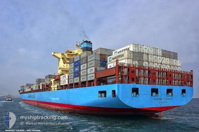
MAERSK TUKANG
Container Ship

Current Trip
| Time Travelled | 1 day |
|---|---|
| Remaining Time | 1 day |
| Distance Travelled | 401.27 nm |
| Remaining Distance | 993.07 nm |
| AVG Speed | 17.9 Noeuds |
| MAX Speed | 21.3 Noeuds |
| AVG Wind | 19.6 knots |
| MAX Wind | 29.5 knots |
| MIN Temp | 8.7°C / 47.66°F |
| MAX Temp | 12°C / 53.6°F |
| Tirant d eau | 11.3 m |
| Position reçue | 3 h, 43 m depuis |
Current Position
| Longitude | -5.00976° |
|---|---|
| Latitude | 49.19813° |
| Etat | Under way using engine |
| Vitesse | 20.3 Noeuds |
| Parcours | 248° |
| Zone | English Channel |
| Station | T-AIS |
| Position reçue | 3 h, 43 m depuis |
Information
The current position of MAERSK TUKANG is in English Channel with coordinates 49.19813° / -5.00976° as reported on 2025-04-16 15:04 by AIS to our vessel tracker app. The vessel's current speed is 20.3 Noeuds and is heading at the port of TANGER MED. The estimated time of arrival as calculated by MyShipTracking vessel tracking app is 2025-04-18 16:56 LT
The vessel MAERSK TUKANG (IMO: 9334686, MMSI: 565825000) is a Container Ship that was built in 2008 ( 17 Age ). It's sailing under the flag of [SG] Singapore.
In this page you can find informations about the vessels current position, last detected port calls, and current voyage information. If the vessels is not in coverage by AIS you will find the latest position.
The current position of MAERSK TUKANG is detected by our AIS receivers and we are not responsible for the reliability of the data. The last position was recorded while the vessel was in Coverage by the Ais receivers of our vessel tracking app.
The current draught of MAERSK TUKANG as reported by AIS is 11.3 meters
Weather
| Temperature | 9.7°C / 49.46°F |
|---|---|
| Wind Speed | 8 knots |
| Direction | 348° NNW |
| Pressure | 1007.1 hPa |
| Humidity | 69.2 % |
| Cloud Coverage | 100 % |


Featured Company
Last Port Calls
| Port | Arrival | Departure | Time In Port |
|---|---|---|---|
| 2025-04-14 17:26 | 2025-04-15 18:30 | 1 d | |
| 2025-04-11 07:28 | 2025-04-12 23:11 | 1 d | |
| 2025-04-04 22:17 | 2025-04-06 01:59 | 1 d | |
| 2025-03-30 13:07 | 2025-03-31 04:38 | 15 h | |
| 2025-03-07 04:31 | 2025-03-08 15:27 | 1 d | |
| 2025-03-01 13:10 | 2025-03-03 19:23 | 2 d | |
| 2025-02-26 09:39 | 2025-02-27 17:51 | 1 d | |
| 2025-02-20 00:06 | 2025-02-20 22:46 | 22 h | |
| 2025-02-16 07:11 | 2025-02-17 06:22 | 23 h |
Most Visited Ports (Last year)
| Port | Arrivals | |
|---|---|---|
| 5 | ||
| 5 | ||
| 4 | ||
| 4 | ||
| 3 | ||
| 3 |
Last Trips
| Origin | Departure | Destination | Arrival | Distance | |
|---|---|---|---|---|---|
| 2025-04-12 23:11 | 2025-04-14 17:26 | 438.99 nm | |||
| 2025-04-06 01:59 | 2025-04-11 07:28 | 489.41 nm | |||
| 2025-03-31 04:38 | 2025-04-04 22:17 | 1411.37 nm | |||
| 2025-03-08 15:27 | 2025-03-30 13:07 | 9562.49 nm | |||
| 2025-03-03 19:23 | 2025-03-07 04:31 | 738.04 nm | |||
| 2025-02-27 17:51 | 2025-03-01 13:10 | 705.03 nm | |||
| 2025-02-20 22:46 | 2025-02-26 09:39 | 2011.54 nm | |||
| 2025-02-17 06:22 | 2025-02-20 00:06 | 1016.53 nm | |||
| 2025-01-22 12:41 | 2025-02-16 07:11 | 9497.00 nm |
Events
| Heure | Evenement | Détails | Position/ Destination | Info |
|---|---|---|---|---|
| 2025-04-16 15:04 | Etat Changé | Default Under way using engine |
49.19749 / -5.01213
GBLGP>MAPTM
|
Vitesse: 20.3 kn Parcours: 248° |
| 2025-04-16 15:04 | Hors de la zone couverte |
49.19813 / -5.00976
English Channel
GBLGP>MAPTM
|
Vitesse: 20.3 kn Parcours: 248° |
|
| 2025-04-16 15:03 | Etat Changé | Under way using engine Default |
49.19875 / -5.00730
GBLGP>MAPTM
|
Vitesse: 20.2 kn Parcours: 240° |
| 2025-04-16 14:44 | Etat Changé | Default Under way using engine |
49.24971 / -4.85975
GBLGP>MAPTM
|
Vitesse: 19.9 kn Parcours: 239.6° |
| 2025-04-16 14:32 | Etat Changé | Under way using engine Default |
49.28142 / -4.77024
GBLGP>MAPTM
|
Vitesse: 20.3 kn Parcours: 240° |
| 2025-04-16 14:12 | Etat Changé | Default Under way using engine |
49.34231 / -4.61830
GBLGP>MAPTM
|
Vitesse: 21 kn Parcours: 239.4° |
| 2025-04-16 14:06 | Etat Changé | Under way using engine Default |
49.36052 / -4.57265
GBLGP>MAPTM
|
Vitesse: 21.2 kn Parcours: 246° |
| 2025-04-16 13:42 | Etat Changé | Default Under way using engine |
49.42209 / -4.38254
GBLGP>MAPTM
|
Vitesse: 21.1 kn Parcours: 237.6° |
| 2025-04-16 13:33 | Changement de zone | French part of the English Channel United Kingdom part of the English Channel |
49.44642 / -4.31185
English Channel
GBLGP>MAPTM
|
Vitesse: 21.1 kn Parcours: 239° |
| 2025-04-16 13:33 | Etat Changé | Under way using engine Default |
49.44642 / -4.31185
GBLGP>MAPTM
|
Vitesse: 21 kn Parcours: 235° |