
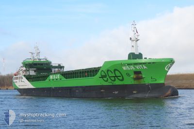
MISJE VITA
Cargo
Current Trip
| Time Travelled | 2 days |
|---|---|
| Remaining Time | 7 h, 40 mins |
| Distance Travelled | 519.77 nm |
| Remaining Distance | 91.23 nm |
| AVG Speed | 7.8 Noeuds |
| MAX Speed | 12.2 Noeuds |
| AVG Wind | 22.9 knots |
| MAX Wind | 43 knots |
| MIN Temp | -4°C / 24.8°F |
| MAX Temp | 6.7°C / 44.06°F |
| Tirant d eau | 6.5 m |
| Position reçue | 9 h, 5 m depuis |
Current Position
| Longitude | 6.62364° |
|---|---|
| Latitude | 55.75262° |
| Etat | Under way using engine |
| Vitesse | 10.6 Noeuds |
| Parcours | 163.5° |
| Zone | North Sea |
| Station | T-AIS |
| Position reçue | 9 h, 5 m depuis |
Info
Information
The current position of MISJE VITA is in North Sea with coordinates 55.75262° / 6.62364° as reported on 2025-02-25 15:12 by AIS to our vessel tracker app. The vessel's current speed is 10.6 Noeuds and is heading at the port of BREMEN. The estimated time of arrival as calculated by MyShipTracking vessel tracking app is 2025-02-26 07:57 LT
The vessel MISJE VITA (IMO: 9927421, MMSI: 258066000) is a Cargo It's sailing under the flag of [NO] Norway.
In this page you can find informations about the vessels current position, last detected port calls, and current voyage information. If the vessels is not in coverage by AIS you will find the latest position.
The current position of MISJE VITA is detected by our AIS receivers and we are not responsible for the reliability of the data. The last position was recorded while the vessel was in Coverage by the Ais receivers of our vessel tracking app.
The current draught of MISJE VITA as reported by AIS is 6.5 meters
Weather
| Temperature | 6°C / 42.8°F |
|---|---|
| Wind Speed | 4 knots |
| Direction | 311° NW |
| Pressure | 1013.3 hPa |
| Humidity | 90.9 % |
| Cloud Coverage | 100 % |
Featured Company
Last Port Calls
| Port | Arrival | Departure | Time In Port |
|---|---|---|---|
| 2025-02-22 19:17 | 2025-02-23 15:07 | 19 h | |
| 2025-02-19 17:37 | |||
| 2025-02-06 21:21 | 2025-02-10 21:32 | 4 d | |
| 2025-02-05 14:38 | 2025-02-06 11:18 | 20 h | |
| 2025-01-30 13:31 | 2025-01-31 19:02 | 1 d | |
| 2025-01-23 17:58 | 2025-01-26 19:00 | 3 d | |
| 2025-01-16 14:47 | 2025-01-17 18:52 | 1 d | |
| 2025-01-12 20:38 | 2025-01-14 19:58 | 1 d | |
| 2025-01-08 20:54 | 2025-01-09 17:42 | 20 h | |
| 2025-01-05 10:22 | 2025-01-07 10:42 | 2 d |
Last Trips
| Origin | Departure | Destination | Arrival | Distance | |
|---|---|---|---|---|---|
| 2025-02-19 17:37 | 2025-02-22 20:17 | 807.30 nm | |||
| 2025-02-06 11:18 | 2025-02-06 21:21 | 2.00 nm | |||
| 2025-01-31 20:02 | 2025-02-05 14:38 | 1167.70 nm | |||
| 2025-01-26 19:00 | 2025-01-30 14:31 | 689.46 nm | |||
| 2025-01-17 19:52 | 2025-01-23 17:58 | 1099.03 nm | |||
| 2025-01-14 20:58 | 2025-01-16 15:47 | 399.00 nm | |||
| 2025-01-09 18:42 | 2025-01-12 21:38 | 606.27 nm | |||
| 2025-01-07 11:42 | 2025-01-08 21:54 | 379.83 nm | |||
| 2024-12-31 00:34 | 2025-01-05 11:22 | 867.71 nm | |||
| 2024-12-27 20:09 | 2024-12-29 19:14 | 524.48 nm |
Events
| Heure | Evenement | Détails | Position/ Destination | Info |
|---|---|---|---|---|
| 2025-02-25 15:26 | Etat Changé | Default Under way using engine |
55.71403 / 6.64662
DEBRE
|
Vitesse: 10.6 kn Parcours: 163.5° |
| 2025-02-25 15:12 | Hors de la zone couverte |
55.75262 / 6.62364
North Sea
DEBRE
|
Vitesse: 10.6 kn Parcours: 163.5° |
|
| 2025-02-25 15:06 | Detecté en mer | Danish part of the North Sea |
55.76905 / 6.61394
North Sea
DEBRE
|
Vitesse: 10.3 kn Parcours: 162.8° |
| 2025-02-25 15:06 | Etat Changé | Under way using engine Default |
55.76905 / 6.61394
DEBRE
|
Vitesse: 10.7 kn Parcours: 162° |
| 2025-02-25 15:06 | Dans la zone couverte |
55.76905 / 6.61394
North Sea
DEBRE
|
Vitesse: 10.3 kn Parcours: 162.8° |
|
| 2025-02-25 07:31 | Hors de la zone couverte |
57.03599 / 5.85539
North Sea
DEBRE
|
Vitesse: 11.2 kn Parcours: 158.9° |
|
| 2025-02-23 22:33 | Detecté en mer | Norwegian part of the North Sea |
60.99949 / 4.79992
North Sea
DEBRE
|
Vitesse: 9.2 kn Parcours: 236.6° |
| 2025-02-23 15:53 | Changement d'ETA | 2025/02/26 07:00 2025/02/26 08:00 |
60.98891 / 7.03268
DEBRE
|
Vitesse: 11.7 kn Parcours: 26.4° |
| 2025-02-23 15:29 | Tirant d'eau modifié | 6.5 4.3 |
60.94109 / 6.91910
DEBRE
|
Vitesse: 11.3 kn Parcours: 71.6° |
| 2025-02-23 15:29 | Changement de destination | DEBRE NOFLA |
60.94109 / 6.91910
DEBRE
|
Vitesse: 11.3 kn Parcours: 71.6° |