

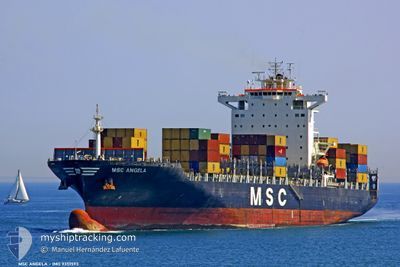
MSC ANGELA
Container Ship

Current Trip
| Time Travelled | 7 h, 17 mins |
|---|---|
| Remaining Time | 2 days |
| Distance Travelled | 51.99 nm |
| Remaining Distance | 331.78 nm |
| AVG Speed | 12.6 Noeuds |
| MAX Speed | 15.7 Noeuds |
| AVG Wind | 6.2 knots |
| MAX Wind | 14 knots |
| MIN Temp | 21.7°C / 71.06°F |
| MAX Temp | 26°C / 78.8°F |
| Tirant d eau | 10.5 m |
| Position reçue | 1 h, 7 m depuis |
Current Position
| Longitude | -80.39152° |
|---|---|
| Latitude | 31.63056° |
| Etat | Under way using engine |
| Vitesse | 5.6 Noeuds |
| Parcours | 156.1° |
| Zone | North Atlantic Ocean |
| Station | T-AIS |
| Position reçue | 1 h, 7 m depuis |
Information
The current position of MSC ANGELA is in North Atlantic Ocean with coordinates 31.63056° / -80.39152° as reported on 2025-06-03 17:02 by AIS to our vessel tracker app. The vessel's current speed is 5.6 Noeuds and is heading at the port of PORT EVERGLADES. The estimated time of arrival as calculated by MyShipTracking vessel tracking app is 2025-06-06 01:31 LT
The vessel MSC ANGELA (IMO: 9351593, MMSI: 370254000) is a Container Ship that was built in 2008 ( 17 Age ). It's sailing under the flag of [PA] Panama.
In this page you can find informations about the vessels current position, last detected port calls, and current voyage information. If the vessels is not in coverage by AIS you will find the latest position.
The current position of MSC ANGELA is detected by our AIS receivers and we are not responsible for the reliability of the data. The last position was recorded while the vessel was in Coverage by the Ais receivers of our vessel tracking app.
The current draught of MSC ANGELA as reported by AIS is 10.5 meters
Weather
| Temperature | 26°C / 78.8°F |
|---|---|
| Wind Speed | 14 knots |
| Direction | 103° ESE |
| Pressure | 1019.8 hPa |
| Humidity | 76.1 % |
| Cloud Coverage | 99 % |


Featured Company
Last Port Calls
| Port | Arrival | Departure | Time In Port |
|---|---|---|---|
| 2025-06-02 17:13 | 2025-06-03 10:53 | 17 h | |
| 2025-05-31 01:51 | 2025-05-31 19:56 | 18 h | |
| 2025-05-28 08:08 | 2025-05-29 05:19 | 21 h | |
| 2025-05-17 14:43 | 2025-05-18 09:42 | 18 h | |
| 2025-05-15 17:40 | 2025-05-16 12:34 | 18 h | |
| 2025-05-11 21:49 | 2025-05-13 08:46 | 1 d | |
| 2025-04-30 15:07 | 2025-04-30 23:08 | 8 h | |
| 2025-04-29 14:01 | 2025-04-30 04:13 | 14 h | |
| 2025-04-25 13:25 | 2025-04-26 12:17 | 22 h | |
| 2025-04-23 13:18 | 2025-04-24 03:14 | 13 h |
Last Trips
| Origin | Departure | Destination | Arrival | Distance | |
|---|---|---|---|---|---|
| 2025-05-31 15:56 | 2025-06-02 13:13 | 115.06 nm | |||
| 2025-05-29 01:19 | 2025-05-30 21:51 | 636.54 nm | |||
| 2025-05-18 11:42 | 2025-05-28 04:08 | 3751.13 nm | |||
| 2025-05-16 14:34 | 2025-05-17 16:43 | 276.01 nm | |||
| 2025-05-13 10:46 | 2025-05-15 19:40 | 127.72 nm | |||
| 2025-04-30 19:08 | 2025-05-11 23:49 | 3930.77 nm | |||
| 2025-04-30 00:13 | 2025-04-30 11:07 | 69.08 nm | |||
| 2025-04-26 08:17 | 2025-04-29 10:01 | 715.41 nm | |||
| 2025-04-23 23:14 | 2025-04-25 09:25 | 283.51 nm | |||
| 2025-04-19 13:23 | 2025-04-23 09:18 | 581.44 nm |
Events
| Heure | Evenement | Détails | Position/ Destination | Info |
|---|---|---|---|---|
| 2025-06-03 17:09 | Etat Changé | Default Under way using engine |
31.62148 / -80.38702
USPEF
|
Vitesse: 5.6 kn Parcours: 156.1° |
| 2025-06-03 17:02 | Etat Changé | Under way using engine Default |
31.63056 / -80.39152
USPEF
|
Vitesse: 5.6 kn Parcours: 157° |
| 2025-06-03 17:02 | Hors de la zone couverte |
31.63056 / -80.39152
North Atlantic Ocean
|
Vitesse: 5.6 kn Parcours: 156.1° |
|
| 2025-06-03 16:40 | Etat Changé | Default Under way using engine |
31.66303 / -80.40774
USPEF
|
Vitesse: 5.7 kn Parcours: 156.7° |
| 2025-06-03 16:35 | Etat Changé | Under way using engine Default |
31.67148 / -80.41200
USPEF
|
Vitesse: 5.7 kn Parcours: 157° |
| 2025-06-03 16:28 | Etat Changé | Default Under way using engine |
31.68190 / -80.41709
USPEF
|
Vitesse: 5.8 kn Parcours: 156.6° |
| 2025-06-03 16:01 | Etat Changé | Under way using engine Default |
31.72218 / -80.43731
USPEF
|
Vitesse: 5.9 kn Parcours: 159° |
| 2025-06-03 15:41 | Etat Changé | Default Under way using engine |
31.75312 / -80.45274
USPEF
|
Vitesse: 6 kn Parcours: 155.9° |
| 2025-06-03 15:33 | Etat Changé | Under way using engine Default |
31.76489 / -80.45865
USPEF
|
Vitesse: 6 kn Parcours: 155° |
| 2025-06-03 15:29 | Etat Changé | Default Under way using engine |
31.77152 / -80.46193
USPEF
|
Vitesse: 6 kn Parcours: 155.9° |