
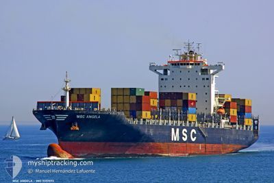
MSC ANGELA
Container Ship
Current Trip
| Time Travelled | 16 h, 3 mins |
|---|---|
| Remaining Time | --- |
| Distance Travelled | 77.51 nm |
| Remaining Distance | --- |
| AVG Speed | 14.1 Knots |
| MAX Speed | 17.4 Knots |
| AVG Wind | 14.5 knots |
| MAX Wind | 18.9 knots |
| MIN Temp | 22.3°C / 72.14°F |
| MAX Temp | 26.8°C / 80.24°F |
| Draught | 10.1 m |
| Position Received | 5 m ago |
Current Position
| Longitude | -80.46747° |
|---|---|
| Latitude | 32.00075° |
| Status | At anchor |
| Speed | |
| Course | --- |
| Area | North Atlantic Ocean |
| Station | T-AIS |
| Position Received | 5 m ago |
Information
The current position of MSC ANGELA is in North Atlantic Ocean with coordinates 32.00075° / -80.46747° as reported on 2025-06-01 11:53 by AIS to our vessel tracker app. The vessel's current speed is 0 Knots
The vessel MSC ANGELA (IMO: 9351593, MMSI: 370254000) is a Container Ship that was built in 2008 ( 17 years old ). It's sailing under the flag of [PA] Panama.
In this page you can find informations about the vessels current position, last detected port calls, and current voyage information. If the vessels is not in coverage by AIS you will find the latest position.
The current position of MSC ANGELA is detected by our AIS receivers and we are not responsible for the reliability of the data. The last position was recorded while the vessel was in Coverage by the Ais receivers of our vessel tracking app.
The current draught of MSC ANGELA as reported by AIS is 10.1 meters
Weather
| Temperature | 22.4°C / 72.32°F |
|---|---|
| Wind Speed | 13 knots |
| Direction | 295° WNW |
| Pressure | 1012.3 hPa |
| Humidity | 69.2 % |
| Cloud Coverage | 33 % |
Featured Company
Last Port Calls
| Port | Arrival | Departure | Time In Port |
|---|---|---|---|
| 2025-05-31 01:51 | 2025-05-31 19:56 | 18 h | |
| 2025-05-28 08:08 | 2025-05-29 05:19 | 21 h | |
| 2025-05-17 14:43 | 2025-05-18 09:42 | 18 h | |
| 2025-05-15 17:40 | 2025-05-16 12:34 | 18 h | |
| 2025-05-11 21:49 | 2025-05-13 08:46 | 1 d | |
| 2025-04-30 15:07 | 2025-04-30 23:08 | 8 h | |
| 2025-04-29 14:01 | 2025-04-30 04:13 | 14 h | |
| 2025-04-25 13:25 | 2025-04-26 12:17 | 22 h | |
| 2025-04-23 13:18 | 2025-04-24 03:14 | 13 h | |
| 2025-04-19 09:51 | 2025-04-19 17:23 | 7 h |
Last Trips
| Origin | Departure | Destination | Arrival | Distance | |
|---|---|---|---|---|---|
| 2025-05-29 01:19 | 2025-05-30 21:51 | 636.54 nm | |||
| 2025-05-18 11:42 | 2025-05-28 04:08 | 3751.13 nm | |||
| 2025-05-16 14:34 | 2025-05-17 16:43 | 276.01 nm | |||
| 2025-05-13 10:46 | 2025-05-15 19:40 | 127.72 nm | |||
| 2025-04-30 19:08 | 2025-05-11 23:49 | 3930.77 nm | |||
| 2025-04-30 00:13 | 2025-04-30 11:07 | 69.08 nm | |||
| 2025-04-26 08:17 | 2025-04-29 10:01 | 715.41 nm | |||
| 2025-04-23 23:14 | 2025-04-25 09:25 | 283.51 nm | |||
| 2025-04-19 13:23 | 2025-04-23 09:18 | 581.44 nm | |||
| 2025-04-17 09:14 | 2025-04-19 05:51 | 399.93 nm |
Events
| Time | Event | Details | Position / Dest | Info |
|---|---|---|---|---|
| 2025-06-01 11:44 | Status Changed | At anchor Default |
32.00080 / -80.46761
USSAV
|
Speed: Course: 293° |
| 2025-06-01 11:26 | Status Changed | Default At anchor |
32.00089 / -80.46756
USSAV
|
Speed: Course: 292° |
| 2025-06-01 11:17 | Status Changed | At anchor Default |
32.00090 / -80.46754
USSAV
|
Speed: Course: 292° |
| 2025-06-01 11:14 | Status Changed | Default At anchor |
32.00090 / -80.46758
USSAV
|
Speed: Course: 292° |
| 2025-06-01 10:59 | Status Changed | At anchor Default |
32.00093 / -80.46756
USSAV
|
Speed: Course: 293° |
| 2025-06-01 10:56 | Status Changed | Default At anchor |
32.00089 / -80.46756
USSAV
|
Speed: Course: 293° |
| 2025-06-01 10:29 | Status Changed | At anchor Default |
32.00097 / -80.46753
USSAV
|
Speed: Course: 290° |
| 2025-06-01 10:26 | Status Changed | Default At anchor |
32.00100 / -80.46751
USSAV
|
Speed: Course: 288° |
| 2025-06-01 10:11 | Status Changed | At anchor Default |
32.00111 / -80.46749
USSAV
|
Speed: Course: 288° |
| 2025-06-01 10:08 | Status Changed | Default At anchor |
32.00113 / -80.46748
USSAV
|
Speed: Course: 287° |