
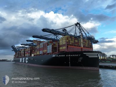
MSC CLAUDE GIRARDET
Cargo D
Current Trip
| Time Travelled | 7 days |
|---|---|
| Remaining Time | 1 day |
| Distance Travelled | 1044.55 nm |
| Remaining Distance | 997.25 nm |
| AVG Speed | 10.2 Noeuds |
| MAX Speed | 17.3 Noeuds |
| AVG Wind | 11.4 knots |
| MAX Wind | 25 knots |
| MIN Temp | 6.1°C / 42.98°F |
| MAX Temp | 14.4°C / 57.92°F |
| Tirant d eau | 15.3 m |
| Position reçue | 1 d depuis |
Current Position
| Longitude | -4.37984° |
|---|---|
| Latitude | 49.54062° |
| Etat | Under way using engine |
| Vitesse | 14.3 Noeuds |
| Parcours | 235.4° |
| Zone | English Channel |
| Station | T-AIS |
| Position reçue | 1 d depuis |
Info
Information
The current position of MSC CLAUDE GIRARDET is in English Channel with coordinates 49.54062° / -4.37984° as reported on 2025-03-11 21:20 by AIS to our vessel tracker app. The vessel's current speed is 14.3 Noeuds and is heading at the port of ALGECIRAS. The estimated time of arrival as calculated by MyShipTracking vessel tracking app is 2025-03-15 02:38 LT
The vessel MSC CLAUDE GIRARDET (IMO: 9936628, MMSI: 636022921) is a Cargo D It's sailing under the flag of [LR] Liberia.
In this page you can find informations about the vessels current position, last detected port calls, and current voyage information. If the vessels is not in coverage by AIS you will find the latest position.
The current position of MSC CLAUDE GIRARDET is detected by our AIS receivers and we are not responsible for the reliability of the data. The last position was recorded while the vessel was in Coverage by the Ais receivers of our vessel tracking app.
The current draught of MSC CLAUDE GIRARDET as reported by AIS is 15.3 meters
Weather
| Temperature | 11.8°C / 53.24°F |
|---|---|
| Wind Speed | 26 knots |
| Direction | 43° NE |
| Pressure | 999.2 hPa |
| Humidity | 61 % |
| Cloud Coverage | 66 % |
Featured Company
Last Trips
| Origin | Departure | Destination | Arrival | Distance | |
|---|---|---|---|---|---|
| 2025-02-20 00:33 | 2025-03-01 21:39 | 793.76 nm | |||
| 2025-02-15 22:34 | 2025-02-18 20:36 | 419.87 nm | |||
| 2025-02-05 01:35 | 2025-02-11 11:48 | 1074.76 nm | |||
| 2025-01-03 18:49 | 2025-02-03 02:20 | 11362.07 nm | |||
| 2024-12-26 21:20 | 2025-01-02 06:45 | 1581.44 nm |
Events
| Heure | Evenement | Détails | Position/ Destination | Info |
|---|---|---|---|---|
| 2025-03-11 21:28 | Etat Changé | Default Under way using engine |
49.52454 / -4.41678
ESALG
|
Vitesse: 14.3 kn Parcours: 235.4° |
| 2025-03-11 21:20 | Hors de la zone couverte |
49.54062 / -4.37984
English Channel
ESALG
|
Vitesse: 14.3 kn Parcours: 235.4° |
|
| 2025-03-11 17:19 | Detecté en mer | United Kingdom part of the English Channel |
49.96961 / -3.07453
English Channel
ESALG
|
Vitesse: 13.5 kn Parcours: 253.7° |
| 2025-03-11 17:18 | Etat Changé | Under way using engine Default |
49.97119 / -3.06607
ESALG
|
Vitesse: 13.5 kn Parcours: 254° |
| 2025-03-11 16:36 | Etat Changé | Default Under way using engine |
50.01542 / -2.83020
ESALG
|
Vitesse: 13.8 kn Parcours: 254.7° |
| 2025-03-11 16:11 | Etat Changé | Under way using engine Default |
50.04025 / -2.68938
ESALG
|
Vitesse: 13.8 kn Parcours: 255° |
| 2025-03-11 16:08 | Etat Changé | Default Under way using engine |
50.04417 / -2.66735
ESALG
|
Vitesse: 13.6 kn Parcours: 254.1° |
| 2025-03-11 15:04 | Changement de zone | Guernsey part of the English Channel United Kingdom part of the English Channel |
50.10824 / -2.30325
English Channel
ESALG
|
Vitesse: 13.1 kn Parcours: 254.8° |
| 2025-03-11 15:03 | Etat Changé | Under way using engine Default |
50.10935 / -2.29685
ESALG
|
Vitesse: 13.2 kn Parcours: 255° |
| 2025-03-11 14:20 | Etat Changé | Default Under way using engine |
50.15425 / -2.05402
ESALG
|
Vitesse: 14 kn Parcours: 250.4° |