
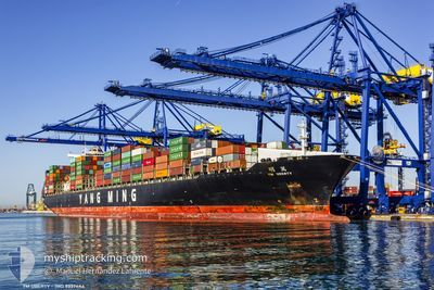
MSC UBERTY VIII
Container Ship
Current Trip
| Time Travelled | 1 day |
|---|---|
| Remaining Time | --- |
| Distance Travelled | 19.50 nm |
| Remaining Distance | --- |
| AVG Speed | 16.4 Noeuds |
| MAX Speed | 17.4 Noeuds |
| AVG Wind | 19.7 knots |
| MAX Wind | 21.7 knots |
| MIN Temp | 24.5°C / 76.1°F |
| MAX Temp | 24.9°C / 76.82°F |
| Tirant d eau | 14.2 m |
| Position reçue | 1 d depuis |
Current Position
| Longitude | 38.80881° |
|---|---|
| Latitude | 22.27986° |
| Etat | Under way using engine |
| Vitesse | 16.1 Noeuds |
| Parcours | 273.6° |
| Zone | Red Sea |
| Station | T-AIS |
| Position reçue | 1 d depuis |
Info
Information
The current position of MSC UBERTY VIII is in Red Sea with coordinates 22.27986° / 38.80881° as reported on 2025-03-20 23:06 by AIS to our vessel tracker app. The vessel's current speed is 16.1 Noeuds and is heading at the port of AQABA. The estimated time of arrival as calculated by MyShipTracking vessel tracking app is 2025-03-22 09:30 LT
The vessel MSC UBERTY VIII (IMO: 9337444, MMSI: 636013689) is a Container Ship that was built in 2008 ( 17 Age ). It's sailing under the flag of [LR] Liberia.
In this page you can find informations about the vessels current position, last detected port calls, and current voyage information. If the vessels is not in coverage by AIS you will find the latest position.
The current position of MSC UBERTY VIII is detected by our AIS receivers and we are not responsible for the reliability of the data. The last position was recorded while the vessel was in Coverage by the Ais receivers of our vessel tracking app.
The current draught of MSC UBERTY VIII as reported by AIS is 14.2 meters
Weather
| Temperature | 24.7°C / 76.46°F |
|---|---|
| Wind Speed | 20 knots |
| Direction | 327° NNW |
| Pressure | 1013.8 hPa |
| Humidity | 59.7 % |
| Cloud Coverage | 1 % |
Featured Company
Last Port Calls
| Port | Arrival | Departure | Time In Port |
|---|---|---|---|
| 2025-03-20 06:18 | 2025-03-21 00:37 | 18 h | |
| 2025-03-18 16:15 | 2025-03-19 21:53 | 1 d | |
| 2025-03-17 06:36 | 2025-03-17 17:12 | 10 h | |
| 2025-03-15 05:37 | 2025-03-15 14:56 | 9 h | |
| 2025-03-10 00:37 | 2025-03-12 07:32 | 2 d | |
| 2025-03-07 18:47 | 2025-03-09 13:15 | 1 d | |
| 2025-03-03 13:08 | 2025-03-04 18:39 | 1 d | |
| 2025-03-01 06:25 | 2025-03-01 16:15 | 9 h | |
| 2025-02-16 09:18 | 2025-02-17 20:55 | 1 d | |
| 2025-02-10 19:35 | 2025-02-12 12:49 | 1 d |
Most Visited Ports (Last year)
| Port | Arrivals | |
|---|---|---|
| 5 | ||
| 5 | ||
| 5 | ||
| 3 | ||
| 3 | ||
| 3 |
Last Trips
| Origin | Departure | Destination | Arrival | Distance | |
|---|---|---|---|---|---|
| 2025-03-19 21:53 | 2025-03-20 06:18 | 85.55 nm | |||
| 2025-03-17 17:12 | 2025-03-18 16:15 | 87.09 nm | |||
| 2025-03-12 07:32 | 2025-03-17 06:36 | 1666.94 nm | |||
| 2025-03-12 07:32 | 2025-03-15 05:37 | 977.51 nm | |||
| 2025-03-09 13:15 | 2025-03-10 00:37 | 184.49 nm | |||
| 2025-03-04 18:39 | 2025-03-07 18:47 | 977.86 nm | |||
| 2025-03-01 16:15 | 2025-03-03 13:08 | 185.89 nm | |||
| 2025-02-17 20:55 | 2025-03-01 06:25 | 4404.78 nm | |||
| 2025-02-12 12:49 | 2025-02-16 09:18 | 303.70 nm | |||
| 2025-02-07 16:58 | 2025-02-10 19:35 | 607.61 nm |
Events
| Heure | Evenement | Détails | Position/ Destination | Info |
|---|---|---|---|---|
| 2025-03-20 23:07 | Etat Changé | Default Under way using engine |
22.28011 / 38.80448
JOAQJ
|
Vitesse: 16.1 kn Parcours: 273.6° |
| 2025-03-20 23:06 | Hors de la zone couverte |
22.27986 / 38.80881
Red Sea
JOAQJ
|
Vitesse: 16.1 kn Parcours: 273.6° |
|
| 2025-03-20 22:50 | Tirant d'eau modifié | 14.2 11.2 |
22.28220 / 38.88415
JOAQJ
|
Vitesse: 16.3 kn Parcours: 234.6° |
| 2025-03-20 22:50 | Changement de destination | JOAQJ SAKAP |
22.28220 / 38.88415
JOAQJ
|
Vitesse: 16.3 kn Parcours: 234.6° |
| 2025-03-20 22:50 | Changement d'ETA | 2025/03/22 06:30 2025/03/20 03:00 |
22.28220 / 38.88415
JOAQJ
|
Vitesse: 16.3 kn Parcours: 234.6° |
| 2025-03-20 22:45 | Etat Changé | Under way using engine Default |
22.29937 / 38.89776
SAKAP
|
Vitesse: 16.6 kn Parcours: 207° |
| 2025-03-20 22:32 | Dans la zone couverte |
22.29676 / 38.89641
Red Sea
|
Vitesse: 16.7 kn Parcours: 206.5° |
|
| 2025-03-20 21:46 | Démarrage | 1.26 nm, South West of KING ABDULLAH |
22.51240 / 39.06959
SAKAP
|
Vitesse: 10.4 kn Parcours: 238° |
| 2025-03-20 21:37 | PORT DE DEPART |
|
22.51240 / 39.06959
SAKAP
|
Vitesse: 2.3 kn Parcours: 250° |
| 2025-03-20 03:49 | Arret |
22.52578 / 39.09422
[SA] KING ABDULLAH
|
Vitesse: Parcours: 270° |