
MTT SENARI
Cargo A
Current Trip
| Time Travelled | 2 days |
|---|---|
| Remaining Time | 1 day |
| Distance Travelled | 802.16 nm |
| Remaining Distance | 682.90 nm |
| AVG Speed | 12.8 Noeuds |
| MAX Speed | 16.8 Noeuds |
| AVG Wind | 13.1 knots |
| MAX Wind | 18.5 knots |
| MIN Temp | 25.1°C / 77.18°F |
| MAX Temp | 28.9°C / 84.02°F |
| Tirant d eau | 7.6 m |
| Position reçue | 1 d depuis |
Current Position
| Longitude | 104.17561° |
|---|---|
| Latitude | 1.26727° |
| Etat | Under way using engine |
| Vitesse | 14.2 Noeuds |
| Parcours | 81.5° |
| Zone | Singapore Strait |
| Station | T-AIS |
| Position reçue | 1 d depuis |
Info
Information
The current position of MTT SENARI is in Singapore Strait with coordinates 1.26727° / 104.17561° as reported on 2025-02-10 20:21 by AIS to our vessel tracker app. The vessel's current speed is 14.2 Noeuds and is heading at the port of TANJUNG PELEPAS. The estimated time of arrival as calculated by MyShipTracking vessel tracking app is 2025-02-14 06:07 LT
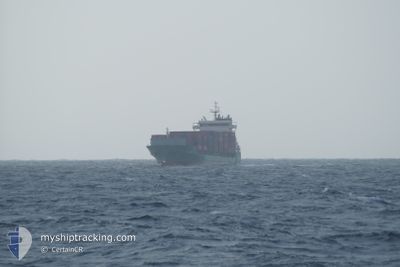
The vessel MTT SENARI (IMO: 9813876, MMSI: 533131059) is a Cargo A It's sailing under the flag of [MY] Malaysia.
In this page you can find informations about the vessels current position, last detected port calls, and current voyage information. If the vessels is not in coverage by AIS you will find the latest position.
The current position of MTT SENARI is detected by our AIS receivers and we are not responsible for the reliability of the data. The last position was recorded while the vessel was in Coverage by the Ais receivers of our vessel tracking app.
The current draught of MTT SENARI as reported by AIS is 7.6 meters
Weather
| Temperature | 26.8°C / 80.24°F |
|---|---|
| Wind Speed | 5 knots |
| Direction | 274° W |
| Pressure | 1012.5 hPa |
| Humidity | 79 % |
| Cloud Coverage | 100 % |
Featured Company
Last Port Calls
| Port | Arrival | Departure | Time In Port |
|---|---|---|---|
| 2025-02-09 09:09 | 2025-02-10 04:33 | 19 h | |
| 2025-02-08 10:17 | 2025-02-08 15:37 | 5 h | |
| 2025-02-03 08:30 | |||
| 2025-01-27 23:09 | 2025-01-29 10:17 | 1 d | |
| 2025-01-22 10:01 | 2025-01-23 04:45 | 18 h | |
| 2025-01-20 14:29 | 2025-01-20 20:38 | 6 h | |
| 2025-01-10 01:02 | 2025-01-11 15:49 | 1 d | |
| 2025-01-05 05:51 | 2025-01-05 21:29 | 15 h | |
| 2025-01-04 05:57 | 2025-01-04 10:52 | 4 h | |
| 2024-12-31 11:19 |
Most Visited Ports (Last year)
| Port | Arrivals | |
|---|---|---|
| 23 | ||
| 20 | ||
| 17 | ||
| 13 | ||
| 3 | ||
| 1 |
Last Trips
| Origin | Departure | Destination | Arrival | Distance | |
|---|---|---|---|---|---|
| 2025-02-08 23:37 | 2025-02-09 17:09 | 188.03 nm | |||
| 2025-02-03 16:30 | 2025-02-08 18:17 | 1070.64 nm | |||
| 2025-01-23 12:45 | 2025-01-28 07:09 | 1425.50 nm | |||
| 2025-01-21 04:38 | 2025-01-22 18:01 | 188.73 nm | |||
| 2025-01-11 23:49 | 2025-01-20 22:29 | 1234.22 nm | |||
| 2025-01-06 05:29 | 2025-01-10 09:02 | 1442.92 nm | |||
| 2025-01-04 18:52 | 2025-01-05 13:51 | 188.19 nm | |||
| 2024-12-31 19:19 | 2025-01-04 13:57 | 1071.33 nm | |||
| 2024-12-19 01:05 | 2024-12-24 01:04 | 1445.07 nm | |||
| 2024-12-17 17:09 | 2024-12-18 12:27 | 185.18 nm |
Events
| Heure | Evenement | Détails | Position/ Destination | Info |
|---|---|---|---|---|
| 2025-02-10 20:25 | Etat Changé | Default Under way using engine |
1.26954 / 104.19399
TWU_MY
|
Vitesse: 14.2 kn Parcours: 81.5° |
| 2025-02-10 20:21 | Hors de la zone couverte |
1.26727 / 104.17561
Singapore Strait
TWU_MY
|
Vitesse: 14.2 kn Parcours: 81.5° |
|
| 2025-02-10 20:14 | Changement de zone | Malaysian part of the Singapore Strait Indonesian part of the Singapore Strait |
1.26330 / 104.14820
Singapore Strait
TWU_MY
|
Vitesse: 14.2 kn Parcours: 81.6° |
| 2025-02-10 17:34 | Tirant d'eau modifié | 7.6 6.4 |
1.07075 / 103.68027
TWU_MY
|
Vitesse: 11.9 kn Parcours: 63.4° |
| 2025-02-10 17:34 | Changement de destination | TWU_MY PTP_MY |
1.07075 / 103.68027
TWU_MY
|
Vitesse: 11.9 kn Parcours: 63.4° |
| 2025-02-10 17:34 | Changement d'ETA | 2025/02/14 03:00 2025/02/08 10:00 |
1.07075 / 103.68027
TWU_MY
|
Vitesse: 11.9 kn Parcours: 63.4° |
| 2025-02-10 17:19 | Etat Changé | Under way using engine Default |
1.05887 / 103.63379
PTP_MY
|
Vitesse: 13 kn Parcours: 113° |
| 2025-02-10 17:17 | Etat Changé | Default Under way using engine |
1.06101 / 103.62815
PTP_MY
|
Vitesse: 13.4 kn Parcours: 122.9° |
| 2025-02-10 17:02 | Etat Changé | Under way using engine Default |
1.08939 / 103.58068
PTP_MY
|
Vitesse: 13.3 kn Parcours: 123° |
| 2025-02-10 16:37 | Etat Changé | Default Under way using engine |
1.12943 / 103.49944
PTP_MY
|
Vitesse: 13.5 kn Parcours: 120.8° |