
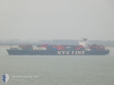
NYK RIGEL
Container Ship
Current Trip
| Time Travelled | 2 days |
|---|---|
| Remaining Time | --- |
| Distance Travelled | 1070.42 nm |
| Remaining Distance | 101.27 nm |
| AVG Speed | 16 Noeuds |
| MAX Speed | 20.7 Noeuds |
| AVG Wind | 16.9 knots |
| MAX Wind | 27.8 knots |
| MIN Temp | 23.5°C / 74.3°F |
| MAX Temp | 26.7°C / 80.06°F |
| Tirant d eau | 11.2 m |
| Position reçue | 2 d depuis |
Current Position
| Longitude | -79.69472° |
|---|---|
| Latitude | 25.84525° |
| Etat | Under way using engine |
| Vitesse | 14.9 Noeuds |
| Parcours | 140.3° |
| Zone | North Atlantic Ocean |
| Station | T-AIS |
| Position reçue | 2 d depuis |
Info
Information
The current position of NYK RIGEL is in North Atlantic Ocean with coordinates 25.84525° / -79.69472° as reported on 2025-02-10 06:16 by AIS to our vessel tracker app. The vessel's current speed is 14.9 Noeuds and is heading at the port of CARTAGENA. The estimated time of arrival as calculated by MyShipTracking vessel tracking app is 2025-02-12 15:00 LT
The vessel NYK RIGEL (IMO: 9416977, MMSI: 371449000) is a Container Ship that was built in 2009 ( 16 Age ). It's sailing under the flag of [PA] Panama.
In this page you can find informations about the vessels current position, last detected port calls, and current voyage information. If the vessels is not in coverage by AIS you will find the latest position.
The current position of NYK RIGEL is detected by our AIS receivers and we are not responsible for the reliability of the data. The last position was recorded while the vessel was in Coverage by the Ais receivers of our vessel tracking app.
The current draught of NYK RIGEL as reported by AIS is 11.2 meters
Weather
| Temperature | 26.1°C / 78.98°F |
|---|---|
| Wind Speed | 24 knots |
| Direction | 69° ENE |
| Pressure | 1008.7 hPa |
| Humidity | 78 % |
| Cloud Coverage | 100 % |
Featured Company
Last Port Calls
| Port | Arrival | Departure | Time In Port |
|---|---|---|---|
| 2025-02-09 23:09 | 2025-02-09 23:16 | 6 m | |
| 2025-02-09 03:50 | 2025-02-09 22:58 | 19 h | |
| 2025-02-09 03:18 | 2025-02-09 03:33 | 14 m | |
| 2025-01-24 21:39 | 2025-01-25 17:34 | 19 h | |
| 2025-01-21 17:14 | 2025-01-22 18:12 | 1 d | |
| 2025-01-18 20:06 | 2025-01-20 20:05 | 1 d | |
| 2025-01-07 20:35 | 2025-01-08 20:06 | 23 h | |
| 2025-01-06 17:10 | 2025-01-07 08:24 | 15 h | |
| 2024-12-29 15:32 | 2024-12-30 03:03 | 11 h | |
| 2024-12-24 05:31 | 2024-12-25 16:47 | 1 d |
Most Visited Ports (Last year)
| Port | Arrivals | |
|---|---|---|
| 8 | ||
| 7 | ||
| 6 | ||
| 5 | ||
| 5 | ||
| 5 |
Last Trips
| Origin | Departure | Destination | Arrival | Distance | |
|---|---|---|---|---|---|
| 2025-02-09 22:58 | 2025-02-09 23:09 | 0.51 nm | |||
| 2025-02-09 03:33 | 2025-02-09 03:50 | 0.67 nm | |||
| 2025-01-25 17:34 | 2025-02-09 03:18 | 4686.18 nm | |||
| 2025-01-22 18:12 | 2025-01-24 21:39 | 448.41 nm | |||
| 2025-01-20 20:05 | 2025-01-21 17:14 | 301.81 nm | |||
| 2025-01-08 20:06 | 2025-01-18 20:06 | 265.19 nm | |||
| 2025-01-07 08:24 | 2025-01-07 20:35 | 111.10 nm | |||
| 2024-12-30 03:03 | 2025-01-06 17:10 | 2632.74 nm | |||
| 2024-12-25 16:47 | 2024-12-29 15:32 | 1705.06 nm | |||
| 2024-12-13 21:15 | 2024-12-24 05:31 | 999.33 nm |
Events
| Heure | Evenement | Détails | Position/ Destination | Info |
|---|---|---|---|---|
| 2025-02-10 06:16 | Etat Changé | Default Under way using engine |
25.84396 / -79.69355
CO CTG
|
Vitesse: 14.9 kn Parcours: 140.3° |
| 2025-02-10 06:16 | Hors de la zone couverte |
25.84525 / -79.69472
North Atlantic Ocean
CO CTG
|
Vitesse: 14.9 kn Parcours: 140.3° |
|
| 2025-02-10 06:16 | Changement de zone | Bahamas part of the North Atlantic Ocean United States part of the North Atlantic Ocean |
25.84525 / -79.69472
North Atlantic Ocean
CO CTG
|
Vitesse: 14.9 kn Parcours: 140.3° |
| 2025-02-10 06:15 | Etat Changé | Under way using engine Default |
25.84871 / -79.69794
CO CTG
|
Vitesse: 15.2 kn Parcours: 132° |
| 2025-02-10 05:50 | Etat Changé | Default Under way using engine |
25.91886 / -79.78146
CO CTG
|
Vitesse: 15.3 kn Parcours: 126.3° |
| 2025-02-10 04:16 | PORT DE DEPART |
|
26.09363 / -80.10887
CO CTG
|
Vitesse: 7.5 kn Parcours: 89° |
| 2025-02-10 04:12 | Démarrage |
26.09346 / -80.11573
[US] PORT EVERGLADES
|
Vitesse: 4 kn Parcours: 88° |
|
| 2025-02-10 04:09 | Arret |
26.09337 / -80.11804
[US] PORT EVERGLADES
|
Vitesse: Parcours: 94° |
|
| 2025-02-10 04:09 | Port d'arrivée |
|
26.09337 / -80.11804
[US] PORT EVERGLADES
|
Vitesse: 1 kn Parcours: 96° |
| 2025-02-10 03:58 | PORT DE DEPART |
|
26.08692 / -80.11402
CO CTG
|
Vitesse: 3 kn Parcours: 173° |