
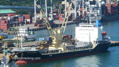
OCEAN HARMONY
Cargo
Current Trip
| Time Travelled | 19 days |
|---|---|
| Remaining Time | --- |
| Distance Travelled | 2398.29 nm |
| Remaining Distance | --- |
| AVG Speed | 9.8 Noeuds |
| MAX Speed | 15 Noeuds |
| AVG Wind | 15.2 knots |
| MAX Wind | 31 knots |
| MIN Temp | 0.9°C / 33.62°F |
| MAX Temp | 19.7°C / 67.46°F |
| Tirant d eau | 5.9 m |
| Position reçue | 25 d depuis |
Current Position
| Longitude | 140.75961° |
|---|---|
| Latitude | 36.10743° |
| Etat | Under way using engine |
| Vitesse | 11.2 Noeuds |
| Parcours | 1.5° |
| Zone | North Pacific Ocean |
| Station | T-AIS |
| Position reçue | 25 d depuis |
Info
Information
The current position of OCEAN HARMONY is in North Pacific Ocean with coordinates 36.10743° / 140.75961° as reported on 2025-12-09 22:23 by AIS to our vessel tracker app. The vessel's current speed is 11.2 Noeuds and is heading at the port of KASHIMA.
The vessel OCEAN HARMONY (IMO: 9800752, MMSI: 353898000) is a Cargo It's sailing under the flag of [PA] Panama.
In this page you can find informations about the vessels current position, last detected port calls, and current voyage information. If the vessels is not in coverage by AIS you will find the latest position.
The current position of OCEAN HARMONY is detected by our AIS receivers and we are not responsible for the reliability of the data. The last position was recorded while the vessel was in Coverage by the Ais receivers of our vessel tracking app.
The current draught of OCEAN HARMONY as reported by AIS is 5.9 meters
Weather
| Temperature | 17.2°C / 62.96°F |
|---|---|
| Wind Speed | 11 knots |
| Direction | 283° WNW |
| Pressure | 1021.3 hPa |
| Humidity | 59.4 % |
| Cloud Coverage | 22 % |
Featured Company
Last Port Calls
| Port | Arrival | Departure | Time In Port |
|---|---|---|---|
| 2025-12-13 06:33 | 2025-12-16 09:39 | 3 d | |
| 2025-12-09 10:09 | 2025-12-10 06:21 | 20 h | |
| 2025-12-04 07:52 | 2025-12-05 06:05 | 22 h | |
| 2025-11-19 17:12 | 2025-11-22 07:35 | 2 d | |
| 2025-11-08 07:48 | 2025-11-09 04:00 | 20 h | |
| 2025-11-01 13:45 |
Last Trips
| Origin | Departure | Destination | Arrival | Distance | |
|---|---|---|---|---|---|
| 2025-12-10 06:21 | 2025-12-13 06:33 | 421.28 nm | |||
| 2025-12-05 06:05 | 2025-12-09 10:09 | 164.66 nm | |||
| 2025-11-22 07:35 | 2025-12-04 07:52 | 1725.50 nm | |||
| 2025-11-09 04:00 | 2025-11-19 17:12 | 1455.73 nm | |||
| 2025-11-01 13:45 | 2025-11-08 07:48 | 639.69 nm |
Events
| Heure | Evenement | Détails | Position/ Destination | Info |
|---|---|---|---|---|
| 2025-12-30 03:31 | Démarrage | 1.51 nm, South West of FUNATOZU |
33.39590 / 129.70297
JP KSM
|
Vitesse: 10 kn Parcours: 0° |
| 2025-12-28 04:38 | Arret | 1.9 nm, West of TSUKINOKAWA |
33.36052 / 129.68631
JP KSM
|
Vitesse: 0.2 kn Parcours: 178° |
| 2025-12-27 22:53 | Démarrage |
33.56113 / 129.03978
JP KSM
|
Vitesse: 10.7 kn Parcours: 92° |
|
| 2025-12-27 12:28 | Arret |
33.62067 / 129.02736
JP KSM
|
Vitesse: 0.2 kn Parcours: 249° |