
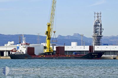
OGUZ SOFUOGLU
General Cargo
Current Trip
| Time Travelled | 23 h, 51 mins |
|---|---|
| Remaining Time | 14 h, 47 mins |
| Distance Travelled | 206.76 nm |
| Remaining Distance | 146.93 nm |
| AVG Speed | 8.3 Noeuds |
| MAX Speed | 10.4 Noeuds |
| AVG Wind | 16.7 knots |
| MAX Wind | 30 knots |
| MIN Temp | 11.5°C / 52.7°F |
| MAX Temp | 15.7°C / 60.26°F |
| Tirant d eau | 5.2 m |
| Position reçue | Maintenant |
Current Position
| Longitude | 12.07723° |
|---|---|
| Latitude | 41.55068° |
| Etat | Under way using engine |
| Vitesse | 9.5 Noeuds |
| Parcours | 126° |
| Zone | Tyrrhenian Sea |
| Station | T-AIS |
| Position reçue | Maintenant |
Info
Information
The current position of OGUZ SOFUOGLU is in Tyrrhenian Sea with coordinates 41.55068° / 12.07723° as reported on 2025-03-14 23:32 by AIS to our vessel tracker app. The vessel's current speed is 9.5 Noeuds and is heading at the port of SALERNO. The estimated time of arrival as calculated by MyShipTracking vessel tracking app is 2025-03-15 15:20 LT
The vessel OGUZ SOFUOGLU (IMO: 9424259, MMSI: 355861000) is a General Cargo that was built in 2008 ( 17 Age ). It's sailing under the flag of [PA] Panama.
In this page you can find informations about the vessels current position, last detected port calls, and current voyage information. If the vessels is not in coverage by AIS you will find the latest position.
The current position of OGUZ SOFUOGLU is detected by our AIS receivers and we are not responsible for the reliability of the data. The last position was recorded while the vessel was in Coverage by the Ais receivers of our vessel tracking app.
The current draught of OGUZ SOFUOGLU as reported by AIS is 5.2 meters
Weather
| Temperature | 15.7°C / 60.26°F |
|---|---|
| Wind Speed | 8 knots |
| Direction | 14° NNE |
| Pressure | 1004.6 hPa |
| Humidity | 76.1 % |
| Cloud Coverage | 100 % |
Featured Company
Last Port Calls
| Port | Arrival | Departure | Time In Port |
|---|---|---|---|
| 2025-03-12 12:06 | 2025-03-14 00:42 | 1 d | |
| 2025-02-28 11:31 | 2025-03-03 22:51 | 3 d | |
| 2025-02-21 14:51 | 2025-02-22 17:07 | 1 d | |
| 2025-02-15 19:45 | 2025-02-16 00:26 | 4 h | |
| 2025-02-13 20:55 | 2025-02-14 17:34 | 20 h | |
| 2025-02-06 08:03 | 2025-02-09 17:35 | 3 d | |
| 2025-01-30 11:45 | 2025-02-04 21:49 | 5 d | |
| 2025-01-27 07:22 | 2025-01-29 13:19 | 2 d | |
| 2025-01-20 19:58 | 2025-01-24 00:37 | 3 d | |
| 2025-01-02 10:12 | 2025-01-04 00:39 | 1 d |
Last Trips
| Origin | Departure | Destination | Arrival | Distance | |
|---|---|---|---|---|---|
| 2025-03-03 22:51 | 2025-03-12 12:06 | 1690.36 nm | |||
| 2025-02-22 17:07 | 2025-02-28 11:31 | 805.87 nm | |||
| 2025-02-16 00:26 | 2025-02-21 14:51 | 1313.59 nm | |||
| 2025-02-14 17:34 | 2025-02-15 19:45 | 259.06 nm | |||
| 2025-02-09 17:35 | 2025-02-13 20:55 | 843.96 nm | |||
| 2025-02-04 21:49 | 2025-02-06 08:03 | 338.90 nm | |||
| 2025-01-29 13:19 | 2025-01-30 11:45 | 24.97 nm | |||
| 2025-01-24 00:37 | 2025-01-27 07:22 | 641.69 nm | |||
| 2025-01-04 00:39 | 2025-01-20 19:58 | 362.72 nm | |||
| 2024-12-20 14:39 | 2025-01-02 10:12 | 1639.42 nm |
Events
| Heure | Evenement | Détails | Position/ Destination | Info |
|---|---|---|---|---|
| 2025-03-14 22:51 | Tirant d'eau modifié | 5.2 6.7 |
41.61823 / 11.95790
ITSAL
|
Vitesse: 9.8 kn Parcours: 127° |
| 2025-03-14 22:51 | Changement de destination | ITSAL ITMDC |
41.61823 / 11.95790
ITSAL
|
Vitesse: 9.8 kn Parcours: 127° |
| 2025-03-14 22:51 | Changement d'ETA | 2025/03/15 12:00 2025/03/11 00:00 |
41.61823 / 11.95790
ITSAL
|
Vitesse: 9.8 kn Parcours: 127° |
| 2025-03-14 21:54 | Dans la zone couverte |
41.71665 / 11.79515
Tyrrhenian Sea
|
Vitesse: 9.7 kn Parcours: 128° |
|
| 2025-03-14 15:07 | Etat Changé | Default Under way using engine |
42.34820 / 10.55795
ITMDC
|
Vitesse: 10 kn Parcours: 126° |
| 2025-03-14 15:07 | Hors de la zone couverte |
42.34855 / 10.55738
Tyrrhenian Sea
|
Vitesse: 10 kn Parcours: 126° |
|
| 2025-03-14 14:53 | Etat Changé | Under way using engine Default |
42.37177 / 10.51690
ITMDC
|
Vitesse: 9.7 kn Parcours: 136° |
| 2025-03-14 14:22 | Etat Changé | Default Under way using engine |
42.42748 / 10.43665
ITMDC
|
Vitesse: 9.3 kn Parcours: 135° |
| 2025-03-14 14:03 | Etat Changé | Under way using engine Default |
42.46187 / 10.39090
ITMDC
|
Vitesse: 9 kn Parcours: 135° |
| 2025-03-14 13:48 | Etat Changé | Default Under way using engine |
42.48945 / 10.35400
ITMDC
|
Vitesse: 9.1 kn Parcours: 136° |