
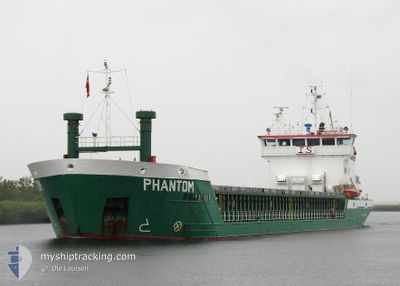
PHANTOM
General Cargo
Current Trip
| Time Travelled | 7 h, 1 mins |
|---|---|
| Remaining Time | --- |
| Distance Travelled | 39.79 nm |
| Remaining Distance | --- |
| AVG Speed | 8.1 Noeuds |
| MAX Speed | 13.1 Noeuds |
| AVG Wind | 6.4 knots |
| MAX Wind | 8.3 knots |
| MIN Temp | 1.4°C / 34.52°F |
| MAX Temp | 5°C / 41°F |
| Tirant d eau | 4.7 m |
| Position reçue | 2 h, 20 m depuis |
Current Position
| Longitude | 8.21198° |
|---|---|
| Latitude | 54.02056° |
| Etat | Under way using engine |
| Vitesse | 11 Noeuds |
| Parcours | 271° |
| Zone | North Sea |
| Station | T-AIS |
| Position reçue | 2 h, 20 m depuis |
Info
Information
The current position of PHANTOM is in North Sea with coordinates 54.02056° / 8.21198° as reported on 2025-02-01 04:26 by AIS to our vessel tracker app. The vessel's current speed is 11 Noeuds and is heading at the port of KAMSAR. The estimated time of arrival as calculated by MyShipTracking vessel tracking app is 2025-02-14 08:00 LT
The vessel PHANTOM (IMO: 9226712, MMSI: 305980000) is a General Cargo that was built in 2000 ( 25 Age ). It's sailing under the flag of [AG] Antigua Barbuda.
In this page you can find informations about the vessels current position, last detected port calls, and current voyage information. If the vessels is not in coverage by AIS you will find the latest position.
The current position of PHANTOM is detected by our AIS receivers and we are not responsible for the reliability of the data. The last position was recorded while the vessel was in Coverage by the Ais receivers of our vessel tracking app.
The current draught of PHANTOM as reported by AIS is 4.7 meters
Weather
| Temperature | 5°C / 41°F |
|---|---|
| Wind Speed | 8 knots |
| Direction | 235° SW |
| Pressure | 1031.5 hPa |
| Humidity | 87.6 % |
| Cloud Coverage | 57 % |
Featured Company
Last Port Calls
| Port | Arrival | Departure | Time In Port |
|---|---|---|---|
| 2025-01-31 19:51 | 2025-01-31 23:46 | 3 h | |
| 2025-01-29 10:17 | 2025-01-29 10:53 | 36 m | |
| 2025-01-25 22:45 | 2025-01-28 11:33 | 2 d | |
| 2025-01-25 15:37 | 2025-01-25 15:58 | 21 m | |
| 2025-01-20 05:39 | 2025-01-20 18:23 | 12 h | |
| 2025-01-14 18:17 | 2025-01-16 19:37 | 2 d | |
| 2024-12-29 13:09 | 2025-01-02 13:19 | 4 d | |
| 2024-12-16 09:11 | 2024-12-23 09:02 | 6 d | |
| 2024-12-12 07:10 | 2024-12-13 10:02 | 1 d | |
| 2024-12-09 13:22 | 2024-12-11 16:18 | 2 d |
Most Visited Ports (Last year)
| Port | Arrivals | |
|---|---|---|
| 4 | ||
| 3 | ||
| 2 | ||
| 2 | ||
| 2 | ||
| 2 |
Last Trips
| Origin | Departure | Destination | Arrival | Distance | |
|---|---|---|---|---|---|
| 2025-01-29 11:53 | 2025-01-31 20:51 | 507.97 nm | |||
| 2025-01-28 12:33 | 2025-01-29 11:17 | 67.00 nm | |||
| 2025-01-25 16:58 | 2025-01-25 23:45 | 65.77 nm | |||
| 2025-01-20 18:23 | 2025-01-25 16:37 | 1005.80 nm | |||
| 2025-01-16 19:37 | 2025-01-20 05:39 | 273.75 nm | |||
| 2025-01-02 15:19 | 2025-01-14 18:17 | 834.40 nm | |||
| 2024-12-23 11:02 | 2024-12-29 15:09 | 326.11 nm | |||
| 2024-12-13 11:02 | 2024-12-16 11:11 | 537.86 nm | |||
| 2024-12-11 17:18 | 2024-12-12 08:10 | 126.02 nm | |||
| 2024-12-02 14:02 | 2024-12-09 14:22 | 1215.19 nm |
Events
| Heure | Evenement | Détails | Position/ Destination | Info |
|---|---|---|---|---|
| 2025-02-01 04:31 | Etat Changé | Default Under way using engine |
54.02101 / 8.18587
KAMSAR
|
Vitesse: 11 kn Parcours: 271° |
| 2025-02-01 04:26 | Hors de la zone couverte |
54.02056 / 8.21198
North Sea
KAMSAR
|
Vitesse: 11 kn Parcours: 271° |
|
| 2025-02-01 04:20 | Etat Changé | Under way using engine Default |
54.01992 / 8.24347
KAMSAR
|
Vitesse: 12.5 kn Parcours: 286° |
| 2025-02-01 04:01 | Etat Changé | Default Under way using engine |
54.00115 / 8.35068
KAMSAR
|
Vitesse: 12.9 kn Parcours: 288.2° |
| 2025-02-01 03:54 | Etat Changé | Under way using engine Default |
53.99290 / 8.39272
KAMSAR
|
Vitesse: 13.1 kn Parcours: 287° |
| 2025-02-01 03:41 | Etat Changé | Default Under way using engine |
53.98073 / 8.46470
KAMSAR
|
Vitesse: 12.4 kn Parcours: 282.6° |
| 2025-02-01 00:21 | Démarrage | 0.91 nm, South West of BRUNSBUETTEL |
53.89038 / 9.14557
KAMSAR
|
Vitesse: 3.1 kn Parcours: 224° |
| 2025-02-01 00:01 | Arret | 0.76 nm, South West of BRUNSBUETTEL |
53.89232 / 9.14832
KAMSAR
|
Vitesse: 0.3 kn Parcours: 220° |
| 2025-01-31 23:59 | Detecté en mer | German part of the North Sea |
53.89302 / 9.14932
North Sea
KAMSAR
|
Vitesse: 2 kn Parcours: 214.3° |
| 2025-01-31 23:46 | PORT DE DEPART |
|
53.90632 / 9.16785
KAMSAR
|
Vitesse: 7.4 kn Parcours: 230° |