

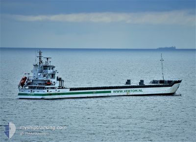
PROMISE
General Cargo

Current Trip
| Time Travelled | 4 days |
|---|---|
| Remaining Time | 4 days |
| Distance Travelled | 926.72 nm |
| Remaining Distance | 938.78 nm |
| AVG Speed | 8.4 Noeuds |
| MAX Speed | 11.9 Noeuds |
| AVG Wind | 13.4 knots |
| MAX Wind | 28 knots |
| MIN Temp | 12.1°C / 53.78°F |
| MAX Temp | 17.9°C / 64.22°F |
| Tirant d eau | 6.4 m |
| Position reçue | 8 h, 12 m depuis |
Current Position
| Longitude | -10.01260° |
|---|---|
| Latitude | 43.36500° |
| Etat | Under way using engine |
| Vitesse | 9.7 Noeuds |
| Parcours | 210.9° |
| Zone | North Atlantic Ocean |
| Station | T-AIS |
| Position reçue | 8 h, 12 m depuis |
Information
The current position of PROMISE is in North Atlantic Ocean with coordinates 43.36500° / -10.01260° as reported on 2025-05-31 21:32 by AIS to our vessel tracker app. The vessel's current speed is 9.7 Noeuds and is heading at the port of SAGUNTO. The estimated time of arrival as calculated by MyShipTracking vessel tracking app is 2025-06-05 09:00 LT
The vessel PROMISE (IMO: 9371816, MMSI: 245959000) is a General Cargo that was built in 2008 ( 17 Age ). It's sailing under the flag of [NL] Netherlands.
In this page you can find informations about the vessels current position, last detected port calls, and current voyage information. If the vessels is not in coverage by AIS you will find the latest position.
The current position of PROMISE is detected by our AIS receivers and we are not responsible for the reliability of the data. The last position was recorded while the vessel was in Coverage by the Ais receivers of our vessel tracking app.
The current draught of PROMISE as reported by AIS is 6.4 meters
Weather
| Temperature | 16.9°C / 62.42°F |
|---|---|
| Wind Speed | 19 knots |
| Direction | 353° N |
| Pressure | 1019.5 hPa |
| Humidity | 87.4 % |
| Cloud Coverage | 100 % |


Featured Company
Last Port Calls
| Port | Arrival | Departure | Time In Port |
|---|---|---|---|
| 2025-05-26 15:47 | 2025-05-28 01:15 | 1 d | |
| 2025-05-26 13:51 | 2025-05-26 15:02 | 1 h | |
| 2025-05-15 17:12 | 2025-05-20 13:45 | 4 d | |
| 2025-05-05 13:56 | 2025-05-09 06:31 | 3 d | |
| 2025-04-29 22:35 | 2025-05-02 21:17 | 2 d | |
| 2025-04-22 23:15 | 2025-04-26 01:22 | 3 d | |
| 2025-04-13 05:21 | 2025-04-15 10:30 | 2 d | |
| 2025-04-10 09:10 | 2025-04-10 22:24 | 13 h | |
| 2025-04-01 17:31 |
Last Trips
| Origin | Departure | Destination | Arrival | Distance | |
|---|---|---|---|---|---|
| 2025-05-26 15:02 | 2025-05-26 15:47 | 7.26 nm | |||
| 2025-05-20 13:45 | 2025-05-26 13:51 | 383.25 nm | |||
| 2025-05-09 06:31 | 2025-05-15 17:12 | 1394.31 nm | |||
| 2025-05-02 21:17 | 2025-05-05 13:56 | 618.85 nm | |||
| 2025-04-26 01:22 | 2025-04-29 22:35 | 771.79 nm | |||
| 2025-04-15 10:30 | 2025-04-22 23:15 | 1373.09 nm | |||
| 2025-04-10 22:24 | 2025-04-13 05:21 | 549.46 nm | |||
| 2025-04-01 17:31 | 2025-04-10 09:10 | 1873.63 nm |
Events
| Heure | Evenement | Détails | Position/ Destination | Info |
|---|---|---|---|---|
| 2025-05-31 21:37 | Etat Changé | Default Under way using engine |
43.35560 / -10.01963
ESSAG
|
Vitesse: 9.7 kn Parcours: 210.9° |
| 2025-05-31 21:32 | Detecté en mer | Spanish part of the North Atlantic Ocean |
43.36500 / -10.01260
North Atlantic Ocean
ESSAG
|
Vitesse: 9.7 kn Parcours: 210.9° |
| 2025-05-31 21:32 | Etat Changé | Under way using engine Default |
43.36500 / -10.01260
ESSAG
|
Vitesse: 9.8 kn Parcours: 208° |
| 2025-05-31 21:32 | Dans la zone couverte |
43.36500 / -10.01260
North Atlantic Ocean
ESSAG
|
Vitesse: 9.7 kn Parcours: 210.9° |
|
| 2025-05-31 21:32 | Hors de la zone couverte |
43.36500 / -10.01260
North Atlantic Ocean
ESSAG
|
Vitesse: 9.7 kn Parcours: 210.9° |
|
| 2025-05-30 22:40 | Etat Changé | Default Under way using engine |
46.52082 / -7.61458
ESSAG
|
Vitesse: 9.5 kn Parcours: 208.8° |
| 2025-05-30 22:37 | Etat Changé | Under way using engine Default |
46.52825 / -7.60863
ESSAG
|
Vitesse: 10 kn Parcours: 211° |
| 2025-05-30 22:37 | Hors de la zone couverte |
46.52825 / -7.60863
North Atlantic Ocean
ESSAG
|
Vitesse: 9.5 kn Parcours: 208.8° |
|
| 2025-05-30 22:19 | Etat Changé | Default Under way using engine |
46.57337 / -7.57203
ESSAG
|
Vitesse: 9.8 kn Parcours: 209.6° |
| 2025-05-30 22:15 | Changement de zone | French part of the North Atlantic Ocean French part of the Celtic Sea |
46.58212 / -7.56485
North Atlantic Ocean
ESSAG
|
Vitesse: 9.8 kn Parcours: 209.6° |