

PROMISE
General Cargo

Current Trip
| Time Travelled | 4 days |
|---|---|
| Remaining Time | --- |
| Distance Travelled | 366.72 nm |
| Remaining Distance | 21.16 nm |
| AVG Speed | 9.8 Knots |
| MAX Speed | 12.7 Knots |
| AVG Wind | 11.2 knots |
| MAX Wind | 20.9 knots |
| MIN Temp | 4.8°C / 40.64°F |
| MAX Temp | 18.3°C / 64.94°F |
| Draught | 3.6 m |
| Position Received | 1 m ago |
Current Position
| Longitude | 4.32977° |
|---|---|
| Latitude | 52.52121° |
| Status | At anchor |
| Speed | 0.6 Knots |
| Course | 243° |
| Area | North Sea |
| Station | T-AIS |
| Position Received | 1 m ago |
Information
The current position of PROMISE is in North Sea with coordinates 52.52121° / 4.32977° as reported on 2025-05-24 22:19 by AIS to our vessel tracker app. The vessel's current speed is 0.6 Knots and is heading at the port of AMSTERDAM. The estimated time of arrival as calculated by MyShipTracking vessel tracking app is 2025-05-23 22:00 LT
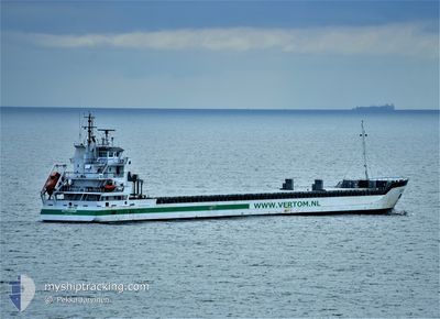
The vessel PROMISE (IMO: 9371816, MMSI: 245959000) is a General Cargo that was built in 2008 ( 17 years old ). It's sailing under the flag of [NL] Netherlands.
In this page you can find informations about the vessels current position, last detected port calls, and current voyage information. If the vessels is not in coverage by AIS you will find the latest position.
The current position of PROMISE is detected by our AIS receivers and we are not responsible for the reliability of the data. The last position was recorded while the vessel was in Coverage by the Ais receivers of our vessel tracking app.
The current draught of PROMISE as reported by AIS is 3.6 meters
Weather
| Temperature | 14°C / 57.2°F |
|---|---|
| Wind Speed | 19 knots |
| Direction | 227° SW |
| Pressure | 1008.3 hPa |
| Humidity | 92.5 % |
| Cloud Coverage | 100 % |


Featured Company
Last Port Calls
| Port | Arrival | Departure | Time In Port |
|---|---|---|---|
| 2025-05-15 17:12 | 2025-05-20 13:45 | 4 d | |
| 2025-05-05 13:56 | 2025-05-09 06:31 | 3 d | |
| 2025-04-29 22:35 | 2025-05-02 21:17 | 2 d | |
| 2025-04-22 23:15 | 2025-04-26 01:22 | 3 d | |
| 2025-04-13 05:21 | 2025-04-15 10:30 | 2 d | |
| 2025-04-10 09:10 | 2025-04-10 22:24 | 13 h | |
| 2025-03-30 09:03 | 2025-04-01 17:31 | 2 d | |
| 2025-03-21 18:34 | 2025-03-24 16:35 | 2 d | |
| 2025-03-19 08:14 | 2025-03-20 02:51 | 18 h | |
| 2025-03-12 12:04 | 2025-03-12 18:17 | 6 h |
Last Trips
| Origin | Departure | Destination | Arrival | Distance | |
|---|---|---|---|---|---|
| 2025-05-09 06:31 | 2025-05-15 17:12 | 1394.31 nm | |||
| 2025-05-02 21:17 | 2025-05-05 13:56 | 618.85 nm | |||
| 2025-04-26 01:22 | 2025-04-29 22:35 | 771.79 nm | |||
| 2025-04-15 10:30 | 2025-04-22 23:15 | 1373.09 nm | |||
| 2025-04-10 22:24 | 2025-04-13 05:21 | 549.46 nm | |||
| 2025-04-01 17:31 | 2025-04-10 09:10 | 1873.63 nm | |||
| 2025-03-24 16:35 | 2025-03-30 09:03 | 786.73 nm | |||
| 2025-03-20 02:51 | 2025-03-21 18:34 | 396.69 nm | |||
| 2025-03-12 18:17 | 2025-03-19 08:14 | 1414.23 nm | |||
| 2025-03-03 16:05 | 2025-03-12 12:04 | 2046.54 nm |
Events
| Time | Event | Details | Position / Dest | Info |
|---|---|---|---|---|
| 2025-05-24 21:52 | Status Changed | At anchor Default |
52.52129 / 4.32982
NLAMS
|
Speed: 0.3 kn Course: 210° |
| 2025-05-24 21:49 | Status Changed | Default At anchor |
52.52152 / 4.32956
NLAMS
|
Speed: 0.4 kn Course: 228° |
| 2025-05-24 14:28 | Status Changed | At anchor Default |
52.52147 / 4.32956
NLAMS
|
Speed: 0.2 kn Course: 204° |
| 2025-05-24 14:25 | Status Changed | Default At anchor |
52.52159 / 4.32927
NLAMS
|
Speed: 0.4 kn Course: 221° |
| 2025-05-23 17:55 | STOP Moving | 10.01 nm, West of IJMUIDEN |
52.51756 / 4.32774
NLAMS
|
Speed: 0.2 kn Course: 349° |
| 2025-05-23 17:49 | Status Changed | At anchor Under way using engine |
52.51782 / 4.32716
NLAMS
|
Speed: 1.2 kn Course: 20° |
| 2025-05-23 16:39 | Detected in Sea | Dutch part of the North Sea |
52.62705 / 4.08809
North Sea
NLAMS
|
Speed: 11.9 kn Course: 140.8° |
| 2025-05-23 16:39 | Status Changed | Under way using engine Default |
52.62705 / 4.08809
NLAMS
|
Speed: 11.8 kn Course: 141° |
| 2025-05-23 16:39 | IN Coverage |
52.62705 / 4.08809
North Sea
NLAMS
|
Speed: 11.9 kn Course: 140.8° |
|
| 2025-05-22 18:14 | OUT of Coverage |
55.41576 / -1.18801
North Sea
NLAMS
|
Speed: 10.2 kn Course: 138.9° |