
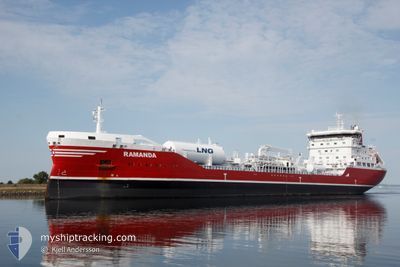
RAMANDA
Tanker
Current Trip
| Trip Time | 2 days |
|---|---|
| Trip Distance | 831.66 nm |
| AVG Speed | 12.6 Noeuds |
| MAX Speed | 17.4 Noeuds |
| Tirant d eau | 8.3 m |
| AVG Wind | 15.7 knots |
| MAX Wind | 23 knots |
| MIN Temp | 1.9°C / 35.42°F |
| MAX Temp | 8.8°C / 47.84°F |
| Position reçue | 20 h, 26 m depuis |
Current Position
| Longitude | -6.92639° |
|---|---|
| Latitude | 55.21630° |
| Etat | Under way using engine |
| Vitesse | 12.7 Noeuds |
| Parcours | 220° |
| Zone | Inner Seas off the West Coast of Scotland |
| Station | T-AIS |
| Position reçue | 20 h, 26 m depuis |
Info
Information
The current position of RAMANDA is in Inner Seas off the West Coast of Scotland with coordinates 55.21630° / -6.92639° as reported on 2025-03-17 19:16 by AIS to our vessel tracker app. The vessel's current speed is 12.7 Noeuds and is currently inside the port of LONDONDERRY.
The vessel RAMANDA (IMO: 9739812, MMSI: 266457000) is a Tanker It's sailing under the flag of [SE] Sweden.
In this page you can find informations about the vessels current position, last detected port calls, and current voyage information. If the vessels is not in coverage by AIS you will find the latest position.
The current position of RAMANDA is detected by our AIS receivers and we are not responsible for the reliability of the data. The last position was recorded while the vessel was in Coverage by the Ais receivers of our vessel tracking app.
The current draught of RAMANDA as reported by AIS is 8.3 meters
Weather
| Temperature | 9°C / 48.2°F |
|---|---|
| Wind Speed | 11 knots |
| Direction | 128° SE |
| Pressure | 1021.3 hPa |
| Humidity | 57.7 % |
| Cloud Coverage | 32 % |
Featured Company
Last Port Calls
| Port | Arrival | Departure | Time In Port |
|---|---|---|---|
| 2025-03-17 21:15 | |||
| 2025-03-14 02:15 | 2025-03-15 06:34 | 1 d | |
| 2025-03-09 13:16 | 2025-03-11 14:11 | 2 d | |
| 2025-02-23 05:45 | 2025-02-24 03:17 | 21 h | |
| 2025-02-19 16:35 | 2025-02-21 15:12 | 1 d | |
| 2025-02-01 08:41 | 2025-02-02 17:43 | 1 d | |
| 2025-01-30 01:02 | 2025-01-31 02:52 | 1 d | |
| 2025-01-27 06:37 | 2025-01-28 07:40 | 1 d | |
| 2025-01-15 07:55 | 2025-01-18 21:07 | 3 d | |
| 2025-01-08 15:13 | 2025-01-10 13:29 | 1 d |
Last Trips
| Origin | Departure | Destination | Arrival | Distance | |
|---|---|---|---|---|---|
| 2025-03-15 06:34 | 2025-03-17 21:15 | 831.66 nm | |||
| 2025-03-11 14:11 | 2025-03-14 02:15 | 112.04 nm | |||
| 2025-02-24 03:17 | 2025-03-09 13:16 | 549.18 nm | |||
| 2025-02-21 15:12 | 2025-02-23 05:45 | 536.72 nm | |||
| 2025-02-02 17:43 | 2025-02-19 16:35 | 752.71 nm | |||
| 2025-01-31 02:52 | 2025-02-01 08:41 | 288.15 nm | |||
| 2025-01-28 07:40 | 2025-01-30 01:02 | 460.54 nm | |||
| 2025-01-18 21:07 | 2025-01-27 06:37 | 967.63 nm | |||
| 2025-01-10 13:29 | 2025-01-15 07:55 | 243.79 nm | |||
| 2025-01-02 22:05 | 2025-01-08 15:13 | 1173.98 nm |
Events
| Heure | Evenement | Détails | Position/ Destination | Info |
|---|---|---|---|---|
| 2025-03-17 21:24 | Arret |
55.04772 / -7.24727
[GB] LONDONDERRY
|
Vitesse: 0.2 kn Parcours: 228° |
|
| 2025-03-17 21:15 | Port d'arrivée |
|
55.04859 / -7.24684
[GB] LONDONDERRY
|
Vitesse: 2.8 kn Parcours: 207° |
| 2025-03-17 19:24 | Etat Changé | Default Under way using engine |
55.20089 / -6.96754
GBLDY
|
Vitesse: 12.7 kn Parcours: 220° |
| 2025-03-17 19:16 | Hors de la zone couverte |
55.21630 / -6.92639
Inner Seas off the West Coast of Scotland
GBLDY
|
Vitesse: 12.7 kn Parcours: 220° |
|
| 2025-03-17 18:02 | Changement de zone | Irish part of the Inner Seas off the West Coast of Scotland United Kingdom part of the Inner Seas off the West Coast of Scotland |
55.32348 / -6.76888
Inner Seas off the West Coast of Scotland
GBLDY
|
Vitesse: 6.4 kn Parcours: 225.8° |
| 2025-03-17 14:29 | Etat Changé | Under way using engine Default |
55.20344 / -5.79356
GBLDY
|
Vitesse: 14.9 kn Parcours: 329° |
| 2025-03-17 14:28 | Etat Changé | Default Under way using engine |
55.20030 / -5.79013
GBLDY
|
Vitesse: 14.7 kn Parcours: 332.5° |
| 2025-03-17 14:20 | Etat Changé | Under way using engine Default |
55.17336 / -5.76485
GBLDY
|
Vitesse: 14.6 kn Parcours: 333° |
| 2025-03-17 14:04 | Etat Changé | Default Under way using engine |
55.11652 / -5.70693
GBLDY
|
Vitesse: 14.2 kn Parcours: 326.9° |
| 2025-03-17 14:03 | Etat Changé | Under way using engine Default |
55.11454 / -5.70465
GBLDY
|
Vitesse: 14.1 kn Parcours: 327° |