

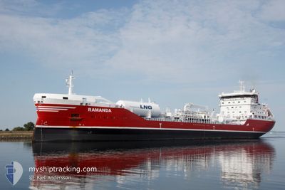
RAMANDA
Tanker

Current Trip
GBLDY
| Time Travelled | 2 h, 13 mins |
|---|---|
| Remaining Time | --- |
| Distance Travelled | 20.06 nm |
| Remaining Distance | --- |
| AVG Speed | 9.8 Knots |
| MAX Speed | 11.7 Knots |
| AVG Wind | 5.4 knots |
| MAX Wind | 9 knots |
| MIN Temp | 0.7°C / 33.26°F |
| MAX Temp | 5.5°C / 41.9°F |
| Draught | 8.3 m |
| Position Received | 9 m ago |
Current Position
| Longitude | -6.82498° |
|---|---|
| Latitude | 55.27367° |
| Status | Under way using engine |
| Speed | 11.5 Knots |
| Course | 41° |
| Area | Inner Seas off the West Coast of Scotland |
| Station | T-AIS |
| Position Received | 9 m ago |
Information
The current position of RAMANDA is in Inner Seas off the West Coast of Scotland with coordinates 55.27367° / -6.82498° as reported on 2025-03-19 09:23 by AIS to our vessel tracker app. The vessel's current speed is 11.5 Knots
The vessel RAMANDA (IMO: 9739812, MMSI: 266457000) is a Tanker It's sailing under the flag of [SE] Sweden.
In this page you can find informations about the vessels current position, last detected port calls, and current voyage information. If the vessels is not in coverage by AIS you will find the latest position.
The current position of RAMANDA is detected by our AIS receivers and we are not responsible for the reliability of the data. The last position was recorded while the vessel was in Coverage by the Ais receivers of our vessel tracking app.
The current draught of RAMANDA as reported by AIS is 8.3 meters
Weather
| Temperature | 5.4°C / 41.72°F |
|---|---|
| Wind Speed | 9 knots |
| Direction | 156° SSE |
| Pressure | 1021 hPa |
| Humidity | 78.6 % |
| Cloud Coverage | 44 % |


Featured Company
Last Port Calls
| Port | Arrival | Departure | Time In Port |
|---|---|---|---|
| 2025-03-17 21:15 | 2025-03-19 07:20 | 1 d | |
| 2025-03-14 01:15 | 2025-03-15 05:34 | 1 d | |
| 2025-03-09 12:16 | 2025-03-11 13:11 | 2 d | |
| 2025-02-23 04:45 | 2025-02-24 02:17 | 21 h | |
| 2025-02-19 15:35 | 2025-02-21 14:12 | 1 d | |
| 2025-02-01 07:41 | 2025-02-02 16:43 | 1 d | |
| 2025-01-30 00:02 | 2025-01-31 01:52 | 1 d | |
| 2025-01-27 05:37 | 2025-01-28 06:40 | 1 d | |
| 2025-01-15 07:55 | 2025-01-18 21:07 | 3 d | |
| 2025-01-08 15:13 | 2025-01-10 13:29 | 1 d |
Last Trips
| Origin | Departure | Destination | Arrival | Distance | |
|---|---|---|---|---|---|
| 2025-03-15 06:34 | 2025-03-17 21:15 | 831.66 nm | |||
| 2025-03-11 14:11 | 2025-03-14 02:15 | 112.04 nm | |||
| 2025-02-24 03:17 | 2025-03-09 13:16 | 549.18 nm | |||
| 2025-02-21 15:12 | 2025-02-23 05:45 | 536.72 nm | |||
| 2025-02-02 17:43 | 2025-02-19 16:35 | 752.71 nm | |||
| 2025-01-31 02:52 | 2025-02-01 08:41 | 288.15 nm | |||
| 2025-01-28 07:40 | 2025-01-30 01:02 | 460.54 nm | |||
| 2025-01-18 21:07 | 2025-01-27 06:37 | 967.63 nm | |||
| 2025-01-10 13:29 | 2025-01-15 07:55 | 243.79 nm | |||
| 2025-01-02 22:05 | 2025-01-08 15:13 | 1173.98 nm |
Events
| Time | Event | Details | Position / Dest | Info |
|---|---|---|---|---|
| 2025-03-19 09:24 | Status Changed | Default Under way using engine |
55.27519 / -6.82266
GBLDY
|
Speed: 11.5 kn Course: 41° |
| 2025-03-19 09:23 | Status Changed | Under way using engine Default |
55.27367 / -6.82498
GBLDY
|
Speed: 11.4 kn Course: 41° |
| 2025-03-19 09:12 | IN Coverage |
55.27367 / -6.82498
Inner Seas off the West Coast of Scotland
|
Speed: 11.5 kn Course: 41° |
|
| 2025-03-19 07:20 | PORT DEPARTURE |
|
55.05576 / -7.23918
GBLDY
|
Speed: 4.1 kn Course: 58° |
| 2025-03-19 07:12 | START Moving |
55.04562 / -7.25349
[GB] LONDONDERRY
|
Speed: 4.1 kn Course: 58° |
|
| 2025-03-17 21:24 | STOP Moving |
55.04772 / -7.24727
[GB] LONDONDERRY
|
Speed: 0.2 kn Course: 228° |
|
| 2025-03-17 21:15 | PORT ARRIVAL |
|
55.04859 / -7.24684
[GB] LONDONDERRY
|
Speed: 2.8 kn Course: 207° |
| 2025-03-17 19:24 | Status Changed | Default Under way using engine |
55.20089 / -6.96754
GBLDY
|
Speed: 12.7 kn Course: 220° |
| 2025-03-17 19:16 | OUT of Coverage |
55.21630 / -6.92639
Inner Seas off the West Coast of Scotland
GBLDY
|
Speed: 12.7 kn Course: 220° |
|
| 2025-03-17 18:02 | Change Sea Area | Irish part of the Inner Seas off the West Coast of Scotland United Kingdom part of the Inner Seas off the West Coast of Scotland |
55.32348 / -6.76888
Inner Seas off the West Coast of Scotland
GBLDY
|
Speed: 6.4 kn Course: 225.8° |