
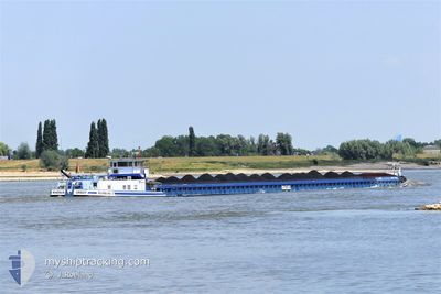
RHENUS ORSOY
Cargo
Current Trip
| Time Travelled | 2 days |
|---|---|
| Remaining Time | 14 h, 5 mins |
| Distance Travelled | 70.90 nm |
| Remaining Distance | 118.66 nm |
| AVG Speed | 5.1 Noeuds |
| MAX Speed | 6.2 Noeuds |
| AVG Wind | 5.3 knots |
| MAX Wind | 12 knots |
| MIN Temp | 1.7°C / 35.06°F |
| MAX Temp | 5.3°C / 41.54°F |
| Tirant d eau | 2.5 m |
| Position reçue | 8 h, 56 m depuis |
Current Position
| Longitude | 9.73932° |
|---|---|
| Latitude | 52.40778° |
| Etat | Under way using engine |
| Vitesse | 4.9 Noeuds |
| Parcours | 117° |
| Zone | North Sea |
| Station | T-AIS |
| Position reçue | 8 h, 56 m depuis |
Info
Information
The current position of RHENUS ORSOY is in North Sea with coordinates 52.40778° / 9.73932° as reported on 2025-02-07 06:16 by AIS to our vessel tracker app. The vessel's current speed is 4.9 Noeuds and is heading at the port of BRANDENBURG. The estimated time of arrival as calculated by MyShipTracking vessel tracking app is 2025-02-08 05:17 LT
The vessel RHENUS ORSOY (MMSI: 211183680) is a Cargo It's sailing under the flag of [DE] Germany.
In this page you can find informations about the vessels current position, last detected port calls, and current voyage information. If the vessels is not in coverage by AIS you will find the latest position.
The current position of RHENUS ORSOY is detected by our AIS receivers and we are not responsible for the reliability of the data. The last position was recorded while the vessel was in Coverage by the Ais receivers of our vessel tracking app.
The current draught of RHENUS ORSOY as reported by AIS is 2.5 meters
Weather
| Temperature | 1.6°C / 34.88°F |
|---|---|
| Wind Speed | 12 knots |
| Direction | 76° ENE |
| Pressure | 1036.8 hPa |
| Humidity | 83.2 % |
| Cloud Coverage | 84 % |
Featured Company
Last Port Calls
| Port | Arrival | Departure | Time In Port |
|---|---|---|---|
| 2025-02-05 11:33 | |||
| 2025-01-31 10:50 | 2025-02-03 06:38 | 2 d | |
| 2025-01-30 18:10 | 2025-01-31 06:30 | 12 h | |
| 2025-01-28 16:13 | 2025-01-29 05:40 | 13 h | |
| 2025-01-25 12:42 | 2025-01-25 15:53 | 3 h | |
| 2025-01-24 11:01 | 2025-01-24 12:13 | 1 h | |
| 2025-01-23 13:27 | 2025-01-23 15:12 | 1 h | |
| 2025-01-18 11:27 | |||
| 2025-01-10 08:53 | 2025-01-10 12:37 | 3 h | |
| 2025-01-08 08:07 | 2025-01-09 10:40 | 1 d |
Last Trips
| Origin | Departure | Destination | Arrival | Distance | |
|---|---|---|---|---|---|
| 2025-01-31 07:30 | 2025-01-31 11:50 | 48.23 nm | |||
| 2025-01-29 06:40 | 2025-01-30 19:10 | 139.52 nm | |||
| 2025-01-25 16:53 | 2025-01-28 17:13 | 169.15 nm | |||
| 2025-01-24 13:13 | 2025-01-25 13:42 | 43.02 nm | |||
| 2025-01-23 16:12 | 2025-01-24 12:01 | 32.45 nm | |||
| 2025-01-18 12:27 | 2025-01-23 14:27 | 171.96 nm | |||
| 2025-01-09 11:40 | 2025-01-10 09:53 | 41.43 nm | |||
| 2025-01-08 06:08 | 2025-01-08 09:07 | 4.60 nm | |||
| 2025-01-04 06:16 | 2025-01-04 19:20 | 66.70 nm | |||
| 2025-01-03 08:43 | 2025-01-03 17:50 | 62.36 nm |
Events
| Heure | Evenement | Détails | Position/ Destination | Info |
|---|---|---|---|---|
| 2025-02-07 06:16 | Hors de la zone couverte |
52.40778 / 9.73932
North Sea
|
Vitesse: 4.9 kn Parcours: 118.5° |
|
| 2025-02-07 05:43 | Dans la zone couverte |
52.42312 / 9.67657
North Sea
|
Vitesse: 4.7 kn Parcours: 85.6° |
|
| 2025-02-06 17:13 | Hors de la zone couverte |
52.40954 / 9.59602
North Sea
|
Vitesse: 5 kn Parcours: 58.2° |
|
| 2025-02-06 15:10 | Etat Changé | Under way using engine Default |
52.38809 / 9.32678
BRANDENBURG
|
Vitesse: 5 kn Parcours: 86° |
| 2025-02-06 15:09 | Etat Changé | Default Under way using engine |
52.38793 / 9.32335
BRANDENBURG
|
Vitesse: 5.1 kn Parcours: 82.3° |
| 2025-02-06 14:43 | Dans la zone couverte |
52.38232 / 9.26027
North Sea
|
Vitesse: 5.7 kn Parcours: 80.9° |
|
| 2025-02-06 12:51 | Hors de la zone couverte |
52.30608 / 9.04206
North Sea
|
Vitesse: 4.8 kn Parcours: 53.3° |
|
| 2025-02-06 11:41 | Dans la zone couverte |
52.30105 / 8.88924
North Sea
|
Vitesse: 5.2 kn Parcours: 73.6° |
|
| 2025-02-06 06:16 | Hors de la zone couverte |
52.39276 / 8.18338
North Sea
|
Vitesse: 3.6 kn Parcours: 117.8° |
|
| 2025-02-06 05:39 | Démarrage | 4.39 nm, East of BRAMSCHE |
52.41280 / 8.11363
BRANDENBURG
|
Vitesse: 3.6 kn Parcours: 93° |