

RIGHT STEP
General Cargo

Current Trip
| Time Travelled | 12 h, 2 mins |
|---|---|
| Remaining Time | --- |
| Distance Travelled | 66.55 nm |
| Remaining Distance | --- |
| AVG Speed | 7.9 Noeuds |
| MAX Speed | 8.2 Noeuds |
| AVG Wind | 7.6 knots |
| MAX Wind | 9 knots |
| MIN Temp | 15.8°C / 60.44°F |
| MAX Temp | 16.8°C / 62.24°F |
| Tirant d eau | 5.6 m |
| Position reçue | 3 h, 37 m depuis |
Current Position
| Longitude | -2.67597° |
|---|---|
| Latitude | 45.74340° |
| Etat | Under way using engine |
| Vitesse | 7.5 Noeuds |
| Parcours | 245.5° |
| Zone | Bay of Biscay |
| Station | T-AIS |
| Position reçue | 3 h, 37 m depuis |
Information
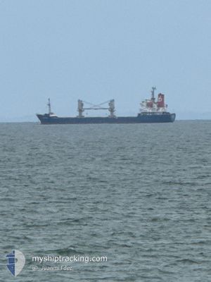
The current position of RIGHT STEP is in Bay of Biscay with coordinates 45.74340° / -2.67597° as reported on 2025-06-03 04:04 by AIS to our vessel tracker app. The vessel's current speed is 7.5 Noeuds and is heading at the port of LAS PALMAS. The estimated time of arrival as calculated by MyShipTracking vessel tracking app is 2025-06-09 13:00 LT
The vessel RIGHT STEP (IMO: 9128013, MMSI: 304816000) is a General Cargo that was built in 1996 ( 29 Age ). It's sailing under the flag of [AG] Antigua Barbuda.
In this page you can find informations about the vessels current position, last detected port calls, and current voyage information. If the vessels is not in coverage by AIS you will find the latest position.
The current position of RIGHT STEP is detected by our AIS receivers and we are not responsible for the reliability of the data. The last position was recorded while the vessel was in Coverage by the Ais receivers of our vessel tracking app.
The current draught of RIGHT STEP as reported by AIS is 5.6 meters
Weather
| Temperature | 15.8°C / 60.44°F |
|---|---|
| Wind Speed | 5 knots |
| Direction | 296° WNW |
| Pressure | 1015.5 hPa |
| Humidity | 69.4 % |
| Cloud Coverage | 41 % |


Featured Company
Last Port Calls
| Port | Arrival | Departure | Time In Port |
|---|---|---|---|
| 2025-05-30 12:12 | 2025-06-02 21:40 | 3 d | |
| 2025-05-26 05:25 | 2025-05-29 07:13 | 3 d | |
| 2025-05-04 16:06 | 2025-05-07 21:23 | 3 d | |
| 2025-04-30 12:11 | 2025-05-03 19:32 | 3 d | |
| 2025-04-28 12:42 | 2025-04-29 19:46 | 1 d | |
| 2025-04-24 18:39 | 2025-04-25 19:43 | 1 d | |
| 2025-04-13 19:14 | 2025-04-16 20:49 | 3 d | |
| 2025-04-07 21:45 | 2025-04-09 22:58 | 2 d |
Last Trips
| Origin | Departure | Destination | Arrival | Distance | |
|---|---|---|---|---|---|
| 2025-05-29 07:13 | 2025-05-30 12:12 | 44.80 nm | |||
| 2025-05-07 21:23 | 2025-05-26 05:25 | 2995.54 nm | |||
| 2025-05-03 19:32 | 2025-05-04 16:06 | 24.18 nm | |||
| 2025-04-29 19:46 | 2025-04-30 12:11 | 120.41 nm | |||
| 2025-04-25 19:43 | 2025-04-28 12:42 | 509.80 nm | |||
| 2025-04-16 20:49 | 2025-04-24 18:39 | 1645.96 nm | |||
| 2025-04-09 22:58 | 2025-04-13 19:14 | 884.85 nm | |||
| 2025-03-29 13:12 | 2025-04-07 21:45 | 1652.90 nm |
Events
| Heure | Evenement | Détails | Position/ Destination | Info |
|---|---|---|---|---|
| 2025-06-03 04:04 | Etat Changé | Default Under way using engine |
45.74340 / -2.67597
ES LPA
|
Vitesse: 7.5 kn Parcours: 245.5° |
| 2025-06-03 04:04 | Etat Changé | Under way using engine Default |
45.74340 / -2.67597
ES LPA
|
Vitesse: 7 kn Parcours: 248° |
| 2025-06-03 04:04 | Dans la zone couverte |
45.74340 / -2.67597
Bay of Biscay
ES LPA
|
Vitesse: 7.5 kn Parcours: 245.5° |
|
| 2025-06-03 04:04 | Hors de la zone couverte |
45.74340 / -2.67597
Bay of Biscay
ES LPA
|
Vitesse: 7.5 kn Parcours: 245.5° |
|
| 2025-06-02 21:04 | Etat Changé | Default Under way using engine |
46.10702 / -1.45770
ES LPA
|
Vitesse: 7.9 kn Parcours: 273° |
| 2025-06-02 20:45 | Hors de la zone couverte |
46.10592 / -1.39931
Bay of Biscay
ES LPA
|
Vitesse: 7.9 kn Parcours: 273° |
|
| 2025-06-02 19:40 | PORT DE DEPART |
|
46.15276 / -1.23897
ES LPA
|
Vitesse: 6.1 kn Parcours: 201° |
| 2025-06-02 19:31 | Démarrage |
46.15822 / -1.22331
[FR] LA PALLICE
|
Vitesse: 3.1 kn Parcours: 269° |
|
| 2025-06-02 19:17 | Etat Changé | Under way using engine Moored |
46.15764 / -1.21258
[FR] LA PALLICE
|
Vitesse: 1.2 kn Parcours: 274° |
| 2025-06-02 18:34 | Tirant d'eau modifié | 5.6 3.4 |
46.15765 / -1.21101
[FR] LA PALLICE
|
Vitesse: Parcours: 265° |