
RITA
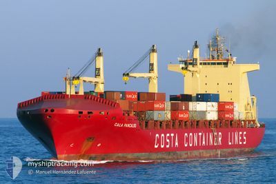
Container Ship
Current Trip
| Trip Time | 1 day |
|---|---|
| Trip Distance | 285.05 nm |
| AVG Speed | 12.2 Noeuds |
| MAX Speed | 12.2 Noeuds |
| Tirant d eau | 8.4 m |
| AVG Wind | 5 knots |
| MAX Wind | 10 knots |
| MIN Temp | -3°C / 26.6°F |
| MAX Temp | 8.5°C / 47.3°F |
| Position reçue | 1 h, 53 m depuis |
Current Position
| Longitude | 26.93203° |
|---|---|
| Latitude | 38.76428° |
| Etat | Under way using engine |
| Vitesse | 0.9 Noeuds |
| Parcours | 92° |
| Zone | Aegean Sea |
| Station | T-AIS |
| Position reçue | 1 h, 53 m depuis |
Info
Information
The current position of RITA is in Aegean Sea with coordinates 38.76428° / 26.93203° as reported on 2025-02-25 06:03 by AIS to our vessel tracker app. The vessel's current speed is 0.9 Noeuds and is currently inside the port of NEMRUT.
The vessel RITA (IMO: 9301988, MMSI: 255806054) is a Container Ship that was built in 2007 ( 18 Age ). It's sailing under the flag of [PT] Portugal.
In this page you can find informations about the vessels current position, last detected port calls, and current voyage information. If the vessels is not in coverage by AIS you will find the latest position.
The current position of RITA is detected by our AIS receivers and we are not responsible for the reliability of the data. The last position was recorded while the vessel was in Coverage by the Ais receivers of our vessel tracking app.
The current draught of RITA as reported by AIS is 8.4 meters
Weather
| Temperature | 4°C / 39.2°F |
|---|---|
| Wind Speed | 5 knots |
| Direction | 136° SE |
| Pressure | 1027.3 hPa |
| Humidity | 52.1 % |
| Cloud Coverage | 100 % |
Featured Company
Last Port Calls
| Port | Arrival | Departure | Time In Port |
|---|---|---|---|
| 2025-02-25 05:48 | |||
| 2025-02-23 10:21 | 2025-02-24 05:33 | 19 h | |
| 2025-02-22 10:27 | 2025-02-23 04:21 | 17 h | |
| 2025-02-20 06:20 | 2025-02-20 23:16 | 16 h | |
| 2025-02-17 07:52 | 2025-02-18 13:18 | 1 d | |
| 2025-02-02 18:40 | 2025-02-04 02:42 | 1 d | |
| 2025-01-28 11:21 | 2025-01-29 05:00 | 17 h | |
| 2025-01-25 03:44 | 2025-01-25 18:03 | 14 h | |
| 2024-12-22 06:50 | 2024-12-23 04:55 | 22 h | |
| 2024-12-17 11:49 | 2024-12-17 22:45 | 10 h |
Most Visited Ports (Last year)
| Port | Arrivals | |
|---|---|---|
| 14 | ||
| 13 | ||
| 13 | ||
| 13 | ||
| 1 | ||
| 1 |
Last Trips
| Origin | Departure | Destination | Arrival | Distance | |
|---|---|---|---|---|---|
| 2025-02-24 08:33 | 2025-02-25 08:48 | 285.05 nm | |||
| 2025-02-23 07:21 | 2025-02-23 13:21 | 62.18 nm | |||
| 2025-02-21 02:16 | 2025-02-22 13:27 | 78.36 nm | |||
| 2025-02-18 15:18 | 2025-02-20 09:20 | 358.56 nm | |||
| 2025-02-04 03:42 | 2025-02-17 09:52 | 3003.70 nm | |||
| 2025-01-29 06:00 | 2025-02-02 19:40 | 126.44 nm | |||
| 2025-01-25 18:03 | 2025-01-28 12:21 | 347.30 nm | |||
| 2024-12-23 12:55 | 2025-01-25 03:44 | 11843.43 nm | |||
| 2024-12-18 06:45 | 2024-12-22 14:50 | 1516.28 nm | |||
| 2024-12-10 23:37 | 2024-12-17 19:49 | 1364.37 nm |
Events
| Heure | Evenement | Détails | Position/ Destination | Info |
|---|---|---|---|---|
| 2025-02-25 06:10 | Etat Changé | Default Under way using engine |
38.76442 / 26.93269
[TR] NEMRUT
|
Vitesse: 0.9 kn Parcours: 92° |
| 2025-02-25 06:10 | Arret |
38.76442 / 26.93269
[TR] NEMRUT
|
Vitesse: 0.1 kn Parcours: 90° |
|
| 2025-02-25 06:03 | Hors de la zone couverte |
38.76428 / 26.93203
Aegean Sea
[TR] NEMRUT
|
Vitesse: 0.9 kn Parcours: 69.4° |
|
| 2025-02-25 05:48 | Port d'arrivée |
|
38.77186 / 26.91174
[TR] NEMRUT
|
Vitesse: 4.5 kn Parcours: 115° |
| 2025-02-25 04:35 | Changement d'ETA | 2025/02/25 05:20 2025/02/25 05:00 |
38.80887 / 26.74695
TRALI
|
Vitesse: 7.1 kn Parcours: 102.6° |
| 2025-02-25 03:53 | Changement de zone | Turkish part of the Aegean Sea Greek part of the Aegean Sea |
38.83194 / 26.63844
Aegean Sea
TRALI
|
Vitesse: 10.9 kn Parcours: 108.7° |
| 2025-02-25 03:35 | Etat Changé | Under way using engine Default |
38.84399 / 26.56992
TRALI
|
Vitesse: 11.4 kn Parcours: 99° |
| 2025-02-25 03:29 | Dans la zone couverte |
38.84399 / 26.56992
Aegean Sea
TRALI
|
Vitesse: 11.3 kn Parcours: 99.1° |
|
| 2025-02-25 02:10 | Etat Changé | Default Under way using engine |
38.88989 / 26.23827
TRALI
|
Vitesse: 11 kn Parcours: 114.4° |
| 2025-02-25 01:57 | Hors de la zone couverte |
38.90578 / 26.19381
Aegean Sea
TRALI
|
Vitesse: 11 kn Parcours: 114.4° |