

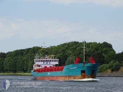
RMS NEUDORF
General Cargo

Current Trip
| Trip Time | 1 day |
|---|---|
| Trip Distance | 154.93 nm |
| AVG Speed | 8.9 Noeuds |
| MAX Speed | 10.9 Noeuds |
| Tirant d eau | 3.5 m |
| AVG Wind | 8.4 knots |
| MAX Wind | 10.9 knots |
| MIN Temp | 10.6°C / 51.08°F |
| MAX Temp | 14.9°C / 58.82°F |
| Position reçue | 1 d depuis |
Current Position
| Longitude | 0.59502° |
|---|---|
| Latitude | 53.30788° |
| Etat | Under way using engine |
| Vitesse | 10.6 Noeuds |
| Parcours | 190° |
| Zone | North Sea |
| Station | T-AIS |
| Position reçue | 1 d depuis |
Information
The current position of RMS NEUDORF is in North Sea with coordinates 53.30788° / 0.59502° as reported on 2025-06-07 01:55 by AIS to our vessel tracker app. The vessel's current speed is 10.6 Noeuds and is currently inside the port of BOSTON.
The vessel RMS NEUDORF (IMO: 8920256, MMSI: 636020767) is a General Cargo that was built in 1990 ( 35 Age ). It's sailing under the flag of [LR] Liberia.
In this page you can find informations about the vessels current position, last detected port calls, and current voyage information. If the vessels is not in coverage by AIS you will find the latest position.
The current position of RMS NEUDORF is detected by our AIS receivers and we are not responsible for the reliability of the data. The last position was recorded while the vessel was in Coverage by the Ais receivers of our vessel tracking app.
The current draught of RMS NEUDORF as reported by AIS is 3.5 meters
Weather
| Temperature | 14.9°C / 58.82°F |
|---|---|
| Wind Speed | 12 knots |
| Direction | 268° W |
| Pressure | 1015.6 hPa |
| Humidity | 54.6 % |
| Cloud Coverage | 33 % |


Featured Company
Last Port Calls
| Port | Arrival | Departure | Time In Port |
|---|---|---|---|
| 2025-06-07 15:44 | |||
| 2025-06-06 00:33 | 2025-06-06 14:12 | 13 h | |
| 2025-05-31 06:16 | 2025-06-01 19:00 | 1 d | |
| 2025-05-29 20:48 | 2025-05-30 09:22 | 12 h | |
| 2025-05-27 08:29 | 2025-05-28 10:03 | 1 d | |
| 2025-05-21 01:20 | 2025-05-22 15:16 | 1 d | |
| 2025-05-17 17:32 | 2025-05-19 06:42 | 1 d | |
| 2025-05-14 16:42 | 2025-05-16 13:31 | 1 d | |
| 2025-05-12 02:41 | 2025-05-13 15:23 | 1 d | |
| 2025-05-06 02:24 | 2025-05-06 17:04 | 14 h |
Last Trips
| Origin | Departure | Destination | Arrival | Distance | |
|---|---|---|---|---|---|
| 2025-06-06 14:12 | 2025-06-07 15:44 | 154.93 nm | |||
| 2025-06-01 19:00 | 2025-06-06 00:33 | 645.48 nm | |||
| 2025-05-30 09:22 | 2025-05-31 06:16 | 156.57 nm | |||
| 2025-05-28 10:03 | 2025-05-29 20:48 | 257.33 nm | |||
| 2025-05-22 15:16 | 2025-05-27 08:29 | 356.08 nm | |||
| 2025-05-19 06:42 | 2025-05-21 01:20 | 316.55 nm | |||
| 2025-05-16 13:31 | 2025-05-17 17:32 | 212.59 nm | |||
| 2025-05-13 15:23 | 2025-05-14 16:42 | 206.12 nm | |||
| 2025-05-06 17:04 | 2025-05-12 02:41 | 466.37 nm | |||
| 2025-05-03 16:22 | 2025-05-06 02:24 | 125.56 nm |
Events
| Heure | Evenement | Détails | Position/ Destination | Info |
|---|---|---|---|---|
| 2025-06-07 15:05 | Arret |
52.96930 / -.01940
[GB] BOSTON
|
Vitesse: 0.3 kn Parcours: 218° |
|
| 2025-06-07 14:44 | Port d'arrivée |
|
52.96010 / -.00112
[GB] BOSTON
|
Vitesse: 5.6 kn Parcours: 324° |
| 2025-06-07 12:55 | Démarrage | 11.49 nm, East of BOSTON |
52.96375 / .29925
GBBOS
|
Vitesse: 3.3 kn Parcours: 220° |
| 2025-06-07 04:39 | Arret | 11.48 nm, East of BOSTON |
52.96757 / .29915
GBBOS
|
Vitesse: 0.1 kn Parcours: 217° |
| 2025-06-07 02:06 | Etat Changé | Default Under way using engine |
53.27753 / .59060
GBBOS
|
Vitesse: 10.6 kn Parcours: 190° |
| 2025-06-07 01:55 | Hors de la zone couverte |
53.30788 / .59502
North Sea
GBBOS
|
Vitesse: 10.6 kn Parcours: 190° |
|
| 2025-06-07 01:20 | Etat Changé | Under way using engine Default |
53.40955 / .57455
GBBOS
|
Vitesse: 10.3 kn Parcours: 171° |
| 2025-06-07 01:18 | Etat Changé | Default Under way using engine |
53.41472 / .57325
GBBOS
|
Vitesse: 10.4 kn Parcours: 169.8° |
| 2025-06-07 01:14 | Etat Changé | Under way using engine Default |
53.42753 / .56985
GBBOS
|
Vitesse: 10.5 kn Parcours: 170° |
| 2025-06-07 01:03 | Etat Changé | Default Under way using engine |
53.46034 / .56062
GBBOS
|
Vitesse: 10.7 kn Parcours: 168.8° |