

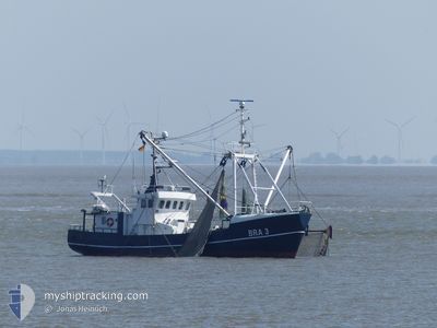
ROTESAND
Fishing Vessel

Current Trip
BUESUM
| Time Travelled | --- |
|---|---|
| Remaining Time | --- |
| Distance Travelled | --- |
| Remaining Distance | --- |
| AVG Speed | --- |
| MAX Speed | --- |
| AVG Wind | --- |
| MAX Wind | --- |
| MIN Temp | --- |
| MAX Temp | --- |
| Tirant d eau | 2.9 m |
| Position reçue | Maintenant |
Current Position
| Longitude | 8.56657° |
|---|---|
| Latitude | 55.08709° |
| Etat | Engaged in Fishing |
| Vitesse | |
| Parcours | 270° |
| Zone | North Sea |
| Station | T-AIS |
| Position reçue | Maintenant |
Information
The current position of ROTESAND is in North Sea with coordinates 55.08709° / 8.56657° as reported on 2025-06-02 22:13 by AIS to our vessel tracker app. The vessel's current speed is 0 Noeuds
The vessel ROTESAND (IMO: 8826668, MMSI: 211342220) is a Fishing Vessel that was built in 1983 ( 42 Age ). It's sailing under the flag of [DE] Germany.
In this page you can find informations about the vessels current position, last detected port calls, and current voyage information. If the vessels is not in coverage by AIS you will find the latest position.
The current position of ROTESAND is detected by our AIS receivers and we are not responsible for the reliability of the data. The last position was recorded while the vessel was in Coverage by the Ais receivers of our vessel tracking app.
The current draught of ROTESAND as reported by AIS is 2.9 meters
Weather
| Temperature | 12°C / 53.6°F |
|---|---|
| Wind Speed | 9 knots |
| Direction | 276° W |
| Pressure | 1014.6 hPa |
| Humidity | 72.1 % |
| Cloud Coverage | 1 % |


Featured Company
Events
| Heure | Evenement | Détails | Position/ Destination | Info |
|---|---|---|---|---|
| 2025-06-02 17:32 | Arret | 6.1 nm, North East of LIST SYLT |
55.08710 / 8.56657
BUESUM
|
Vitesse: 0.2 kn Parcours: 268° |
| 2025-06-02 17:12 | Démarrage | 6.2 nm, North East of LIST SYLT |
55.08686 / 8.57113
BUESUM
|
Vitesse: 6.5 kn Parcours: 116.4° |
| 2025-06-02 16:36 | Arret | 6.12 nm, North East of LIST SYLT |
55.08685 / 8.56795
BUESUM
|
Vitesse: 0.2 kn Parcours: 187° |
| 2025-06-02 16:27 | Démarrage | 6.03 nm, North East of LIST SYLT |
55.08089 / 8.57370
BUESUM
|
Vitesse: 4.3 kn Parcours: 2° |
| 2025-06-02 16:22 | Changement de zone | Danish part of the North Sea German part of the North Sea |
55.07912 / 8.57304
North Sea
|
Vitesse: 0.2 kn Parcours: 109.4° |
| 2025-06-02 16:22 | Dans la zone couverte |
55.07912 / 8.57304
North Sea
|
Vitesse: 0.2 kn Parcours: 109.4° |