
SANTA CLARA
Not available
Current Trip
| Time Travelled | 1 day |
|---|---|
| Remaining Time | --- |
| Distance Travelled | 232.96 nm |
| Remaining Distance | 225.79 nm |
| AVG Speed | 7 Noeuds |
| MAX Speed | 9.2 Noeuds |
| AVG Wind | 25.9 knots |
| MAX Wind | 28.9 knots |
| MIN Temp | 21°C / 69.8°F |
| MAX Temp | 25.7°C / 78.26°F |
| Tirant d eau | 11 m |
| Position reçue | 3 d depuis |
Current Position
| Longitude | 18.49966° |
|---|---|
| Latitude | -34.49923° |
| Etat | Under way using engine |
| Vitesse | 14.5 Noeuds |
| Parcours | 117.4° |
| Zone | South Atlantic Ocean |
| Station | T-AIS |
| Position reçue | 3 d depuis |
Info
Information
The current position of SANTA CLARA is in South Atlantic Ocean with coordinates -34.49923° / 18.49966° as reported on 2025-02-17 04:52 by AIS to our vessel tracker app. The vessel's current speed is 14.5 Noeuds and is heading at the port of PORT ELIZABETH.
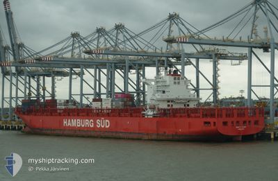
The vessel SANTA CLARA (MMSI: 219075000) is a Not available It's sailing under the flag of [DK] Denmark.
In this page you can find informations about the vessels current position, last detected port calls, and current voyage information. If the vessels is not in coverage by AIS you will find the latest position.
The current position of SANTA CLARA is detected by our AIS receivers and we are not responsible for the reliability of the data. The last position was recorded while the vessel was in Coverage by the Ais receivers of our vessel tracking app.
The current draught of SANTA CLARA as reported by AIS is 11 meters
Weather
| Temperature | 25.4°C / 77.72°F |
|---|---|
| Wind Speed | 27 knots |
| Direction | 42° NE |
| Pressure | 1012.1 hPa |
| Humidity | 85.7 % |
| Cloud Coverage | 59 % |
Featured Company
Last Port Calls
| Port | Arrival | Departure | Time In Port |
|---|---|---|---|
| 2025-02-18 05:20 | 2025-02-19 12:56 | 1 d | |
| 2025-02-03 09:29 | 2025-02-03 17:44 | 8 h | |
| 2025-02-02 00:23 | 2025-02-02 13:55 | 13 h | |
| 2025-01-27 04:05 | 2025-01-28 11:25 | 1 d | |
| 2025-01-24 05:16 | 2025-01-26 07:41 | 2 d | |
| 2025-01-20 10:57 | 2025-01-21 10:46 | 23 h | |
| 2025-01-02 14:16 | 2025-01-06 18:52 | 4 d | |
| 2024-12-26 00:53 | 2024-12-29 21:42 | 3 d | |
| 2024-12-10 05:19 | 2024-12-11 07:35 | 1 d |
Most Visited Ports (Last year)
| Port | Arrivals | |
|---|---|---|
| 12 | ||
| 6 | ||
| 5 | ||
| 5 | ||
| 5 | ||
| 5 |
Last Trips
| Origin | Departure | Destination | Arrival | Distance | |
|---|---|---|---|---|---|
| 2025-02-03 18:44 | 2025-02-18 07:20 | 5583.42 nm | |||
| 2025-02-02 14:55 | 2025-02-03 10:29 | 4.83 nm | |||
| 2025-01-28 12:25 | 2025-02-02 01:23 | 1693.34 nm | |||
| 2025-01-26 08:41 | 2025-01-27 05:05 | 275.79 nm | |||
| 2025-01-21 10:46 | 2025-01-24 06:16 | 167.33 nm | |||
| 2025-01-06 20:52 | 2025-01-20 10:57 | 6198.84 nm | |||
| 2024-12-29 23:42 | 2025-01-02 16:16 | 831.11 nm | |||
| 2024-12-11 09:35 | 2024-12-26 02:53 | 559.73 nm | |||
| 2024-11-27 20:49 | 2024-12-10 07:19 | 5563.58 nm |
Events
| Heure | Evenement | Détails | Position/ Destination | Info |
|---|---|---|---|---|
| 2025-02-19 12:56 | PORT DE DEPART |
|
-33.82211 / 25.68933
PORT ELIZABETH
|
Vitesse: 5.9 kn Parcours: 189° |
| 2025-02-19 12:40 | Démarrage |
-33.80034 / 25.68552
[ZA] COEGA
|
Vitesse: 3.3 kn Parcours: 134° |
|
| 2025-02-18 05:28 | Arret |
-33.80570 / 25.69160
[ZA] COEGA
|
Vitesse: 0.2 kn Parcours: 87° |
|
| 2025-02-18 05:20 | Port d'arrivée |
|
-33.80733 / 25.69299
[ZA] COEGA
|
Vitesse: 6.8 kn Parcours: 352° |
| 2025-02-17 04:55 | Etat Changé | Default Under way using engine |
-34.50354 / 18.51022
PORT ELIZABETH
|
Vitesse: 14.5 kn Parcours: 117.4° |
| 2025-02-17 04:52 | Hors de la zone couverte |
-34.49923 / 18.49966
South Atlantic Ocean
|
Vitesse: 14.5 kn Parcours: 117.4° |
|
| 2025-02-17 04:05 | Tirant d'eau modifié | 11 11.7 |
-34.41587 / 18.29682
PORT ELIZABETH
|
Vitesse: 13.7 kn Parcours: 128° |
| 2025-02-17 03:59 | Tirant d'eau modifié | 11.7 11 |
-34.39796 / 18.27839
PORT ELIZABETH
|
Vitesse: 14.1 kn Parcours: 140° |
| 2025-02-17 03:59 | Changement d'ETA | 2025/02/18 06:00 |
-34.39796 / 18.27839
PORT ELIZABETH
|
Vitesse: 14.1 kn Parcours: 140° |
| 2025-02-17 03:55 | Etat Changé | Under way using engine Default |
-34.38459 / 18.26580
PORT ELIZABETH
|
Vitesse: 14.3 kn Parcours: 145° |