
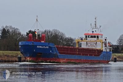
SCHILLPLATE
General Cargo
Current Trip
IEGRN
| Time Travelled | 1 day |
|---|---|
| Remaining Time | --- |
| Distance Travelled | 112.84 nm |
| Remaining Distance | --- |
| AVG Speed | 9.3 Noeuds |
| MAX Speed | 10.9 Noeuds |
| AVG Wind | 16.8 knots |
| MAX Wind | 22.7 knots |
| MIN Temp | 6°C / 42.8°F |
| MAX Temp | 7.4°C / 45.32°F |
| Tirant d eau | 4.7 m |
| Position reçue | 17 h, 52 m depuis |
Current Position
| Longitude | -3.41927° |
|---|---|
| Latitude | 53.90357° |
| Etat | Under way using engine |
| Vitesse | 10.6 Noeuds |
| Parcours | 95.6° |
| Zone | Irish Sea and St. George's Channel |
| Station | T-AIS |
| Position reçue | 17 h, 52 m depuis |
Info
Information
The current position of SCHILLPLATE is in Irish Sea and St. George's Channel with coordinates 53.90357° / -3.41927° as reported on 2025-02-25 06:39 by AIS to our vessel tracker app. The vessel's current speed is 10.6 Noeuds
The vessel SCHILLPLATE (IMO: 9505285, MMSI: 236111603) is a General Cargo that was built in 2009 ( 16 Age ). It's sailing under the flag of [GI] Gibraltar.
In this page you can find informations about the vessels current position, last detected port calls, and current voyage information. If the vessels is not in coverage by AIS you will find the latest position.
The current position of SCHILLPLATE is detected by our AIS receivers and we are not responsible for the reliability of the data. The last position was recorded while the vessel was in Coverage by the Ais receivers of our vessel tracking app.
The current draught of SCHILLPLATE as reported by AIS is 4.7 meters
Weather
| Temperature | 6.1°C / 42.98°F |
|---|---|
| Wind Speed | 10 knots |
| Direction | 239° WSW |
| Pressure | 1013.4 hPa |
| Humidity | 86.1 % |
| Cloud Coverage | 88 % |
Featured Company
Last Port Calls
| Port | Arrival | Departure | Time In Port |
|---|---|---|---|
| 2025-02-23 19:35 | 2025-02-24 20:11 | 1 d | |
| 2025-02-04 16:54 | 2025-02-07 13:54 | 2 d | |
| 2025-02-01 15:42 | 2025-02-04 10:36 | 2 d | |
| 2025-01-31 19:37 | 2025-02-01 14:00 | 18 h | |
| 2025-01-23 06:48 | 2025-01-23 11:18 | 4 h | |
| 2025-01-12 08:14 | 2025-01-15 20:22 | 3 d | |
| 2025-01-06 19:50 | 2025-01-08 07:31 | 1 d | |
| 2024-12-31 15:52 | 2025-01-02 20:26 | 2 d | |
| 2024-12-27 13:37 | 2024-12-28 15:20 | 1 d | |
| 2024-12-21 12:28 | 2024-12-22 00:53 | 12 h |
Last Trips
| Origin | Departure | Destination | Arrival | Distance | |
|---|---|---|---|---|---|
| 2025-02-07 16:54 | 2025-02-23 19:35 | 3462.78 nm | |||
| 2025-02-04 13:36 | 2025-02-04 19:54 | 65.90 nm | |||
| 2025-02-01 17:00 | 2025-02-01 18:42 | 16.43 nm | |||
| 2025-01-23 12:18 | 2025-01-31 22:37 | 1838.47 nm | |||
| 2025-01-15 21:22 | 2025-01-23 07:48 | 1802.83 nm | |||
| 2025-01-08 07:31 | 2025-01-12 09:14 | 1053.42 nm | |||
| 2025-01-02 21:26 | 2025-01-06 19:50 | 801.77 nm | |||
| 2024-12-28 16:20 | 2024-12-31 16:52 | 879.82 nm | |||
| 2024-12-22 01:53 | 2024-12-27 14:37 | 1044.94 nm | |||
| 2024-12-21 06:57 | 2024-12-21 13:28 | 80.60 nm |
Events
| Heure | Evenement | Détails | Position/ Destination | Info |
|---|---|---|---|---|
| 2025-02-25 08:20 | Arret | 4.54 nm, North of FLEETWOOD |
53.99005 / -3.04622
IEGRN
|
Vitesse: 0.2 kn Parcours: 224° |
| 2025-02-25 06:43 | Etat Changé | Default Under way using engine |
53.90218 / -3.39644
IEGRN
|
Vitesse: 10.6 kn Parcours: 95.6° |
| 2025-02-25 06:39 | Hors de la zone couverte |
53.90357 / -3.41927
Irish Sea and St. George's Channel
|
Vitesse: 10.6 kn Parcours: 95.6° |
|
| 2025-02-25 06:37 | Etat Changé | Under way using engine Default |
53.90399 / -3.42641
IEGRN
|
Vitesse: 10.4 kn Parcours: 100° |
| 2025-02-25 06:27 | Dans la zone couverte |
53.90357 / -3.41927
Irish Sea and St. George's Channel
|
Vitesse: 10.6 kn Parcours: 95.6° |
|
| 2025-02-25 03:12 | Etat Changé | Default Under way using engine |
53.93859 / -4.36014
IEGRN
|
Vitesse: 9.1 kn Parcours: 90.9° |
| 2025-02-25 03:11 | Etat Changé | Under way using engine Default |
53.93862 / -4.36163
IEGRN
|
Vitesse: 9.3 kn Parcours: 92° |
| 2025-02-25 03:11 | Hors de la zone couverte |
53.93862 / -4.36163
Irish Sea and St. George's Channel
|
Vitesse: 9.1 kn Parcours: 90.9° |
|
| 2025-02-25 03:08 | Dans la zone couverte |
53.93862 / -4.36163
Irish Sea and St. George's Channel
|
Vitesse: 9.1 kn Parcours: 90.9° |
|
| 2025-02-25 01:33 | Hors de la zone couverte |
53.95779 / -4.76317
Irish Sea and St. George's Channel
|
Vitesse: 8.7 kn Parcours: 85.1° |