
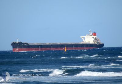
SHIN YAHAGI MARU
Cargo
Current Trip
| Time Travelled | 32 days |
|---|---|
| Remaining Time | --- |
| Distance Travelled | 5130.26 nm |
| Remaining Distance | --- |
| AVG Speed | 10.3 Noeuds |
| MAX Speed | 14.2 Noeuds |
| AVG Wind | 17 knots |
| MAX Wind | 41.6 knots |
| MIN Temp | 4.7°C / 40.46°F |
| MAX Temp | 30.2°C / 86.36°F |
| Tirant d eau | 12.6 m |
| Position reçue | 3 d depuis |
Current Position
| Longitude | 141.12424° |
|---|---|
| Latitude | 35.74352° |
| Etat | Under way using engine |
| Vitesse | 3.3 Noeuds |
| Parcours | 23° |
| Zone | North Pacific Ocean |
| Station | T-AIS |
| Position reçue | 3 d depuis |
Info
Information
The current position of SHIN YAHAGI MARU is in North Pacific Ocean with coordinates 35.74352° / 141.12424° as reported on 2025-02-11 15:34 by AIS to our vessel tracker app. The vessel's current speed is 3.3 Noeuds
The vessel SHIN YAHAGI MARU (IMO: 9682758, MMSI: 636016806) is a Cargo It's sailing under the flag of [LR] Liberia.
In this page you can find informations about the vessels current position, last detected port calls, and current voyage information. If the vessels is not in coverage by AIS you will find the latest position.
The current position of SHIN YAHAGI MARU is detected by our AIS receivers and we are not responsible for the reliability of the data. The last position was recorded while the vessel was in Coverage by the Ais receivers of our vessel tracking app.
The current draught of SHIN YAHAGI MARU as reported by AIS is 12.6 meters
Weather
| Temperature | 13°C / 55.4°F |
|---|---|
| Wind Speed | 15 knots |
| Direction | 169° S |
| Pressure | 1018.3 hPa |
| Humidity | 63.2 % |
| Cloud Coverage | 40 % |
Featured Company
Most Visited Ports (Last year)
| Port | Arrivals | |
|---|---|---|
| 5 | ||
| 3 | ||
| 1 | ||
| 1 | ||
| 1 |
Events
| Heure | Evenement | Détails | Position/ Destination | Info |
|---|---|---|---|---|
| 2025-02-15 11:00 | Arret |
35.77320 / 141.35811
JP HIC
|
Vitesse: 0.2 kn Parcours: 116° |
|
| 2025-02-15 08:33 | Démarrage | 14.09 nm, East of CHOSHI |
35.78717 / 141.13281
JP HIC
|
Vitesse: 5.9 kn Parcours: 93° |
| 2025-02-15 02:24 | Arret | 17.96 nm, East of CHOSHI |
35.82101 / 141.20421
JP HIC
|
Vitesse: 0.2 kn Parcours: 77° |
| 2025-02-14 23:14 | Démarrage |
35.89499 / 141.76439
JP HIC
|
Vitesse: 3.6 kn Parcours: 255° |
|
| 2025-02-13 12:29 | Arret |
35.71724 / 141.35847
JP HIC
|
Vitesse: 0.3 kn Parcours: 289° |
|
| 2025-02-12 06:53 | Arret |
35.87307 / 141.37740
JP HIC
|
Vitesse: 0.3 kn Parcours: 159° |
|
| 2025-02-11 15:37 | Etat Changé | Default Under way using engine |
35.74620 / 141.12436
JP HIC
|
Vitesse: 3.3 kn Parcours: 23° |
| 2025-02-11 15:34 | Démarrage | 13.4 nm, East of CHOSHI |
35.74352 / 141.12424
JP HIC
|
Vitesse: 3.3 kn Parcours: 23° |
| 2025-02-11 15:34 | Hors de la zone couverte |
35.74352 / 141.12424
North Pacific Ocean
|
Vitesse: 3.3 kn Parcours: 336.2° |
|
| 2025-02-11 15:29 | Etat Changé | Under way using engine Default |
35.74090 / 141.12738
JP HIC
|
Vitesse: 1.5 kn Parcours: 317° |