
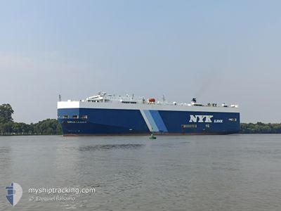
SIRIUS LEADER
Vehicles Carrier
Current Trip
| Time Travelled | 3 days |
|---|---|
| Remaining Time | --- |
| Distance Travelled | 942.71 nm |
| Remaining Distance | --- |
| AVG Speed | 13.6 Noeuds |
| MAX Speed | 17.8 Noeuds |
| AVG Wind | 7.5 knots |
| MAX Wind | 15 knots |
| MIN Temp | 18°C / 64.4°F |
| MAX Temp | 28.1°C / 82.58°F |
| Tirant d eau | 7.9 m |
| Position reçue | 8 h, 31 m depuis |
Current Position
| Longitude | -48.17097° |
|---|---|
| Latitude | -25.64578° |
| Etat | At anchor |
| Vitesse | 0.2 Noeuds |
| Parcours | 60° |
| Zone | South Atlantic Ocean |
| Station | T-AIS |
| Position reçue | 8 h, 31 m depuis |
Info
Information
The current position of SIRIUS LEADER is in South Atlantic Ocean with coordinates -25.64578° / -48.17097° as reported on 2025-02-16 01:09 by AIS to our vessel tracker app. The vessel's current speed is 0.2 Noeuds and is heading at the port of PORTO NOGARO. The estimated time of arrival as calculated by MyShipTracking vessel tracking app is 2025-02-15 23:30 LT
The vessel SIRIUS LEADER (IMO: 9213806, MMSI: 564561000) is a Vehicles Carrier that was built in 2000 ( 25 Age ). It's sailing under the flag of [SG] Singapore.
In this page you can find informations about the vessels current position, last detected port calls, and current voyage information. If the vessels is not in coverage by AIS you will find the latest position.
The current position of SIRIUS LEADER is detected by our AIS receivers and we are not responsible for the reliability of the data. The last position was recorded while the vessel was in Coverage by the Ais receivers of our vessel tracking app.
The current draught of SIRIUS LEADER as reported by AIS is 7.9 meters
Weather
| Temperature | 26°C / 78.8°F |
|---|---|
| Wind Speed | 6 knots |
| Direction | 335° NNW |
| Pressure | 1010.9 hPa |
| Humidity | 88.6 % |
| Cloud Coverage | 100 % |
Featured Company
Last Port Calls
| Port | Arrival | Departure | Time In Port |
|---|---|---|---|
| 2025-02-11 16:38 | 2025-02-13 01:50 | 1 d | |
| 2025-02-08 12:37 | 2025-02-08 16:36 | 3 h | |
| 2025-02-06 08:05 | 2025-02-07 19:58 | 1 d | |
| 2025-01-23 18:34 | 2025-01-24 00:18 | 5 h | |
| 2025-01-18 16:54 | 2025-01-19 03:50 | 10 h | |
| 2025-01-14 13:31 | 2025-01-16 00:39 | 1 d | |
| 2025-01-09 18:55 | 2025-01-10 07:19 | 12 h | |
| 2024-12-28 00:46 | 2024-12-28 18:50 | 18 h | |
| 2024-12-24 05:43 | 2024-12-24 14:42 | 8 h | |
| 2024-12-19 16:14 | 2024-12-21 07:09 | 1 d |
Last Trips
| Origin | Departure | Destination | Arrival | Distance | |
|---|---|---|---|---|---|
| 2025-02-08 13:36 | 2025-02-11 13:38 | 962.04 nm | |||
| 2025-02-07 16:58 | 2025-02-08 09:37 | 169.68 nm | |||
| 2025-01-23 19:18 | 2025-02-06 05:05 | 4500.92 nm | |||
| 2025-01-18 21:50 | 2025-01-23 13:34 | 1475.66 nm | |||
| 2025-01-15 18:39 | 2025-01-18 10:54 | 661.86 nm | |||
| 2025-01-10 02:19 | 2025-01-14 07:31 | 1531.30 nm | |||
| 2024-12-28 15:50 | 2025-01-09 13:55 | 4540.21 nm | |||
| 2024-12-24 11:42 | 2024-12-27 21:46 | 196.40 nm | |||
| 2024-12-21 04:09 | 2024-12-24 02:43 | 955.27 nm | |||
| 2024-12-16 10:56 | 2024-12-19 13:14 | 1050.91 nm |
Events
| Heure | Evenement | Détails | Position/ Destination | Info |
|---|---|---|---|---|
| 2025-02-16 01:12 | Etat Changé | Default At anchor |
-25.64578 / -48.17103
BR>PNG
|
Vitesse: 0.2 kn Parcours: 60° |
| 2025-02-16 01:09 | Hors de la zone couverte |
-25.64578 / -48.17097
South Atlantic Ocean
BR>PNG
|
Vitesse: 0.2 kn Parcours: 23.1° |
|
| 2025-02-16 01:06 | Etat Changé | At anchor Default |
-25.64588 / -48.17100
BR>PNG
|
Vitesse: 0.2 kn Parcours: 87° |
| 2025-02-16 00:42 | Etat Changé | Default At anchor |
-25.64570 / -48.17097
BR>PNG
|
Vitesse: 0.2 kn Parcours: 75° |
| 2025-02-16 00:32 | Etat Changé | At anchor Default |
-25.64566 / -48.17097
BR>PNG
|
Vitesse: 0.1 kn Parcours: 63° |
| 2025-02-15 23:57 | Etat Changé | Default At anchor |
-25.64566 / -48.17087
BR>PNG
|
Vitesse: 0.3 kn Parcours: 47° |
| 2025-02-15 23:48 | Etat Changé | At anchor Default |
-25.64577 / -48.17089
BR>PNG
|
Vitesse: 0.1 kn Parcours: 43° |
| 2025-02-15 23:41 | Dans la zone couverte |
-25.64577 / -48.17089
South Atlantic Ocean
BR>PNG
|
Vitesse: 0.3 kn Parcours: 225.8° |
|
| 2025-02-15 20:59 | Etat Changé | Default At anchor |
-25.64588 / -48.17112
BR>PNG
|
Vitesse: 0.1 kn Parcours: 118° |
| 2025-02-15 20:56 | Hors de la zone couverte |
-25.64594 / -48.17102
South Atlantic Ocean
BR>PNG
|
Vitesse: 0.1 kn Parcours: 267.7° |